Good Heavens: A Real Sand Castle?

12

We did not go inside the castle on our recent visit to Harlech on the Mid-Wales coast. To tell the truth I’m rather offended by the tyranny that these brutish bastions of Edward I  represent. He, the irascible English monarch (1272-1307) built a whole string of overbearing fortifications between 1277 and 1304 (Caernarfon being the very grandest), this in a bid to subjugate the Welsh. Of course, in a nice twist of historical irony, the castles are now major international tourist attractions, bringing welcome income to the Welsh economy. (Take that, Edward Longshanks!)

What interested me was a little photo exploration of the castle’s present setting.

For instance, the header photo is something of a trompe l’oeil. Quite misleading in fact. The castle does not sit among the massive sand dunes that have invaded much of the Welsh coast over past centuries and are still growing. It sits on a 200 foot (61 metres) eminence of ancient Cambrian rock (the Harlech Dome), whose footings were once lapped by the sea, and where ships bringing in supplies would once have docked.

So yes, here we have a fascinating case of falling sea levels, or rather, rising land levels. Parts of  Britain’s landmass have risen, and apparently some are still rising (e.g. Scotland) in response to the post-glacial ice weight reduction (isostatic rebound), as in ten thousand years after the event, while others, e.g. south east England, where there are newer rocks and/or compacting clay strata (as in London), are sinking or eroding each year.

Geology has much to answer for. It is ongoing, never static.  A pity that most of us (and that very much includes Mrs. Farrell) know so little about it, or the forces that have shaped and continue to influence the planet. I seem to remember my geography teacher, aeons ago, telling us that Britain was tilting. And it’s far from being the only place where geology is still  moving upwards or downwards. [e.g. an unrelated phenomenon in the Pacific where satellite data show many atolls and islands are growing in size rather than eroding].

But back to Harlech. There’s a diagrammatic reconstruction of the early 14th century castle’s outer defences and setting above the sea here:

13

16

This photo above gives you a glimpse of the golf course that lies between Harlech  (castle and lower town) and the massive dune system behind the now distant beach.

And looking from the other direction:

14

*

It should be said that the Welsh people did not take English oppression lying down. There were a good few revolts and uprisings, and one in particular in 1400 under Owain Glendwyr, an actual Prince of Wales (as opposed to the  fabricated English ones of recent times). He captured Harlech in 1404 and made it his family home and military HQ for four years. He also held his second parliament there in 1405. However, for all that, Welsh rule was short lived. English forces retook Harlech in 1409 during the reign of Henry V.

*

20

21

Looking from the castle towards North Wales, to Eryri, the mountains of  Snowdonia, and the plain below where once there was sea.

23

19

*

It is intriguing how things change, and how if we fail to grasp in what ways they change and why, we truly risk  losing the reality plot. As we headed to the beach I was amused by this sign on the golf course:

43

Where once there was passage for ships, the biggest risk is now flying golf balls. Who’d’ve thought it.

And finally an old image of the castle around 1890-1900 courtesy of the Library of Congress on Wikipedia:

Harlech Castle c 1890 Library of Congress

*

More about the Morfa Harlech dune system HERE. Yes, it is still growing.

44

Lens-Artists: One Subject Three Ways  Patti wants us to look at our subject from different angles.

On The Ice-Sheet Path ~ Stiperstones Revisited

IMG_0542ed

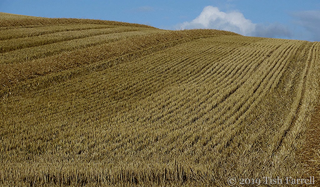
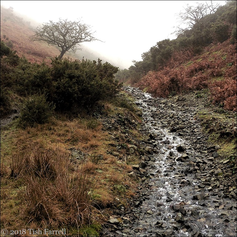
This time we approach from the west, the Shropshire border with Wales below and behind us.  The path from The Bog climbs up through sheep pasture hedged with gorse. The gold is dazzling. In sun-sheltered hollows, out of the wind, the flower-mass gives off coconutty scents. The grassland too is flushed with gold – a mass of buttercups.

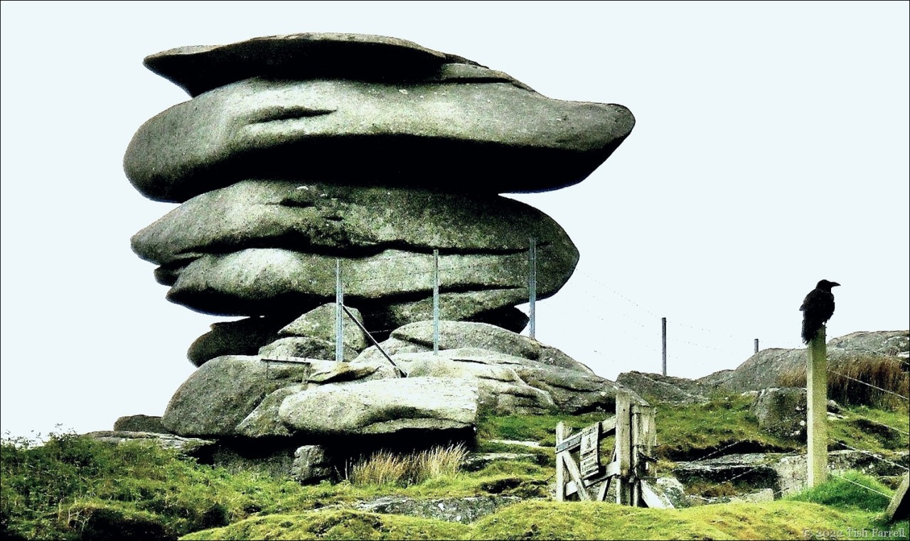
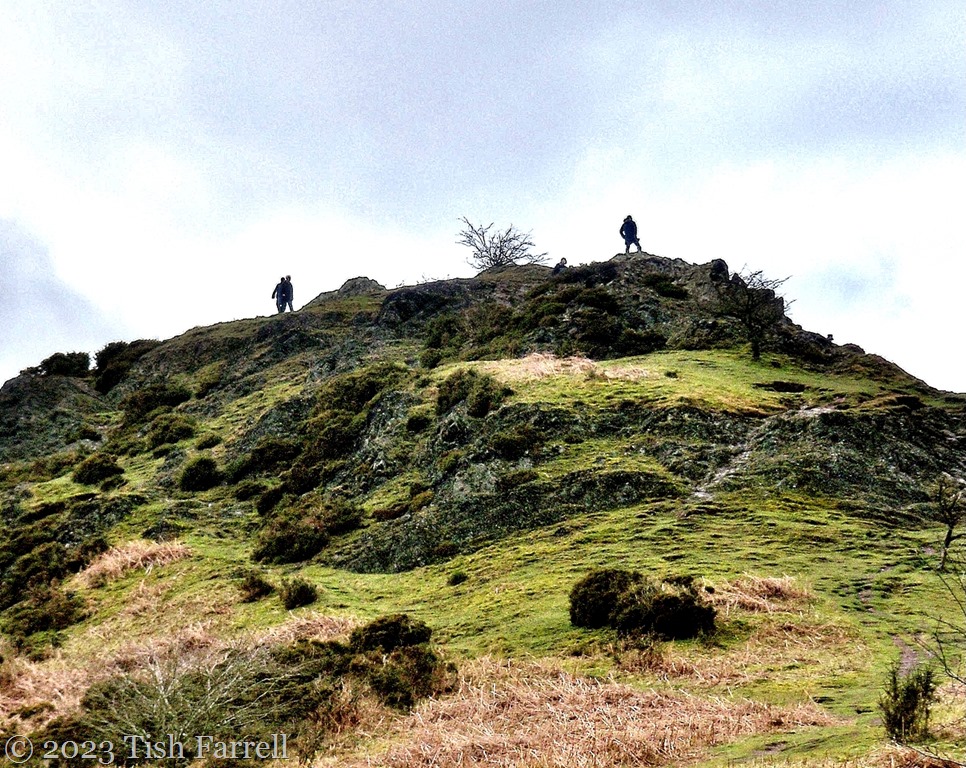
After a steepish climb, the path sets off more evenly along the foot of the Stiperstones ridgeway, the quartzite tors of Cranberry Rocks and Manstone Rock standing proud on the skyline. We are making for the Devil’s Chair (header photo), but it is still invisible at this point along the path.

IMG_0515re

The tors’ rubble spill  (stone runs) makes them look more like man-made spoil heaps than natural phenomena. And of course this was an industrial landscape across nearly two millennia:  from Roman times to the early 20th century. Although back then the activity was mostly hidden from sight in the deep mine shafts and caverns dug for the extraction of valuable lead ore.

The tors, though, are their own work, their response to environmental pressures – the fractured tumble created by the freeze-thaw cycles of the last glaciation when the Welsh ice sheet nudged up against the hillside, but did not cover it. In fact, as we follow the path, we must be walking over terrain where the ice would have lain feet deep, the far edge below the tors ebbing in surface melt-water in summer, resuming the deep-freeze lock-down in winter.

It’s surely not too hard to imagine?

For as we walk here under the sun, the bright gorse and lush new bilberry bushes, bleating of lambs, distant mew of a buzzard, I note that even now in late May, the wind still has a piercingly icy edge.

It reminds me, too, that for some reason most of us have decided, on the basis of nothing in particular, that the planet has somehow done with ice ages; that they must be a thing of the past. Yet the last ice sheets only retreated 10,000 years ago; we are presently in an interglacial, the Holocene.

IMG_0527re

Within interglacial periods there are phases of warming and cooling. E.g. It is generally accepted that around 6,000 years ago that the northern hemisphere was much warmer (Holocene thermal maximum) than it is today (NOAA National Oceanic & Atmospheric Administration US). There is likewise evidence from analysis of pollen and other prehistoric deposits in peat bogs across Europe of  periods of dramatic climatic decline e.g. the Late Bronze Age Britain (from around 3,000 years ago) when it became much wetter and cooler. Yet by the time the Romans had taken over the land, there was another warm phase. And again in the Medieval period, this before the general descent into the Little Ice Age of 14th-19th centuries for which there are also historical accounts. (I mentioned the London Frost Fairs of the Little Ice Age in a recent post on chaotic weather.)

The cycle of ice ages and climatic variation within interglacial phases is apparently dependent on shifts in the inclination of the earth on its axis, plus associated so-called ‘wobbles’, together with variations in the sun’s energy output. In other words, there can be  no doubting that here we have in play planetary cycles that are stratospherically beyond humanity’s capacity to control. Anyway, it’s making me think that hanging on to the woolly jumpers and thermal underwear might not be a bad idea.

And talking of woolly jumpers, as the Devil’s Chair comes into view I find myself the subject of ovine scrutiny…

IMG_0532re

IMG_0533re

*

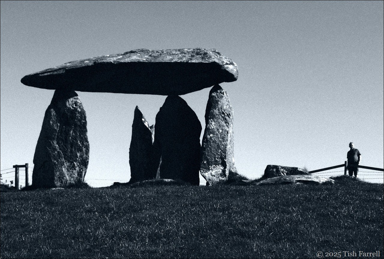
And now for the Devil’s Chair, long the subject of Shropshire myth and witchery:

IMG_0540ed

*

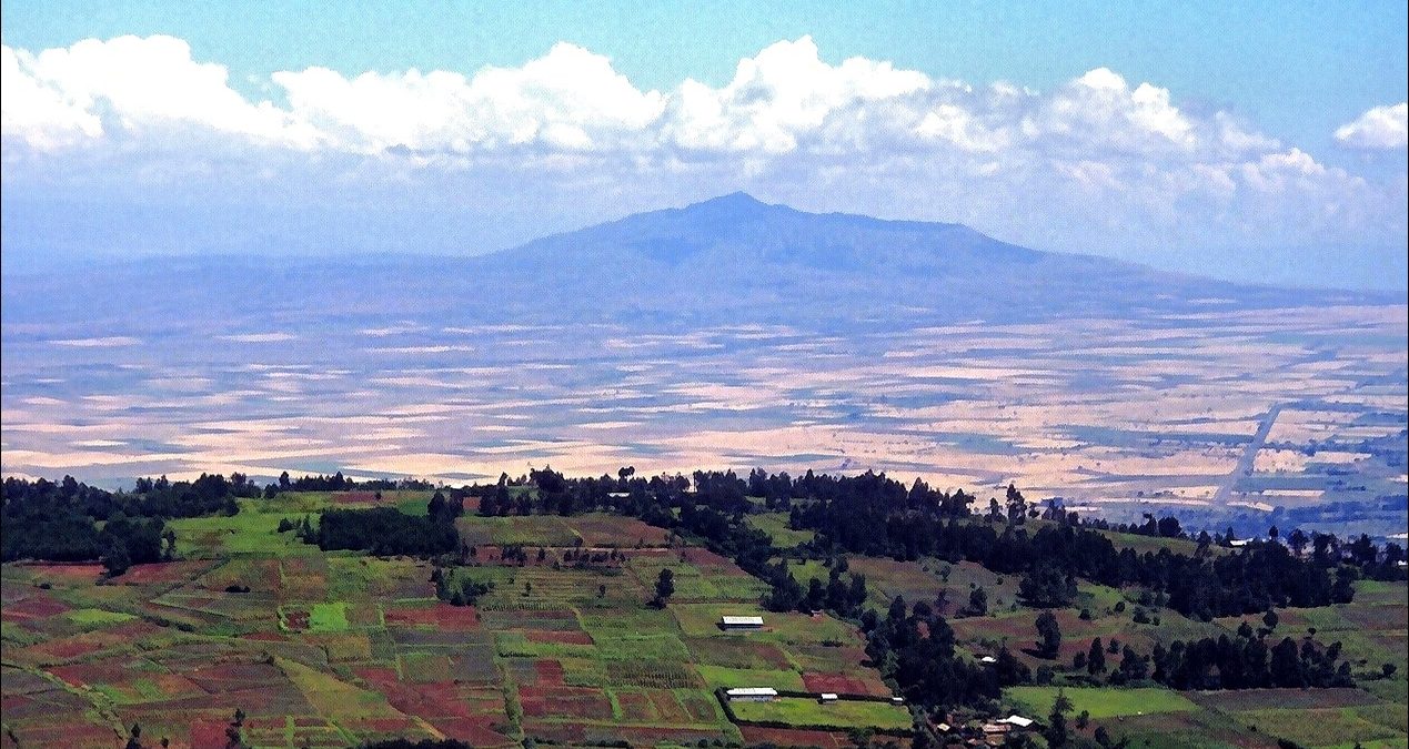
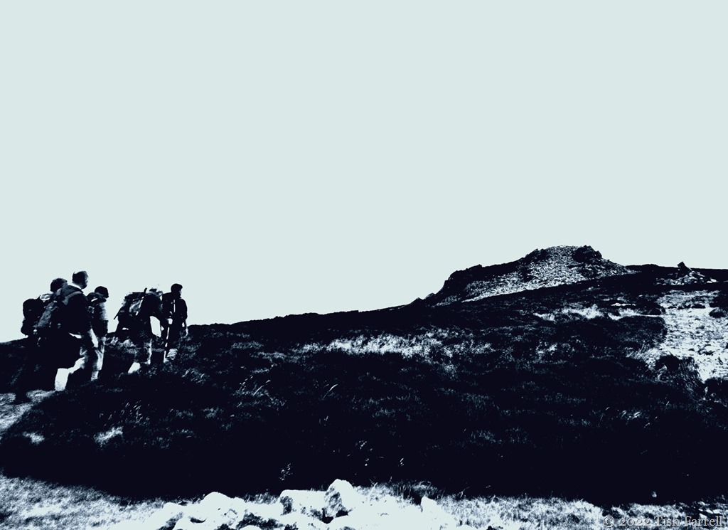
And the view from this spot, back towards Cordon Hill, the border and Wales. Remember that ice sheet. This was the land that it covered. At the glacial maximum around 22,000 years ago the ice was estimated to be up to half a kilometre deep. Sheffield University has produced some interactive maps.

IMG_0545re

IMG_0546re

The dark tussocks are heather which will bloom in late summer. The bright green bushes are bilberries, locally called win- or wimberries – our native version of blueberries, ready to pick around August time, but presently flowering. The little rosy bells are hard to see, but the bees are finding them:

IMG_0555re

*

As we retrace our steps to The Bog where we’ve left the car, I’m stopped in my tracks by  the sight of a mountain ash tree seedling. There it is, growing so strongly atop a weathered gate post. It makes me smile. It seems like a sign: the earth, the real world, has much to teach us when we choose to pay attention.

IMG_0559ed

Rocks, boulders, Stiperstones

P1080542cr

Shropshire’s mysterious Stiperstones featured in a recent Square Odds post. Here are more shots in monochrome, plus a few facts for geology lovers.

The grey-white rock of the ridge is quartzose sandstone known as the Stiperstones Quartzite Formation, created some 480 million years ago in the Ordovician era.

The tors and the rubble-like surroundings we see today are the work of more recent events in the last Ice Age (c. 115,000 – c. 11,700 years ago).  During this time, the eastern edge of the Welsh ice sheet was nudged up against the Stiperstones, not covering it,  but causing the quartzite to fracture during periods of intense freezing followed by thawing.

The highest point (Manstone Rocks) is 536 metres (1,759 ft) above sea level, making it the county’s second tallest hill after Brown Clee.  The ridge extends some 8 kilometres (5 miles), the summit crowned with a series of six distinctive outcrops.

For geology buffs there is a detailed overview of Shropshire’s 700 million year geological history by Peter Toghill HERE.

This next photo: men on Manstone Rock, the highest point on the Stiperstones…

P1080557cr

P1080558cr

P1050991cr

P1060001cr

Cee’s Black & White Photo Challenge: rocks, boulders, stones

It Seemed Like A Small Treasure

IMG_3991

There it was lying among the chaff and wheat stalks, a small fossil brachiopod, the size of my thumbnail, both shells of the bivalve quite intact, but washed free of its sedimentary matrix, to be found by me as I wandered about in Townsend Meadow after the harvest.  I was out in the field, relishing the new views, seeing the town from fresh angles as I climbed the hill, and much like Monet with his many haystack renditions, as I went, snapping multiple views of the large straw bales. With the morning sun on them they looked like some rustic art installation.

I saw the fossil from the corner of my eye and instantly switched to archaeologist mode, at first hoping it might be a Roman coin. It was a similar size and pewtery dullness to the ones I’d uncovered at nearby Wroxeter Roman City when I was digging there aeons ago. But no. It is a washed up remnant from the Silurian Sea, the 400 million-year shallow ocean, whose bed in more recent eras thrust upwards to form Wenlock Edge.

But that’s not all that is marvellous. Before the upthrusting, back in the oceanic days when this little mollusc was still busy sifting warm currents to find its lunch, the land beneath my feet was lying south of the Equator, somewhere near the Comoros Islands in the Indian Ocean. It takes one’s breath away: Shropshire to the Comoros. Is all too hard to grasp. Too much time, too much planetary expanse for the mind to girdle. I mean how could the world’s parts have done so much monumental shunting about? And we humans with all our technology think ourselves masters of the globe. Silly, silly us.

Anyway, I brought the little fossil home, and it sits on my desk. It feels like a touchstone, an omen, a talisman. What meaning might I take from it? This 400 million-year-old mollusc found by chance among the chaff and sawn-off stalks after the wheat harvest.

copyright 2019 Tish Farrell

IMG_3978


Christmas Walk Through The Mists Of Time

P1100539

Here we are – midday on Christmas Day in Ashes Hollow, Little Stretton, Shropshire, walking across some of the oldest landscape on the planet. Such vast antiquity is perhaps an unexpected distinction within a rural English county whose location, even to the citizens of the United Kingdom, is often a total mystery.

But here it is, one of the valleys, locally known as batches, whose streams wheedle their way down from the flanks of the Long Mynd, a 7-mile ridge of Precambrian rock, formed around 570 to 560 million years ago. It is also well travelled geology, having moved 13,000 miles from its origins in the Antarctic circle where its iron-rich sediments (eroded from volcanic mountains) first accumulated on the sea bed. This was closely followed by some tectonic shunt and shift which squeezed the sediments into a U-shape, so tipping them from the horizontal to the vertical. It’s a feature you can glimpse here and there on exposed rock faces. It means too, that in one sense at least, as you pass, you are walking through time.

Time Square #27

Back To The Stiperstones ~ Or Slow Under The Surface, And What On Earth Were The Luftwaffe Doing Here?

This week at Lost in Translation, Paula’s prompt is ‘SLOW’. So here is another vista from our recent trip to South Shropshire’s Stiperstones (see also the previous post.) And the reason I’ve chosen it is because I cannot think of anything slower than the trans-global  journey of the landmass on which these hills sit. It has been travelling an inch a year for 450 million years, moving up from its source on the southern shores of the Iapetus Sea, 60 degrees south of the equator and roughly where the Indian Ocean is today. I’m not sure if the land beneath our feet is still heading north, or if one day Shropshire will be in the Arctic.

That’s quite a thought.

The other aspect of slow-going to be seen in these photos is the gradual weathering of the folded, upthrust former beach from which this 5-mile ridge is mostly formed. Much of the shaping began with the last Ice Age when the glaciers extended across Shropshire.

A far more recent, and somewhat bizarre reshaping apparently took place during World War 2, when the Luftwaffe, flying over the north end of the Stiperstones, mistook the rocks of the Devil’s Chair outcrop for a town with ammunition dumps, and duly bombed the place. How they came to this conclusion is hard to understand. Even in the heyday of the local lead mining industry, the communities were small and sparse and tucked into hillsides and valleys. There has never been a town in these parts. Perhaps in the dark the strangely glowing quartzite exercised some mystical, mystifying interference in pilot perception. Who knows?

It is anyway another good yarn to add to the tales of witchcraft and devilry that, in the human imagination of ages, enmesh these bleak uplands.

IMG_5519

We certainly saw no signs of bombing, though it might be hard to spot among the heaps of fragmenting quartzite. These particular shots were taken at Cranberry Rocks at the southerly end of the Stiperstones. We did not make it as far as the Devil’s Chair; it was too hard underfoot and too windy. But we do mean to make another visit one day soon, and tackle the hill from the northern end. We just have to remember not to go when mist threatens, or we might come on the Devil himself, brooding nastily on his craggy, Luftwaffe-remodelled throne.


copyright 2017 Tish Farrell

Of Rivers Running Backwards And Looping The Loop

P1060204

Last week I took you on a walk along Wenlock Edge behind our house, and talked about the melting ice fields of the last Ice Age (around 15,000 years ago), and how the River Severn that once flowed north, started to back up against the limestone ridge of Wenlock Edge and so formed Lake Lapworth. And then I said how the expanding melt waters worked their way through the rock wall, and so formed the Severn Gorge, and at the same time created a whole new southerly course for Britain’s longest river.  Well, this is where it all happened – at the northerly end of Wenlock Edge.

Off to the left of the photo, and out of shot, is the old Ironbridge Power Station. It’s coming up next in a ‘zoomed in’ shot.

P1060205

The power station stands on the riverbank at the entrance of the Gorge, and below Benthall Edge, and thus marks the spot where the Severn first headed south. And just to orientate you further, dead ahead to the left of the power station is Ironbridge and Coalbrookdale, and to the right, and below the power station is the road to Much Wenlock. You can just see the house roofs along it. Benthall Edge is thus a southerly spur striking off from Wenlock Edge.

Like Wenlock Edge, Benthall Edge is also composed of limestone strata formed around 400 million years ago when both Edges were part of the Silurian Sea. From the early 1200s the monks of nearby Buildwas Abbey had the rights from Lord Benthall to quarry the limestone, which they burned in kilns to make fertilizer for their farm fields, and lime mortar for building. They also cropped the woodland along Benthall Edge to make charcoal.

In later centuries the Benthall limestone was used in local blast furnaces, tipped in with ironstone, and when fired,  acted as a flux which drew impurities from the metal. This was tapped off as slag, and the resulting molten iron cast into ‘pigs’ on the furnace floor. The pig iron was then shipped on to the forge to be worked further into wrought iron, a more durable product than cast iron, which has a tendency to fracture. So now, if you can picture it,  see that little stretch of the Gorge by the power station thick with sulphurous smoke, and hear the whole place banging and clanging with forge hammers.

These days Benthall Edge is a tranquil place of hanging woodland and winding paths, although you can still spot the remains of old quarries among the trees. The ‘Lime Trail’ information leaflet of the Severn Gorge Countryside Trust provides an extraordinary statistic about the quarrying. It says that over a period of 750 years an estimated 1.2 million cubic metres of limestone was removed from the Edge. So there we have it: landscape formed both by human and natural agencies – though I’m wondering how that piece of man-made intervention was calculated.

But now to get back to the other feature of note at this spot – the River Severn’s meanders between the villages of Buildwas and Leighton.

P1060211

I’ve not really done it justice, this looping riverscape formed by silting on the one hand, and erosion on the other; an oxbow lake in the making. I think I probably needed to climb a tree to achieve a better panorama:

P1060203

It is  of course a favourite viewpoint for geography fieldtrippers, and a very fine place to linger, although not for too long on a winter’s afternoon, however bright and beautiful.

As we headed home, the December sun was lighting up cascades of Old Man’s Beard along the roadside; the trailing seed heads of wild clematis making their own festive streamers. Caught here through the car windscreen. (I wasn’t driving).

P1060212

Rambling Yesterday On Wenlock Edge ~ “The Holly And The Power Station”?

IMG_3731

We went for a tramp along the Edge Wood at midday yesterday. It’s three fields up from our back garden and quite a haul to reach it. Once there, a breather is definitely called for, and so it’s a good moment to stop and look at the old Ironbridge Power Station cooling towers.

P1060131

Some find them ugly, but I like them. They are true landmarks – geologically and historically speaking. They stand on the banks of the River Severn, England’s longest river, which rises in the Welsh uplands and descends through the Midlands to the Bristol Channel. The towers stand on a piece of landscape – the Severn Gorge – which was only created 15,000 years ago – a mere nano-second past in Earth History Time.

But the thing that most fascinates me is that the River Severn, presently running south past the towers, once flowed north, so meeting the sea on the coast between North Wales and Chester. This remarkable change of direction is all down to the last Ice Age and the fact that the land was glacier-locked as far south as Shrewsbury, our county town. The Severn’s northern outlet thus became blocked by ice, and so the river backed up, forming a great lake (Lapworth) as the water lay trapped between the ice sheet, and the limestone ridge of Wenlock Edge.

Little by little, as the Ice Age drew to a close, the river wheedled its way through the northerly end of Wenlock Edge and carved a new course, cutting through, and so exposing the Industrial Revolution-making strata of coal, ironstone, fire clay, and limestone. And as I’ve said in other posts, this part of Shropshire lays claim to being ‘the cradle of the Industrial Revolution’, though crucible might be a better metaphor, given the emphasis on iron production.

However, the 18th century pioneering ironmasters of the Severn Gorge were not the first to take advantage of the local geology. Nearly two millennia earlier the Romans were already exploiting these resources. Their military camp of Viroconium (Wroxeter) lay just to the north of the Gorge and, once the locals were suitably subdued, so the camp transformed into a great city, one of the four largest in Britain. There is evidence of glass making and iron working in the area, and local clays would have served for brick and tile production. In fact one of the brick-built basilica walls still rises impressively above the surrounding farmland, a surprising survival when so much of the city fabric was recycled through succeeding centuries.

Back in the Gorge, and many centuries after the end of Roman rule, the mediaeval  monks of Buildwas Abbey and Much Wenlock Priory were also busy making use of local natural resources on an industrial scale. They had mines, decorative tile works, iron-making forges and bloomeries. They also had a thriving export business along the River Severn. There’s a record from around 1200 that states that the Prior of Buildwas was fined because twelve of his barges were blocking the river downstream at Bridgnorth. Probably not your usual vision of what monastic enterprises got up to.

Given so much entrepreneurial and manufacturing business afoot in the Gorge AND a navigable river with access to the great port of Bristol,  it is not surprising that when the monasteries were dissolved in 1540, and their properties distributed to the king’s friends and favourites, that the place should attract a rash of opportunistic London merchants, lawyers and aristocrats, all out to get rich and exploit the former monastic concerns for themselves. Soap  making, cold tar exploitation, coal mining, iron production, steel-making experiments were being conducted by very unlikely people of the well-heeled sort across south-east Shropshire.

Such industrial fervour was further stoked by Queen Elizabeth I (1533-1603) who offered a prize for anyone who could find a way to smelt decent iron using coal instead of charcoal. The loss of the nation’s great trees, needed for naval purposes and the protection of the realm, was causing the monarch much concern. The prize, however, was to remain unclaimed. It would be a good century later before  Abraham Darby arrived in the Gorge and, after remodelling a former monastic iron works in Coalbrookdale, perfected the much sought-after technique.

His discovery helped shape the world we occupy today. See what geology has to answer for.

And here’s some more of quite another sort: the Wrekin. We have the best view of it on our homeward path back down into Wenlock.

P1060146

The plain to the left of the hill was the location of the glacial Lake Lapworth. The Roman city was in that vicinity too. The Severn Gorge is off-screen to the right of the Wrekin.

I’ve written about the Wrekin’s mythological and geological origins HERE, but I may not have mentioned there that it has an Iron Age hillfort on the top. This was a stronghold of the Celtic Cornovii  i.e. those who  were duly subdued and citified by the invading Romans. Under Roman rule Viroconium became the Cornovii regional capital, which they continued to occupy until the late 600s – 700 C.E. when the site was abandoned.

We were always told at school that Viroconium’s last days were due to Saxons or Vikings marauding up the River Severn, but there is no sign that the exit from the city was anything but peaceful. I remember working on the excavation of the presumed road-of-retreat long ago as an archaeology student. I have to say that at the time I wasn’t altogether convinced by the site director’s interpretation of the remains that we were uncovering. At least it made me consider that much depends on the way you excavate a site. This site was being stripped across a whole field, rather than being investigated through the judicious placing of exploratory trenches. It seemed to me that certain trowelling techniques, as applied by willing and enthusiastic novices, might be responsible for creating features that aren’t actually there at all. An interesting thought on how the past might be re-created and invented.

And now just to prove how cold it was on our ramble, and not just gloriously, and so unexpectedly sunny: next some ICE, a phenomenon not witnessed in these parts for several seasons. Which brings me back to the start of this yarn, but hopefully not to the start of a new Ice Age as long predicted by certain climatologists. There have been enough tangents along our path already.

P1060148

copyright 2016 Tish Farrell


Jo’s Monday Walk  Please take a turn in this quarter for another fabulous ramble with Jo in the Algarve.

The Old Quarry ~ Thursday’s Special

P1000657

P1000646

I’ve always found quarries disturbing places – the wholesale delving into the earth, the ravaged landscapes left behind. And yes, I know we need the resources. (Our own house is built of this fossilized Silurian Sea, although actually I’d be just as happy with brick or timber).

Shadwell Quarry behind Much Wenlock’s Windmill Hill is only one of the many old limestone quarries along Wenlock Edge. These days they are no longer worked but host various business enterprises that simply need a large amount of storage space. Quarry owners are supposed to do some restoration after the blasting has stopped, but I’ve not noticed much of this actually happening.

These photos show how slowly recolonization of quarried land takes place. (For an aerial view go HERE.) It has been twenty years since Shadwell was decommissioned.

The water in the quarry bottom is also a strange blue, almost turquoise at times, coloured by the limestone deposits. At over seventy feet deep, it lures tipsy young men to prove their manliness by diving in from one of the man-made cliffs while their mates film the act and post the videos on You Tube. Last summer I spotted gangs of school leavers heading off behind Windmill Hill. They were armed with ghetto blasters and towels and I overheard them saying they were ‘going to the beach’.

It’s interesting how people’s perceptions of places differ. One sees ‘exciting resort’; another oppressive dereliction – albeit with strains of desolate grandeur.

P1000661

*

I’ve written more about the history of Wenlock’s limestone quarrying  at Hidden Wenlock #4

This week at Lost in Translation Paula’s theme is ‘forbidding’. Please call in there if you want to take part in the challenge. She suggests many possibilities for interpretation.

“Wheat…fields of wheat…” Musings on the path to the allotment


100_5994

Okay, who knows which film this quote comes from? As an extra clue I give you the line in ‘full’: “Wheat… lots of wheat… fields of wheat… a tremendous amount of wheat…”

For some reason I cannot explain, this particular exhortation is rather popular in the Farrell household.  The Team Leader is wont to deliver it at unexpected  intervals and with some vigour. This habit even predates the time when we actually came to live beside  a field that often has wheat growing in it. So here is it. The field behind our house. And while I admit it might overstep the bounds of propriety to share my washing with the world, here is another view of the wheat field from our garden. I also think the flower shadows on the sheet rather fine: housework turned artwork?

077 (2)

I have written in earlier posts how our house lies on the edge of Wenlock Edge, a twenty-mile scarp formed from the upthrust bed of a tropical sea – the Silurian Sea in fact. This geological formation is a breath-taking 400  million years old – a place once inhabited by trilobites, and molluscs, and sponges and corals, although it should be made clear that when these creatures lived, the shallow sea in question was not in the northern hemisphere.  No indeed. In its tropical heyday Shropshire lay off equatorial East Africa. We are thus, for all our rustic appearance, a well-travelled county. We also have lots of geology of international importance, but  which I cannot begin to describe because the terminology and chronological expanses confound even me, a prehistorian. The Shropshire Geological Society have  a good site HERE should you wish to know more.

100_2077

The reason I’m showing you the wheat field is because my path to the allotment runs along the edge of it. I walk back and forth at least once a day. And so when I’m not writing blog posts or fiddling with my novel, this is one of the places where I’m likely to be. There is always something that catches my eye – thistles, the light, clouds, buzzards, the rooks and jackdaws, a neighbour’s three white ducks that regularly escape from their pen to eat slugs along the path, cats on the prowl, pretending I can’t see them.

Even the wheat is quite interesting. It amazes me how it manages to force its way up through a cloddy layer of grey clay that bakes to concrete after a few days with no rain. This soil, too, is a product of a geological event – a deluge of  volcanic ash from aeons ago and that has now broken down into bentonite clay.  It is the same soil in the allotment. Soft fruits seem to thrive on it. Everything else is a challenge. Wheat, though, has apparently been grown along the slopes above the town for generations, hence the name The Wheatlands for some of our now built-upon areas.

100_5840

100_5839

And talking of building, a couple of years ago when the Local Authority called for landowners to put forward development land, our local landowner proposed  this and most of the fields on the Edge side of the town, including the allotments too, gardens  that have been there since the 1940s.  Development on this scale is something that most town residents fervently  hope will not happen. We have already been threatened with up to 500 houses over the next 11 years. This in a town with antiquated drainage, severe traffic congestion, few jobs, poor public transport, and inflated house prices, and one that has seen several new developments of upmarket houses in the last few years.  More crucially, the town sits in a bowl below the Edge and has recently been designated a rapid response flood risk area by the Environment Agency.

001 (2)

More tarmac, roofs and roads that speed up run off from the hills above our homes are the last thing we need.  Some of the newest developments in the town are themselves subject to flooding.

100_5849

 100_5995

All right, I admit it. The landscape behind our house is perhaps not particularly noteworthy of itself, but the light and sky above it are. The uptilted scarp of Wenlock Edge forms a false horizon, so there is always much weather to watch. It changes every second. One day we saw a fire rainbow which we gather is quite rare.

Ironically, it it perhaps because this view from our house is ever under threat, that makes us look at it and appreciate it all the more. But it makes me angry too. I am not opposed to development, but it should be well planned, and enhance the locality, not cause problems for other people’s homes. There appears to be no mechanism in English planning that can ensure the provision of good quality housing at prices people can afford. Density seems to be the only planning criterion, not  homes with green spaces around them, and places for community orchards and gardens, footpaths and cycle tracks and areas where people of all ages can play. All things that boost wellbeing. You would wonder why it is so hard to do.

It is true that  Much Wenlock people have recently voted to have the Local Authority  accept their Neighbourhood Plan, a community compiled document that reflects our aspirations and plans for the foreseeable future. Our Conservative Party MP, Philip Dunne, tells us the Plan will deliver localism to our door, that is, we will have a say in the kind and scale of development that is proposed for our town and parish, development that will protect landscapes, open spaces and heritage while improving the quality of life for everyone. Whether it will, or not remains to be seen, particularly under a government whose recently sacked Secretary for the Environment apparently allowed for the destruction of ancient woodland as long as developers replanted elsewhere.  Bio-diversity anyone?

Which I suppose brings me back to the quote; “Wheat…fields of wheat…” You can’t get more of a monoculture than that. Hey ho. So many things to unpick. Think I’ll trundle up the path to the allotment and pick raspberries.

copyright 2014 Tish Farrell

Related:

…of Silurian Shores

Old Stones of Wenlock: repurposing the Silurian Sea

In Much Wenlock an Inspector Calls

100_4193

P.S. The quote is from Woody Allen’s Love and Death