
Grasses, sky and clouds on Wenlock Edge
*
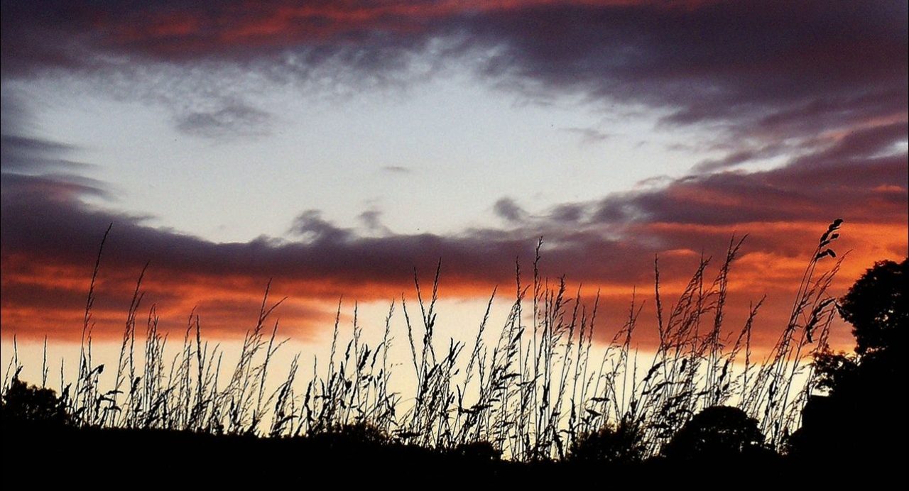
Sometimes you need to lie down to take a photo; taking this header shot was one of those moments. I wondered how the thin stems of meadow grasses would look against the fiery sky. They had much to compete with. Some more distant treetops got a look in too. Earth to sky: we’re holding our own despite the light show.
And a different take on earthly-aerial juxtapositions; this time a barley field, sun reflecting off the tufty awns that surround the grain. I liked the contrasting textures of spiky crop and meringue-soft cloud; the green against the blue, white-grey contrast:

*
The colour red always makes its presence felt. Here a single red bird cherry leaf:


The showy crab apples somehow make a lowly snail all the more remarkable.
*
I do take an awful lot of landscape photos, but perhaps you can have too many ‘good views’. The presence of some living/moving element generally makes for a more engaging shot:

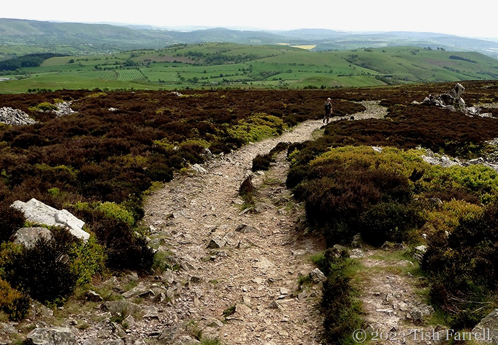
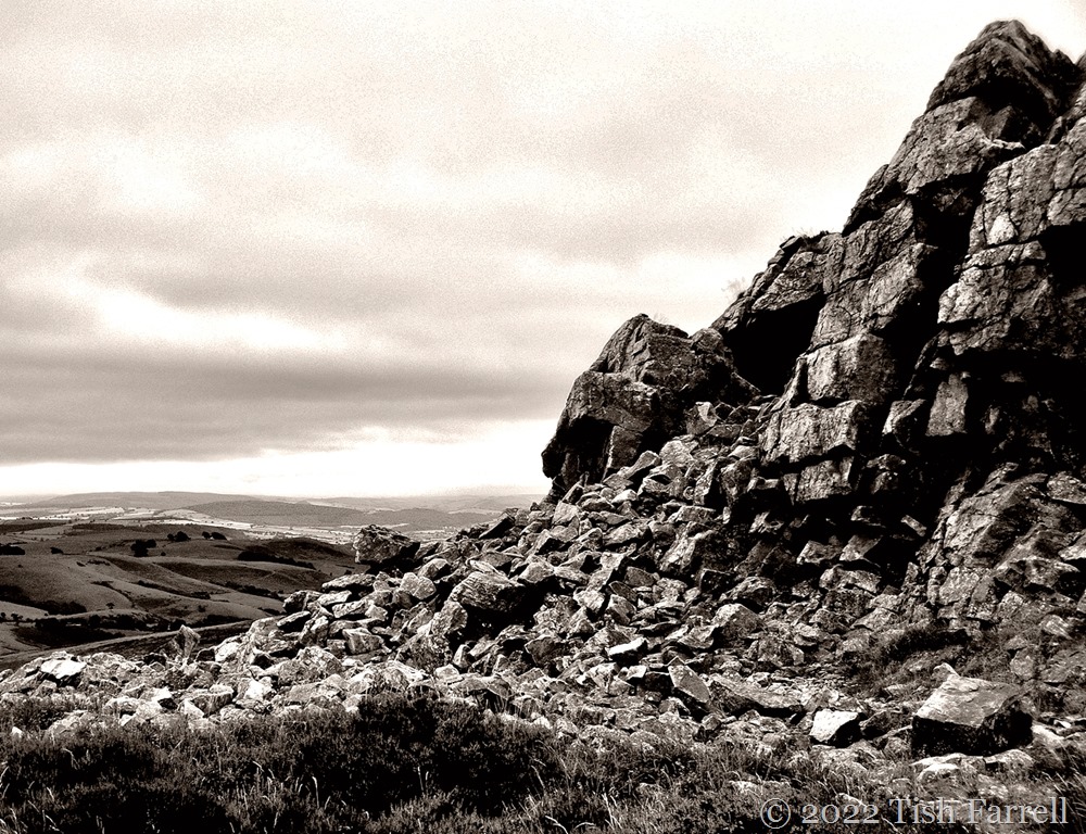
This rather strange view of a Stiperstones tor was shot in monochrome in gloomy midday light. Odd things seem to happen in this mysterious Shropshire upland: so who knows where the sky went. But then I liked the happenstance appearance of the tight-knit group of hikers. They walked into the shot, their group posture conveying group purpose: they will reach the top.
And you want to follow them.
*

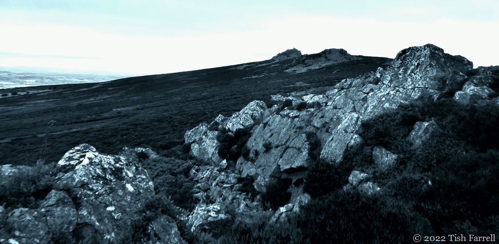
This is another chance Stiperstones photo, taken on the same day. Despite the poor light the tor does seem to radiate something. That’s my other half on the skyline. As ever he has stopped to see what had become of me, dawdling somewhere behind. I was so pleased when he stood still. There he is – a tiny human beside a momentous stack of geology, remnant of the ancient days when this quartzite ridge was crushed and fractured during the last Ice Age.
Back then, two great glaciers (one from Ireland, the other from the heights of Plynlimon in mid-Wales) convened in the Shropshire hills. They kept the ridge company, not covering it, but nudging the tops through alternating periods of freeze and thaw. Needless to say, this would not have been a human-friendly landscape. Even now, in bad weather, it is a brutally exposed spot.
*
And closer to home, the not quite live elephant on Wintles Hill adds a certain something (if only viewer puzzlement) to this Shropshire autumn landscape. The different layers of sunlight and shadow also caught my eye:

Copyright 2026 Tish Farrell
#IAmNotACrop
Lens-Artists: the power of juxtaposition This week Patti at Lens-Artists asks us to consider the power of juxtaposition in our compositions. Please see her super post for guidance and inspiration.