From The Grave Of The Good Burgess ~ Speaking Truth To Power

IMG_3897cr

My last post featured a recent visit to Bishop’s Castle’s parish churchyard and the mystery surrounding the grave of an unnamed African who died in the town in September 1801. This week I returned to the visit another intriguing grave. It stands in sight of the great Norman tower of 1291, and marks a death that occurred in May 1802, a few months after I.D.’s burial, and also the year of a general election.

And what an epitaph it is. What a swingeing ticking off of the town’s ‘worthies’; very much in the vein of ‘you know who you are’.  (And doubtless everyone else in the town knew too).

Here’s what the headstone says:

To the memory of Matthew Marston. He departed this life May 29th 1802 aged 81, the oldest Burgess of the Borough.

His steady and uncorrupt conduct presents an examples to his brother Burgesses for perpetual imitation and a useful lesson to the Parliamentary Representatives of the Borough that Opulence and Power cannot alone secure universal suffrage.

*

IMG_3903ed

*

And to what particular corrupt practice is the Marston stone referring?

Bribes for votes, that’s what, and the fact the town’s burgesses controlled the electoral roll. Only they could vote in elections, and only they had the power to admit new burgesses to the roll. And these were the men who managed all aspects of the town’s affairs, from market trading to judicial and coroner’s courts.

In 1802, when there were around 170 burgesses on the roll, the going rate for a vote was 25 guineas – well over a thousand pounds by today’s values, and enough then to buy 2 horses or 5 cows or employ a skilled tradesman for 173 days (National Archives currency converter).

For a small rural town, Bishop’s Castle seems to have earned itself a big reputation for shady political dealings: a ‘rotten borough’ from 1690-1763, and a ‘pocket borough’ from 1763 – 1832. During these years the town returned two parliamentary representatives, all members of the landowning class, or in the case of the pocket borough, all relatives or favoured associates of Robert Clive. (He had returned from India, where he had risen from lowly agent in the East India Company to Governor of the Bengal Presidency, amassing a fortune equivalent to 48 million pounds). Only with the Reform Act of 1832, did the parliamentary borough of Bishop’s Castle meet its end. We now have 5 regional county representatives.

During the rotten and pocket eras, parliamentary representatives were obviously intent only on furthering their own and sponsors’ interests and causes. This situation was compounded by the fact that several times the entire manor of Bishop’s Castle changed hands with the new owners seeking to secure a seat for their own man. In 1683 it featured in a marriage settlement between one Anne Mason and the Earl of Macclesfield. It was Anne’s ne’er-do-well cousin Richard Mason, seemingly the Earl’s ‘placeman’, who then bribed and bullied his way to Parliament, standing as M.P. for 30 years.

In 1718 the new Bishop’s Castle owners, the Harleys, appalled that their own candidate had failed to win a seat, roundly condemned the town’s burgesses (‘profligate wretches’) for their ‘villainous roguery’ and ‘perfidy’ in voting for Mason. They sold the manor on to the Earl of Carnarvon (Duke of Chandos)  who then, after considerable expense, secured his own placeman at the next by-election. His purposes doubtless served, he then sold the manor to his nephew, local landowner, John Walcot of Walcot Hall, who then found the means to further his interests through favoured candidates.  And so it went on. On and on.

But what of Bishop‘s Castle’s ordinary folk? Over all these centuries of political vested-interest, one might well wonder how did life go for the ploughman, dairymaid, tavern keeper, clerk, cowhand and stonemason, or for the cooper, brewer, carpenter, apothecary, farmwife, cook, curate and chamber maid? How indeed?

You can well see that the Marston family had a point when they erected this headstone to their kinsman, the good burgess: a lone voice of integrity?

IMG_3900ed

previous post The Man from Africa: I.D. unknown

source: The Story of Bishop’s Castle eds David Preshous, George Baugh, John Leonard, Gavin Watson, Andrew Wigley  2018 Logaston Press


And We Think Our Weather Is Chaotic, But What About 1821-22?

P1030781

Last night in Wenlock it was all howling wind and battering raindrops on the roof lights. Then this morning the gusts were positively whistling through the tiniest gap in the closed bathroom window. Shivery indeed. Yet the onset of this 40 mile per hour small gale was yesterday described by the weatherfolk  as ‘brisk’. A bit of an understatement methinks. But however one describes it, this current bout of wild and changeable weather now makes the week of lunch-in-the-garden back in March seem a long time ago. (Did it even happen?) And on top of that, it’s definitely curtailing gardening pursuits.

On the other hand, being confined indoors yesterday led to an interesting internet discovery of a wild-weather nature, this courtesy of the very fabulous Derbyshire Record Office which holds archive riches relating to Arctic explorer Sir John Franklin, he whose 1845 expedition to chart the Northwest Passage, tragically foundered in the ice. Among the treasure trove of documents listed in the archive is the transcription of an 1822 letter written in the May of that year by Franklin’s first wife, poet Eleanor Anne Porden. Franklin is away in the Arctic while Eleanor is writing from London, and filling him in on the dramatic events of England’s weather during 1821-1822.

For someone who is used to forever hearing how our weather is set to become ever more chaotic, I found it fascinating to learn how very chaotic it already was in 1821 when Britain was emerging from the Little Ice Age (c. medieval period – 1850). Eleanor’s letter in fact makes reference to the last of the Thames’ Frost Fairs held in 1814.

A view of the river Thames: 1814

The Last Frost Fair of 1814 copyright Museum of London

Between 1600 and 1814 the Thames would freeze for up to 2 months creating an astonishing  venue for all manner of events and entertainment.

*

But first she broaches the weather topic by telling John Franklin that though matters may be peaceable in other domains, ‘the elements are in sad confusion.’

She goes on to say:

I should think that the mean temperature of last year was pretty nearly what it ought to be, but the seasons were all mixed together, and not well mixed neither; we had neither Spring nor Autumn, Winter nor Summer. Only two nights greeted us with the agreeable novelty of a frost, and the consequence was that a friend of ours saw the armies of two rival confectioners fighting for the thin cake of ice on a pond behind his house. As for snow, I think you had best bring a little home in a bottle, to shew as a curiosity to those who may have forgotten its colour.

Then she moves on to the storms ‘such as I never remember’ following one after another for three months:

Trees were torn up, and houses blown down, and from the coasts the accounts were dreadful- three Indiamen* were lost in sight of land.

* ships of the British East India Company

Next came the Christmas Thames’ floods in London’s Westminster and Vauxhall

forcing numbers of inhabitants to take refuge in the upper rooms of their houses, till they could be carried away in boats. At Staines it is said that the water was rushing in torrents through every house, and parts of Windsor were in similar condition.

She quips that people who usually travelled up to London for the Christmas season had abandoned their plans, not wishing to embark on a sea voyage in order to achieve that objective.

And then follows an account of the most bizarre event of all:

To complete my catalogue of marvels, in less than three months after, a strong south wind so drove back the waters of the Thames, that aided by a neap tide the channel was left nearly dry, and it was crost on foot between London and Blackfriars bridges, almost in the spot where an ox had been roasted whole on the ice just 8 years before…I understand that the tide afterwards flowed with unusual force for 3 days, and it has been thought that the extraordinary shape of the river must have been connected with some volcanic phenomenon.

And finally she concludes with mention of London’s May weather:

this week we were shivering over a fire, and now the thermometer is at 81⁰ in the shade.

You can read the whole lively letter HERE

Meanwhile, planting still curtailed, I shall cultivate a state of reduced grumpiness about Shropshire’s changeable elements. I am anyway much amused by Eleanor’s suggestion that Sir John Franklin should return home with a bottle of snow to remind the general populace what this unfamiliar substance looks like. The more things change, eh…

Odd Moment With A Sheep And Old Tales Of Dodgy Deals

P1060951cr

I don’t know about you, but I feel quite uncomfortable being so closely scrutinized by a member of the ovine tribe. It happens now and then as I tramp the lanes and byways of Much Wenlock.

This one was in the field opposite Wenlock Priory ruins, which interestingly had much to do with sheep rearing in the early Middle Ages. In fact the sale of wool from its flocks was an important source of the Priory’s wealth. And so you may imagine the brotherly fury (even to the point of murderous intent) that was roused  when, in the late 1200s, the then Prior, John de Tycford, engaged in some dirty dabbling in the futures market and sold 7 years’ wool crop in advance and then kept the proceeds.

One monk, William de Broseley was so incensed, he left the Priory and gathered a gang in the woods, all set to ambush and kill the Prior. News of this plan did not go down well with the higher authorities, who instructed sheriffs to arrest ‘vagabond monks of the Cluniac order.’ William was duly captured and received his just deserts (not defined by chroniclers, but doubtless deeply unpleasant).

Meanwhile the Prior, who also went in for monastic asset stripping as well as having a history of fraternizing with money-lenders, had friends in a very high place: first King Henry III and then his successor-son, Edward Longshanks, aka Edward I. De Tycford, it seems, was good at political intrigue and had been royally employed on a  diplomatic mission to nearby troublesome Wales. It did not seem to matter that he had run the Priory into debt. When he left Much Wenlock in 1285 it was to take up an appointment  as Prior of Lewes in Sussex, not only another grand Cluniac house, but also a politically sensitive location. The army of Henry III had retreated into the Priory in 1264 during the barons uprising led by Simon de Monfort. This had caused serious division between the monks, many of whom were later punished or banished back to France.

And so it goes. It’s how the world runs. Power and money control ALL aspects of our lives, although we’re mostly too distracted to see how deep and wide this goes. Perhaps the sheep is trying to tell me something. Perhaps I ought to tell it: I am not a sheep.

The Square Odds #15

Out Of The Archive: A Favourite Piece Of Historical Sleuthing

100_1225 - palace massena

The family who lived in the Palais de Masena

Believe me, the family gathering depicted in these two murals has more tales to tell than most. They could be the very depiction of Tolstoy’s famous opening to the tragic novel Anna Karenina: (And I paraphrase) all happy families look alike, but the unhappy ones are unhappy in their own inimitable way.

The original post Nice Family? En famille at the Massena Palace continues HERE

*

So what spurred me to discover more about these set-piece murals wherein members of an elite Nice family gaze at one another across a palace staircase? Silly question really. It was the mysteries that cropped up – once I paid them closer attention.

For instance why has the blue-bloused woman of the second mural adopted such a vulgarly aggressive stance when the keys hanging from her waist suggest she is mistress of the house, the chatelaine? And who is the droopy waif leaning on her shoulder?And why are so many people lurking, or peering between marble columns. And who is the lovely woman with the macaws and exotic tapestry; is the blue-bloused woman’s look of contempt from across the stairwell meant for her? But most of all, one has to wonder why this family would commission well known French artist François Flameng to show them in this way? Was he having a joke at their considerable expense?

The proposed explanations are in the original post so I won’t repeat them here. But I will tell you that the family members are all descended through intermarriage from three ordinary men, plain soldiers, Masséna, Murat and Ney who through courageous acts rose to prominence in Bonaparte’s army, were appointed Marshals of Empire and thereafter acquired all manner of riches and other grandiose titles.

But the reason this archive post is one is one of my favourites is because the sleuthing involved was so fascinating. I was astonished at how much could be gleaned from a few hours trawling the internet. It seemed like magic – lead after lead revealing a few more snippets about a world distant from me in time and space. And I thought then – this is the world wide web at its best; this is what its creator intended: to share knowledge and information; to open minds and eyes; to enthrall, educate and entertain in positive ways. It could still be like that, couldn’t it…I mean without the hate and fakery?

July Squares #19

The Derbyshire Gate Post Mystery Explained?

P1080981

P1080294

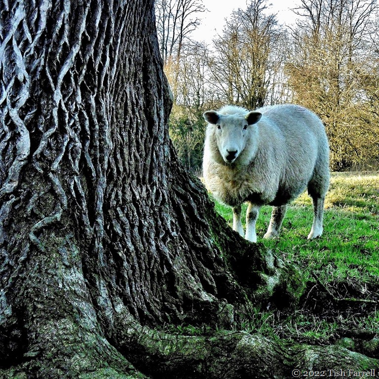
In the last post I queried the large perforations to be found in the tops of some Derbyshire stone gate posts or stoops. I thought they made handy viewfinders, but could find no other explanation. Then I found some more photos I’d taken at Callow Farm. These are a pair – one with a partial orifice, the other without.

And it’s at this point things may become as clear as Derbyshire mud. But I have found an explanation. The only problem is I don’t wholly understand it.

It comes from a worthy volume published in 1813 and available for free from Google. (How I hate it that they have laid claim to all the old books in the universe, but how I love being able to access such works without leaving my desk, this despite the fact that much of the scanning is often execrable.)

The book in question is volume 2 of General View of the Agriculture of Derbyshire by John Farey senior, Mineral Surveyor of Upper Crown Street, Westminster. This is what he says. I’ve increased the font in hopes comprehension might strike:

Anciently, the Gates in the Peak Hundreds were formed and hung without any iron-work, even nails, as I have been told; and some yet remain in Birchover and other places, where no iron-work is used in the hanging: a large mortise-hole is made thro’ the hanging-post, perpendicular to the plane of the Gate, at about four feet and a half high, into which a stout piece of wood is firmly wedged, and projects about twelve inches before the Post; and in this piece of wood, two augur holes are made, to receive the two ends of a tough piece of green Ash or Sallow, which loosely embraces the top of the head of the Gate (formed to a round), in the bow so formed : the bottom of the head of the Gate is formed to a blunt point, which works in a hole made in a stone, set fast in the ground, close to the face of the Post. It is easy to see, by the mortise-holes in all old Gate-Stoops, that this mode of hanging Gates was once general.

From this it seems clear that any iron hinges and latches were later additions to such old stoops. John Farey goes on to praise this kind of improvement:

A great contrast to these rude Gates, is exhibited, on the Farm of Mr. Thomas Harvey of Hoon Hay, who has four sets of hooks and catches, all adjustible by nuts and screws, fixed in his Gate-Posts, which are very stout, in the line of a private and bridle Road thro’ his Farm ; so that from whichever quarter the wind may come, in blowing weather, the Gates can readily be shifted, so as to be shut too by the wind, instead of being forced open thereby : there is also a screw for adjusting the top thimbles of these Gates, for making them shut more perfectly.

So there we have it – a loopy length of ash or willow used to do the job of a gate, though I still can’t quite picture it. But then instead of wondering about that, I found myself distracted by Mr. Farey’s genuine enthusiasm for more efficient gatery with all its iron trappings.

In this modern era we all assume a well functioning gate is a good thing – guarding property, keeping out vagrants and cold callers. But this notion of privately controlled land is fairly new. And to my mind it has had every one of us hoodwinked. Simon Fairlie puts it succinctly at the start of his very enlightening essay A Short History of Enclosure in Britain  from The Land magazine:

Over the course of a few hundred years, much of Britain’s land has been privatized — that is to say taken out of some form of collective ownership and management and handed over to individuals. Currently, in our “property-owning democracy”, nearly half the country is owned by 40,000 land millionaires, or 0.06 per cent of the population, while most of the rest of us spend half our working lives paying off the debt on a patch of land barely large enough to accommodate a dwelling and a washing line.

He then explains that from Saxon times, and continuing under Norman rule into the Middle Ages, the Open Field System was the norm. It was also the norm in much of Europe until modern times, wherein each family had its own plot within a communally managed ecosystem.

The notion of one man possessing all rights to one stretch of land would have been unthinkable to British medieval smallholders. The king or lord of the manor owned an estate, but not in the way we understand ownership. The peasant population also had rights and, at specified times of the year, could graze stock, cut wood or peat, draw water or grow crops on various pieces of land, often in a number of different places.  English farmers also met twice a year at the manor court where land management issues were discussed, and those taking more than their fair share of communal resources challenged.

The benefit of the Open Field System is explained as follows:

A man may have no more than an acre or two, but he gets the full extent of them laid out in long “lands” for ploughing, with no hedgerows to reduce the effective area, and to occupy him in unprofitable labour. No sort of inclosure of the same size can be conceived which would give him equivalent facilities. Moreover he has his common rights which entitle him to graze his stock all over the ‘lands’ and these have a value, the equivalent of which in pasture fields would cost far more than he could afford to pay. CS and C S Orwin The Open Fields, Oxford, 1938

A group of peasant farmers could also share equipment such as a good plough and a full team of oxen to haul it, a facility that would benefit them all. One herdsboy could supervise the daily grazing of the community’s cattle, taking them out after family milking, bringing back in for evening milking at their individual homesteads, so leaving farmers free to carry out other income producing pursuits. Everyone’s sheep could also be driven out to the common moorland to graze, each animal identifiable to their owners by a sheep mark.

Somewhat strangely I have learned that the sheep mark of my Callow Fox ancestors was still in existence in 1930s, when the fiery right-to-roam campaigner G H B Ward, editor of the Sheffield Clarion Ramblers’ Handbooks went to interview my great uncle Robert Fox about the history of the Callow Foxes. Ward visited him in his cottage at Foolow and there saw the sheep mark belonging to an earlier Robert Fox (1780-1863), who used it to mark the horns of his sheep communally grazed on the Longshaw pasture. Enclosure took place there during the early 19th century, the Inclosure Act commissioners awarding the Duke of Rutland nearly 2,000 acres. And so the former sheepwalk used by William and Sarah Fox of Callow during the 18th century, and by their son George and grandson Robert into the early 19th century was turned into the headquarters of the largest grouse-shooting estate in the Peak District (David Hey The History of the Peak District Moors).

For nearly a century this former common land was policed by gamekeepers, and the general populace denied age-old rights including access to paths and bridleways. It was only with the mass trespasses of ramblers like G H B Ward during the early 20th century that the countryside began to be opened up once more. One cannot help but cheer when one learns that the decline in Rutland fortunes led to the sale of the estate in 1933. Ramblers and other members of public raised the necessary funds to buy the park and then handed it over to the National Trust. Sheffield Corporation bought the moors, which are now part of the Peak District National Park. Humanity is now free to roam there once more, as we saw on our recent visit – hundreds of families striding out in the fresh upland air.

IMG_1799

The fact remains though that Britain’s big landowners exploited the Inclosure Acts to enrich themselves by taking for their own use alone (and still hanging on to them) thousands of acres that were once communally used for centuries by their tenants.  But I leave the last words on the Commons land rights to Simon Fairlie. At the risk of sounding totally reductionist I contend that this is how we ended up where we are now; the wretched state of the planet; and the current tax-haven millionaires’ mortal fear of any notion of communal rights or shared resources. If we continue to let such people control and grow rich on resources which should benefit all – more fool us.

Britain set out, more or less deliberately, to become a highly urbanized economy with a large urban proletariat dispossessed from the countryside, highly concentrated landownership, and farms far larger than any other country in Europe. Enclosure of the commons, more advanced in the UK than anywhere else in Europe, was not the only means of achieving this goal: free trade and the importing of food and fibre from the New World and the colonies played a part, and so did the English preference for primogeniture (bequeathing all your land to your eldest son). But enclosure of common land played a key role in Britain’s industrialization, and was consciously seen to do so by its protagonists at the time.

copyright 2018 Tish Farrell

The Castle At Koroni

P1020683

Over the past three thousand years the Messenian Peloponnese has suffered so many phases of foreign invasion it is hard to know where to start unravelling its history.  Best stick with the built remains then. This massive medieval bastion belongs to Koroni Castle, built in the early 1200s CE by the Venetians, and one of a string of Messenian coastal forts controlled by the Republic until 1500.

The Turks invaded next. After summary slaughter in neighbouring Methoni, so spurring Koroni to a quick surrender, they set about strengthening the  castle’s eastern defences, which perhaps included this tower. It is hard to track down details. One Greek writer, whose identity I am yet to discover, described Koroni Castle as ‘the architecture of hate.’ He had a point. Venice anyway regained control in 1685, and of course the Turks came back again later, staying until the Revolution of 1821, which finally ousted them.

Koroni’s historic heyday, though, was the thirteenth century. Under the first round of Venetian rule it was referred to as ‘the chief eyes of the Republic’, and as such, was one of the main ports of call for the ships and galleys of Venice’s Levantine trade. Its must-have product was cochineal, much desired by Venetians for the lustrous dye it yielded.  So now you know where that gorgeous Venetian red came from – this small corner of the Peloponnese.

P1020710 - Copy (2)

Today, you can spend many hours wandering around the castle’s 40 hectare interior. It is then you begin to grasp that before the Venetians occupied Koroni there were invader Franks on site – they of the French-Italian Crusader States. And before them, in the era of the Eastern Roman Empire of Constantinople, there was a Byzantine fort. This had apparently been built atop an ancient acropolis. And long before the Byzantine presence – that is from around 700 BCE and for a few hundred years, the Spartans were in occupation, so muddying the archaeological remains of the very much earlier Bronze Age Mycenaean period (1400-1100 BCE) and the ancient settlement of Assini.

And these are just the barest bones of Koroni’s history.

P1020707 - Copy (2)

There are also astonishing present-day aspects. The first that strikes you is that people actually live inside the castle. As you walk up from the towering seaward gateway, you find yourself on an ancient cobbled street, and next there are cottages with pretty gardens, and later we come on an olive grove and a small holding. As ever, there are many cats about. There is also a cemetery which is in current use, several churches, ancient and modern, used and disused, and a monastery that is now only inhabited by nuns. The latter has a tranquil garden and a gift shop and picturesque cottages where the nuns live, and you are free to wander around.

P1020713

*

This next and final shot is was taken just outside the monastery entrance, one of the several sacred buildings built cheek by jowl in this part of the castle interior. It is dedicated to Saint Sophia and, dating from the 11th century Byzantine period, overlies the ancient temple precincts of Apollo. At which point you lose all grasp of time, since there is simply too much of it to fathom, and decide that a swift downhill return to a harbour taverna and an enlivening cappuccino is definitely called for.

IMG_2795

copyright 2017 Tish Farrell

castle 1688

Koroni Castle CORONELLI, Vincenzo 1688  Aikaterini Laskaridis Foundation Library


Cee’s Black & White Challenge: Bricks or Stones

#PerouliaDreaming

Hafren, Sabrina, Severn ~ Please Meet Our Local Goddess Plus A Tale Of Madcap Daring

P1070722

She is most usually known by the Roman version of her name: Sabrina goddess of the River Severn. I told her story in the previous post, but thought this close up view fitted the bill for Paula’s ‘pick a word’ at this week’s Thursday’s Special. The five prompts are: confined, jazzy, patulous, momentous and serene. So I’m going for the first and  last – Sabrina serene but confined to her plinth in a pool in Shrewbury’s Dingle.

It also seems she is confined in other ways too.

The statue was the work of Birmingham sculptor Peter Hollins (1800-1886), and made for Shropshire worthy, the Earl of Bradford in 1846. I thought she was carved from stone, but a little googling reveals that the Public Monuments and Sculpture Association National Recording Project ( who knew of such a body?) thinks she may be cast in some sort of metal and then covered with plaster. They also say she is afflicted with a biological growth – so that has ‘patulous’ covered too, though they don’t say what it is. I’m wondering if it’s responsible for the vaguely luminous areas. Poor nymph.

The scarcely legible quotation underneath her comes  from John Milton’s Comus , a mask in which  Sabrina is one of the main characters. This  work also has Shropshire connections having had its premier showing at Ludlow Castle in 1634, presented before another worthy,  ‘the Earl of Bridgewater, then President of Wales.’

Sabrina fair,
listen where thou art sitting
under the glassie, cool, translucent wave,
in twisted braids of lilies knitting
the loose train of thy amber-dropping hair;
listen for dear honour’s sake,
goddess of the silver lake,
listen and save.

And if you find these words far too gluey and overwrought, then here’s an edgier Sabrina yarn, though I must warn you – it does not end well. It was the Public Monuments entry that put me on to it. It begins with a church spire – specifically the one atop St Mary’s Church in Shrewsbury and also one of the tallest spires in England.  This church has graced the town’s skyline for over 500 years, although parts of it are far older than this, dating back to Saxon times c AD 960. Also some of its stones were apparently cut by Roman masons, and carted in from the abandoned Roman city of Wroxeter some miles away.

P1020453

I think you might call the spire momentous – even before we get to what happens next.  It is over 200 feet tall.

Enter one Robert Cadman, steeplejack and mender of weather cocks. It is the winter of 1739, time of the Great Frost, and Cadman has been employed to put right St. Mary’s weather cock that has been blown askew. He duly does the job, but he has further plans for the church spire. For Robert Cadman is also a stuntman and, for his daring descent from the cupola of London’s St Paul’s cathedral, blowing a trumpet while sliding down a rope,  he has already earned the nickname ‘Icarus of the Rope’.

He has handbills printed and spread about the town:

image

The History and Antiquities of Shrewsbury From Its First Foundation to the Present Time, Comprising a Recital of Occurrences and Remarkable Events, for Above Twelve Hundred Years, Volume 1, 1837

*

The River Severn is frozen solid, and so the Great Frost becomes an occasion for fun and festivities. An engraving of the time shows  skaters and people playing table tennis out on the frozen river; there are tents; there are sheep being roasted; several of the great Severn trow sailing barges are ice-bound; there’s even a printing press out there too. All in all, then, Sabrina is providing the perfect arena for the spectacle Cadman has planned.

He attaches an 800 foot rope (240 metres) through a window on St. Mary’s spire. The other end is anchored across the river at Gay Meadow – (well out of shot on the right of the next photo). The show begins with Cadman’s walk up the rope towards the spire:

P1020440
His usual act is to ascend bare-chested, performing all kinds of stunts as he goes. When he performed in Derby this walk took around an hour. The return descent, or flight as it was termed then (since there was apparently quite a yen for this kind of flying  in the early 18th century), would be swift. For this part of the act our intrepid performer puts on a wooden breastplate which has a groove cut down the middle. He then lies on the rope and hurtles down, headfirst, blowing a trumpet, and accompanied by a stream of smoke as his breastplate burns with the friction of the rope. Whew!

But on this day, when Cadman reaches the spire, he decides the rope is too tight and signals across the river for it to be loosened. There is a misunderstanding. The rope is tightened, and half-way down, the rope snaps – whipping up in horrible coils as Cadman hits the iron-hard ground, his body apparently rebounding several feet in the air. Accounts have it that Cadman’s wife, who has been moving among the crowd of spectators collecting money, runs stricken to his corpse, throwing away the money as she goes.

Robert Cadman was buried at the foot of the spire and the sorry tale is commemorated in a plaque by the main door of St Mary’s church:

Let this small Monument record the name
of Cadman, and to future time proclaim
How by’n attempt to fly from this high spire
across the Sabrine stream he did acquire
His fatal end. ‘Twas not for want of skill
Or courage to perform the task he fell,
No, no, a faulty Cord being drawn too tight
Harried his Soul on high to take her flight
Which bid the Body here beneath good Night
Feb.ry 2nd 1739 aged 28

*

And now just to restore some sense of serenity, here are some shots of St. Mary’s interior. The church is now redundant, but it does have a very good cafe. It also contains some wonderfully ancient stained glass windows. The final image of the set is the Jesse window above the altar and dates from between 1330 and 1350.

100_5536

100_5537

100_5528

100_5534

copyright 2017 Tish Farrell

In Search Of Lost Time In Eyam And An Outbreak Of Plague

P1050535

This very unusual wall sundial is to be found above the Priest’s Door on the east side of Eyam parish church in Derbyshire. It dates from 1775, and was designed and made locally. I discovered it when were in the village doing a spot of family history research – not researching in any organised way I might add – more a matter of walking ancestral paths and acquiring a sense of place. Eyam is anyway a village with an awful lot of history, not least the story of how its inhabitants dealt with an outbreak of bubonic plague in 1665-1666 by imposing a cordon sanitaire around the village boundary, and for over a year sticking to it so as not to spread the disease to neighbouring communities.

Over the fourteen months that the outbreak persisted, 280 out of the 800 population died. It is thought the infection arrived in a parcel of fabric, sent in late summer from London to the Eyam tailor, Alexander Hadfield. The package was opened by his assistant, George Viccars, and it was he who was the first to fall ill and die. Thereafter, the disease spread rapidly throughout the autumn, slowed over the winter, and returned in full force in the following spring and summer. In the worst month of August 1666 seventy eight villagers died.

Eyam’s self-imposed quarantine was managed by the young village rector, Reverend William Mompesson, and Nonconformist minister Reverend Thomas Stanley. It was agreed that every household would bury their own dead and, in a bid to  maintain morale and give comfort to survivors, church services were held in the open air so people could gather together, but not too closely. Local landowner, the Duke of Devonshire, and others from neighbouring villages saw that supplies of food and other necessities were left at the village boundary.

It is a harrowing episode that demonstrates great human resilience and bravery, not least by the Reverend Mompesson, whose own wife was among the last victims. And today, as you wander around the village, the event continues to be marked by commemorative plaques outside the cottages that were once the homes of the families who were particularly afflicted.

It could seem mawkish, crass even, to make a visitor attraction from this horrific episode, but somehow it isn’t. The village quietly embraces you in a reflection on shared humanity – now and back through time.  In fact the sun dial says it all: Induce animum sapientum –  cultivate an enquiring mind. And then on the two supporting stone corbels, which you can’t quite read in the photo: ut  umbra sic vita – life passes like a shadow.

I especially like the way that when it is noon in Eyam, the sundial shows the relative times in Calicut, Mecca and Panama, to name but a few of the far-flung places inscribed on the dial. It also includes a chart for longitudinal adjustments of local True Sun Time to Greenwich meantime, and throughout the year. Somehow it is uplifting to feel that in this isolated Derbyshire village, and over the centuries, the gaze of its inhabitants has extended to a world beyond its village boundaries.

So far I haven’t mentioned why we were visiting Eyam or explained presumed family links with this locality. Researches into the Fox family of Callow in Hathersage (covered in other posts) suggest that a possibly direct ancestor, one Robert Fox, yeoman farmer and lead miner, was living in the area between 1678 and 1699. I have a copy of his will and household inventory, so I know he owned 13 cushions and several field beds in one or more parlours. There were no Fox plague victims in Eyam, although Robert Fox’s second wife, Margaret Mower, had lost an uncle, Rowland Mower. His will is included in the 1842 book by local historian, William Wood, The History and Antiquities of Eyam ~ with a full and particular account of the Great Plague.

The Fox family connection is all a bit of a yarn, which may never be unravelled. So for now some more views of the village:P1050536

Eyam Parish Church and its 8th century Saxon Cross complete with Celtic influences.

*

P1050552

*

P1050549

P1050551

*

P1050558

This is Eyam Hall, very much post-plague, and built between 1671-6 and incorporating a much smaller existing property in the heart of the village. Its builders were newcomers, the land-owning-merchant Wright family, and their arrival signified revival, and an increasing interest in developing the lead mining potential the area. Landowners large and small were keen to exploit this highly valued mineral. And although lead had been mined across Derbyshire since Roman times, there is almost a ‘gold rush’ feel about the exploitative zeal from the late 17th century.

It is possible that post-plague opportunities around Eyam attracted the likes of putative ancestor, Robert Fox. My band of fellow Fox-hunters has not been able to establish if he was an incomer or if there were existing family connections with Eyam. His father was a tenant farmer at The Oaks, near Highlow, a few miles away, and he and Robert’s brothers may also have been involved in the lead business,  possibly smelting.

Robert owned four small parcels of lead-bearing land in Foolow, two of which adjoined Wright land. When he thought he was dying in 1691 and wrote his will, he was very concerned to make it clear he had ownership of them, and that the proceeds of his property should be managed by his brother and brother-in-law for the upbringing and education of his four children – James, William, Mary and Robert. In fact he did not die until 1699, and it is not clear what happened to his family. We think the eldest James became a shoemaker in Eyam, and that Robert was possibly a very successful joiner in Wirksworth, the lead mining capital of Derbyshire. William is the one we have our eye on as the possible ancestor for the Callow Foxes, but his baptismal record has so far proved elusive, which is most annoying when we know that his three siblings were baptised in Eyam church. Ah, well. Such are the fascinations and frustrations of tracking down traces of families long past.

IMG_0002

From: William Wood The History & Antiquities of Eyam 1842

Black & White Sunday: Traces of the Past


JOSEPH SIDDALL

P.S. A number of readers have asked what became of 3 year old Joseph Siddall. The Eyam Museum researches seem to indicate that there were in fact two surviving Siddall children, and they went to live with relatives in Sheffield, not that far from Eyam. There is quite a dynasty of Siddalls in the Eyam-Stoney Middleton area of Derbyshire, so they would not have been left without any family connections.

Thursdays Special ~ Winding Our Way Round Kingsand and Cawsand With Some Pirate Tales Thrown In

100_8607

The meandering streets of Kingsand and Cawsand were all but deserted when we went wandering there one winter’s afternoon. The twinned  villages fringe adjoining bays, clinging to the hillside above the Tamar Estuary in south east Cornwall. The river marks the county boundary – Devon, and the port city of Plymouth to the north, Cornwall to the south.

The communities of these rugged shores run together so it’s hard to know when you have left one and entered the other. They have always looked to the sea for a living, although these days this is more about providing seaside holidays for outsiders. The place had a determinedly deserted air during our December visit. Many of the houses are now second homes; unoccupied out of season.

Once, though, it would have been a teeming place – a thriving fishing community from the medieval period, and the centre of the pilchard trade from the early 16th century. You can still see the remains of the fish cellars, or ‘pilchard palaces’ that were built along the shore north of Kingsand. These were for the storage and processing of fish, and there’s a surviving example, the red sandstone building, on the far right of the next photo.

100_8625

Smuggling was the other big business – its heyday running through the 1700s and into the 1800s. The place was a smuggler’s haven in fact – with some fifty vessels dedicated to the nefarious trade in contraband liquor.

And then there were the pirates. In 1604 one especially notorious rogue, a Kent man called John Ward,  upped the stakes of his earlier career as a privateer, and decided to join forces with the Barbary pirates of North Africa. He stole a French merchant ship off the Scilly Isles and headed for Cawsand, even then a well known centre for Cornish smuggling.  Mooring in the bay there, Ward went ashore and set about recruiting local smugglers to join his enterprise as a Barbary pirate.

The Barbary corsairs were slavers, mostly North Africans from Algiers, Tripoli and Tunis, but there were Dutch and Englishmen operating with them too. They terrorised Britain’s south west shores for 300 years, snatching people from their homes. By 1626 there around 60 Barbary men-of-war preying on communities of the Devon and Cornish coasts, and attacks were almost a daily event. A parliamentary committee of 1645 established that there were at least 3,000 English men, women and children held captive in Algiers. It was only in 1816 that combined British and Dutch forces ended their power, at which time four thousand Christian slaves were said to have been liberated.

As for Ward, he and his happy band of recruits wormed their way in with governor of Tunis, he who had made that city rich by providing a haven for pirates and taking a cut of their loot in goods and captives. Ward captured many ships, and directed his own pirate fleet. Then built himself a palace with his ill gotten gains and lived a life of drinking, gaming and swearing, to name the least of the vices he apparently indulged in. One wonders what happened to his Cawsand recruits. Did they ever go home? Ward himself gave up piracy, got married and took to raising chickens. He died of plague in Tunis 1622.

And now, after that little diversion, some more turny-twisty byways and shorelines from Kingsand and Cawsand, accompanied always by the sea’s ebb and flow on the nearby rocks, and the cries of gulls:

100_8643

100_8653

100_8658100_8535

100_8540

100_8565

100_8612

Thursday’s Special: winding.  Please visit Paula to see her astonishing interpretation of this week’s theme.

Meet T’owd Man ~ AKA The Old Man Of Wirksworth

IMG_3500

He is said to be 800 years old, or thereabouts, this mythic little figure of a lead miner with his pick and kibble (basket). He is presently to be found embedded in the wall inside St. Mary’s Church in the Derbyshire Peak District town of Wirksworth. But this was not his original home. He once lived in the nearby village of Bonsall, where he was found during the restoration of the 13th century  parish church of St. James. This was in 1863, and it was then that T’owd Man found his way (along with other pieces of interesting medieval stone work) into the garden of one Churchwarden Coates.

This highhanded commandeering of the local lead miners’ talisman did not please the general populace, who wanted him restored to sacred territory. Somehow in the argy bargy he ended up being firmly mortared into the wall of St. Mary’s Church in Wirksworth instead – where he has remained ever since for his own good and general safekeeping. He has also become the town’s ‘unofficial’ symbol, so you can pay him a visit, AND get the tee shirt.

But this story of general displacement is making me wonder. What  if T’owd Man is a good deal older than is currently thought.  I’m assuming his 13th century date was given him because he was found in a church of 13th century origins. But to my eye he could easily be a Saxon carving. What if the medieval builders of the Bonsall church had also recycled him?  (There are in fact many examples of Saxon carving within St. Mary’s, all re-deployed from an earlier church. See my post Expressions of Power  ~ Secular and Spiritual? for more of the background history).

Lead mining was a key industry in the area from at least Roman times. There is also documentary evidence of its importance in Saxon Wirksworth. In 835 the township was ruled by Abbess Cynewaru, and in a missive of that time she states that she was every year sending a gift of lead valued at 300 shillings to Christ Church, Canterbury. Much later in the Domesday Book of 1086 the entry for Wirksworth includes 3 lead works.

Wirksworth was in fact the centre for the trade. It was a hard and dangerous business. The miners were also a maverick lot. Many were yeoman farmers who combined hill farming with lead working, and some grew extremely rich on the trade, although many died from explosions in the mines, and the general toxicity of working with lead.

All the miners’ activities were subject to a system of rigorous rules and regulations overseen by the Barmaster of the Barmote Court. This court was held in Wirksworth for at least 7 centuries, and had its origins in Saxon Burg Moots (moot is Saxon for gathering or assembly). The last version of the court or Moot Hall still survives. It was built just out of the town centre in 1814 to replace a grander Moot Hall that stood in the Market Place. It seems the noisy behaviour of the miners, and the congestion they caused in the town centre, led to the earlier building being demolished.

IMG_3436

Wirksworth is a fine town for a visit. Its many surviving seventeenth and eighteenth century houses attest to the general prosperity of the place over many decades.  When the lead ran out in the 19th century, limestone quarrying replaced it. Rivers were harnessed to power cotton mills, and so the industrial age kicked in. And if this smacks too much of ‘dark satanic mills’, don’t you believe it. The town sits in glorious countryside, in the heart of England, in fact at ‘its very navel’ as one-time resident D.H. Lawrence put it. Here, then, are some more views from England’s very green and pleasant navel:

This slideshow requires JavaScript.


copyright 2017 Tish Farrell

Thursday’s Special ~ Traces of the Past Check in here to see what Paula and other bloggers have posted.