It’s A Wonderful World: From Kenya’s Rift To Wenlock’s Edge

better

Two landscapes a world apart, but for the most part both largely shaped by human endeavour. The first shot is one from the old Africa album: the Great Rift Valley just north of Nairobi. In the foreground is Escarpment, a faulted terrace of the Eastern Rift. The patchwork of fields are smallholdings – some 12 acres, others much smaller. This was one of the study areas for he-who-builds-sheds-and-greenhouses’ doctoral thesis on the smut fungus of Napier grass, an essential staple fodder crop for farmers who, for lack of pasture, zero-graze their cows and sheep (i.e. stock is kept in pens and paddocks and food is delivered to them).

Beyond Escarpment on the Rift floor you can see the yellow wheat fields of large-scale farming concerns. The last time we drove that way from Lake Naivasha there were zebra and other plains game helping themselves to the crop. Zebra in a wheat field? Now there was a sight to excite a Shropshire lass used only to seeing flights of greedy pigeons in her homeland fields.

The hazy peak in the distance is the old volcano, Longonot.

But that was then.

So now to Shropshire – a winter view from Wenlock Edge not far from home: farm fields and the Wrekin, which is not actually an old volcano but a hill composed of lava layers spewed from other volcanoes.

IMG_1928cropped

Lens-Artists: wonderful

Longonot ~ This Volcano Has Well And Truly Blown Its Top

IMG_0026sq

This is Mount Longonot, one of several old volcanoes in Kenya’s Great Rift Valley.  The caldera was formed in a series of huge explosions around 20,000 years ago. Can you imagine it? Any humans standing on the Great Rift escarpment, where I was standing to take this photo, would have had an absolutely astonishing view. And indeed, there would have been people around then – East Africa’s indigenous hunter-gatherers, small statured, fine-boned people whose presence long preceded the 16-17th century arrival of Bantu farmers and the Nilotic cattle herders.

The volcano is officially ‘extinct’ though Maasai traditions make report of fresh lava sometime around the 1860s.There are also active steam vents which Kenya is hoping to exploit to produce clean geothermal energy. You can see more about this HERE with some excellent photos of Longonot. (The smoke on my photo is most likely from stubble burning).

As I mentioned in an recent post about the Maasai Mara, until the arrival of British colonial settlers in the early 20th century, the entire Rift Valley was Maasai grazing territory and the landmarks thus have Maasai names. Longonot derives from oloonong’ot meaning ‘steep ridges’ in Ki-Maa. A fitting description.

But to my mind (and in true Conan Doyle The Lost World style) the most magical thing about Longonot is the hidden forest on the crater floor where zebra, giraffe, buffalo, hartebeest, lion and gazelle may roam. There is a path to the top, but it is quite a hike, nearly 2 miles to reach the rim and a good 4 miles around it. Back in our day you also needed to enlist the services of a Kenya Wildlife Service ranger to go with you, which didn’t always work out. It’s a big regret that we never did do this climb.

Here’s another view of it  showing the oloonong’ot .

Scan-130716-0008 (9)

Scan-130716-0008 (3)cr

And the highest point of the cone seen from Lake Naivasha (2,776 metres; 9,108 ft): a seine fisherman and papyrus beds (where hippos may lurk) in the foreground.

Square Tops #6

Delicate Distinctions In The Great Rift

Scan-130601-0004

Scan-130601-0003

I mean to say are these my memories caught in decomposing film, the photos taken long ago on the shores of Lake Elmenteita? Or are these scenes simply mirages?

There’s no way to be absolutely sure.

But then I do recall distinct sensations – eyes stinging in the corrosive cocktail of flamingo guano and volcanic soda – a circumstance that could well account for the blurriness of these vistas. The acrid deposits along the water’s edge also made my nose curl and run. And then there was the disorientating honking and grunting of lessers and greaters, so oddly amplified over the shallow lake. That pale pink mist was strange too, as if some unseen hand had released it for theatrical effect. And finally there were the chilly first-light temperatures which ever argued with a determined point of view that equatorial climes could not possibly be so frosty.

Sometimes in Africa it was hard to know which way was up.

IMG_0003

copyright 2019 Tish Farrell

Lens-Artists: Delicate This week Ann-Christine shows us delicacy in many exquisite forms. Please pay her a visit and be inspired.

Great Rift Zoom-In ~ Thursday’s Special

cropped 2

This week Paula’s set us a very  different kind of challenge. She asks us to show her a zoomed in – zoomed out image. I’ve  applied so much zoom to this photograph that the detail is abstracted. I rather like it – the patchwork quilt effect. It is a view of smallholder farms at Escarpment, just north of Kenya’s capital Nairobi. I was out with Graham (in his capacity as Smut Survey Team Leader) looking for outbreaks of a fungal infection on fodder grass. You can read the full story at an earlier post Looking for Smut on Kenya’s Highland Farms. Escarpment was one of the locations we surveyed, and living up to its name, it lies on the easterly elevation of the Great Rift Valley.

Scan-130429-0154 (2) zoom out

(Click on the image for a larger view). The old volcano in the Rift is Longonot, and the zigzag of road seen faintly to the right of the valley bottom takes you to Lake Naivasha. Even now, after so many years away from Africa, this view stops my breath. And then I find myself breathing in – thinner air at 8,000 feet – whiffs of dust, thorn trees, diesel, roasting maize at a roadside trader’s hearth…

Thursday’s Special: zoom in/zoom out

So Easy To Be Green After The Rains In Kenya’s Great Rift

IMG_0003_NEW

It is hard for many of us to imagine living in lands that have rain only in given seasons with little or none in between. In Kenya, in theory at least, the long rains come during March and April, and the short rains between October and December. All depends on the movement of the Indian Ocean monsoon winds, and long before awareness of serious climate change,  Africa’s rainy seasons were known to be fickle.

So: the arrival of timely rains to plant or ripen crops is matter of survival  for most rural households. Only 15% of the country’s land is fertile enough and receives sufficient rain to support agriculture, and most of this is cultivated by smallholder farmers, women for the most part, while their husbands go to the towns to earn cash to buy stuff – medicine, fertilisers, stone to build a house etc.

The second photo was taken just north of Nairobi, from one of the Great Rift view-points looking over the smallholder farming community of Escarpment. The farms here were originally a series of single 12 acre lots, distributed by the British administration around 1951. I’m not sure what prompted this land hand-out to Africans, or how  the beneficiaries were chosen, or if they had to buy the land, although that seems unlikely as Africans were not allowed to own land as individuals. By then the native reserves, the only places where indigenous people could farm, were more than overcrowded. Land shortage, especially within the Kikuyu reserves, meant that the marriageable generation could not marry for lack of farm plots, and this was one of the main drivers of the Land Freedom Uprising of 1952 – aka Mau Mau.

When we visited Escarpment during  Graham’s Napier Grass smut survey, Njonjo, our driver-guide played host, since this was where he had his own farmstead. He told us that his family’s 12 acre plot had been so subdivided (from father to sons according to custom) that he only had a quarter of an acre. He proudly showed it to us anyway, with his good crop of maize, and said it adjoined his brother’s plot.

Of course there comes a point when further subdivision is pointless, and there is not enough ground to support even the smallest family. Nearer the city such communities have turned ancestral farm land into room rental land, and erstwhile family gardens are now part of the city perimeter slum sprawl. It’s how it goes. As I’ve said in an earlier post, the British left their constructs of Crown land, landed gentry land ownership and native reserves well embedded when they so ‘graciously’ handed Kenya back to Kenyans, and made them pay for it too, thus creating a great big debt that was only paid off in recent times.

British feudal notions about land ownership never did fit with the more communally minded African ideas about land usage and proprietorship, although they certainly came to suit the current ruling elite, a family that has hung on to power (one way another) since the British bestowed it upon them in 1963.  Let us hope we manage the exit from Europe with more wisdom. Much as we Brits like to think we went around civilising the world, we also left a lot of skeletons in cupboards when we beat our retreat.

copyright 2017 Tish Farrell

Daily Post Photo Challenge: It is easy being green


Over the Edge: Landscapes or Seascapes?

Rift Valley from Escarpment - Copy

Scan-130429-0001

Looking down on the small holder farms of Escarpment in Kenya’s Great Rift Valley

*

And on Shropshire farm fields from Wenlock Edge

IMG_1911

100_7057

It’s an interesting thought that in time the Great Rift Valley could become a seascape, for even now the earth’s crust is pulling apart along its 6,000 kilometre length.  The Horn of Africa, Somalia and the eastern half of Kenya would then become an island. Meanwhile these views of Shropshire show a landscape that was once covered in a shallow tropical sea. Also Wenlock Edge, on which I am standing to take this photograph, was once the bed of that sea before geological forces shunted it upwards. It makes you think, doesn’t it – the relentless forces of change?

And for the story that connects these vistas: First Post Revisited: By the Silurian Sea

For more about the Great Rift see an earlier post: Vulcanicity: welcome to the hot zone

Cee’s Fun Foto Challenge: Landscapes or Seascapes

Vulcanicity ~ Welcome to the hot zone

Scan-130716-0008 (9)

I have long had a fearful fascination with volcanoes – probably ever since, as a young child in the 1950s, I saw a newsreel item of Mount Etna erupting. It seemed like a living nightmare. I remember especially the unstoppable flows of boiling lava that rolled over everything in their path.  Even in places where it had cooled I seem to remember people who walked on it found their shoes smouldering. It was perhaps my first apprehension of the fact that the earth could do things that mankind was incapable dealing with. I remember having a dream afterwards where the ground beneath my feet kept cracking open into ever widening fissures: my first anxiety dream perhaps.

With this in mind, you will understand how very deeply impressed I was when I first set eyes on Africa’s Great Rift Valley.

File:Great Rift Valley NASA.jpg

NASA non-copyright image

*

Here, on the surface of the earth, we have a 4,000 mile chain of connected fissures that extends from Lebanon in the Middle East to Mozambique in south east Africa. It comprises the Jordan Rift Valley, Red Sea Rift and the East African Rift, which itself divides into eastern and western arms with Lake Victoria Nyanza in between. The entire system has been described as a world wonder, the biggest rupture in the planet’s land surface, and the only geological feature that can be seen clearly from the moon. The East African Rift of course includes the great ice-topped volcanoes of Kilimanjaro and Mount Kenya that are mere remnants of their formerly gargantuan fiery selves.

So however you look at it, moon- or otherwise, the Great Rift is definitely a case of EXTREME geology. All that seismic shunt and shift. And it is still happening and at this very moment. One day the Horn of Africa and littoral East Africa will be an island.

*

The East African Rift is thought to have begun to pull apart around 40 million years ago. Scientists surmise that the environmental changes associated with fissuring may have had a significant impact on the evolution of humankind. So far, very many of the earliest fossils of (potential) human ancestors have been found in the Rift – Olduvai Gorge, and in the vicinity of Lakes Baringo, Turkana and Omo. On the other hand, this could simply be a reflection of the  decades of systematic searching in these areas, instigated largely by the Leakey dynasty of palaeontologists. But whether a good case of careful looking or not, I’m still prepared to believe that humans could have evolved here.

*

The photograph at the start of this post is of the old volcano, Longonot. It lies in the Rift between Nairobi and Naivasha in Kenya. In the next shot you can see it from Lake Naivasha (hippo added for purposes of scale Smile). Part of this lake is also formed within a submerged crater.

Scan-130716-0010 (2)

One key side effects of volcanic activity is highly fertile soil. In Kenya and Tanzania the Rift Valley floor supports the Serengeti grasslands that in turn are home to millions of herbivores, their following of big cat predators, and the whole wonderful species-rich eco-system. These plains also have long been the grazing grounds of the best known nomadic pastoralists on the planet, the Maasai.

2 Masai1

Before the British invaded East Africa in the late nineteenth century (intent on setting up the Imperial British East Africa Company) and concluded that any land not occupied by people at that point in time was EMPTY and thus FREELY AVAILABLE, the Maasai ranged over vast tracts of the Rift grassland system. It is believed that their ancestors moved out from the Horn of Africa about four thousand years ago. 

This means that the Maasai lived a life that suited them and apparently with little cost to the environment for 4,000 years before the British came along and herded them into a reserve where the land is least fertile and watered for human purposes, and otherwise known as the Maasai Mara. Europeans then set about destroying the plains’ wildlife on a breathtakingly ugly scale. The invaders, or their activities also became vectors for deadly disease – rinderpest that decimated native cattle, and smallpox and syphilis that took their toll on the human populations.

Rift Valley from Escarpment

Smallholder farms at Escarpment just north of Nairobi. Mount Longonot beyond.

*

Once the British had staked their claim in British East Africa, the Bantu farming communities that inhabited the higher hillside zones of Kenya were also enclosed in Reserves. The occupants could only leave to work for Europeans. The justification for creating reserves with designated boundaries (and they were quite large areas) was to protect tribal land holdings from the incoming white settlers.

African farmers, being the successful cultivators they had been for several millennia, were naturally inhabiting the best and most covetable land. So in this sense, the British administration had a point. The early settlers were British aristocrats like Lord Delamere and  the sons of the Earl of Enniskillen, and thus the kind of men who expected to own vast acreages and begin farming/ranching on an industrial/landed gentry scale.

Meanwhile from 1896-1902, and as a result of military paranoia of epic proportions, the British had built a very expensive 600-mile railway  from Mombasa to Lake Victoria. It was called the Lunatic Line even at the time of its building. But as the strategic objective receded in importance during the early 20th century, so the Colonial Office needed settlers – well-heeled, gentlemen of means who would grow produce for export and so help pay for the railway.

colonyinmakingor00cranuoft_0023[1]

First page of Lord Cranworth’s A Colony in the Making: Or Sport and Profit in British East Africa, Macmillan 1912. A guidebook and general sales pitch to attract gentleman settlers. (Out of copyright).

*

Thus, in the wake of the adventure-aristocrats came retired military men, among them individuals who were variously set on nation-building, knocking the natives into shape and, in the process, getting rich from flax, ostrich feathers and coffee. The country’s fine shooting and fishing were definite lures, and made much of in the publicity brochures sent out from British East Africa. Other attractions included the notion of plentiful cheap farm labour and house servants, and thus the preservation of social status that was already well on the wane for the middle classes back in Blighty.

napier grass on the Rift

But now we come to the rub. Or in fact two rubs. Firstly, when the monsoon winds are blowing in the right direction, Kenya has the most benign climate imaginable,  providing two rainy seasons, and thus two and sometimes three growing seasons for some crops. The elevated plateau of Central Province in particular, and its Aberdares highlands are rarely too hot. The beauty of the great forests suggested Scotland or Wales rather than Africa to the newcomers. They set about building mini-baronial lodges and laying out English lawns and rose beds.

But then comes the other rub. The soil. As I’ve said, volcanic soils are very fertile, but they are also very fragile. Wholesale clearance of trees and bush will quickly create desert. The late, great Kenyan environmentalist, Wangari Maathai, has maintained that felling deeply rooting forest trees ultimately leads to desertification for a whole range of reasons. 

The forests not only attract rain but the trees shelter, stabilize and feed the soil (many tropical species fix nitrogen). Most importantly, she pointed out, the deep roots open up underground aquifers to water the land.

Traditional farmers of course made gardens within the forest rather than large fields. They cleared trees certainly, but they did not clear all trees. Some had sacred meaning, like the wild fig, and were protected. Others were valued for cropping purposes – for animal fodder, medicine, bee forage etc.

When the old colonials set out for Africa on a cash-cropping spree, full of the notions that they knew best how to farm, they singularly failed to understand that indigenous peoples, far from being ‘undeveloped’, had very good reasons for doing things the way they did them. Their objectives were more about living well than getting rich.

Pre-colonial accounts by explorers and missionaries show that the Bantu peoples were very successful farmers. They planned their planting to take into account the possible vagaries of climate. For instance, drought resistant millet might be the mainstay crop, and cultivated on the  drier soils in their territory. Squashes and beans would be grown near stream beds, and water-hungry maize would be the risk crop,  planted on a river bank on the off chance that seasonal floods would be small enough not to wash the crop away, but good enough to provide a bonus to the annual harvest.

Kikuyu farmer and sugar cane

The other important contingency depended on kinship and clan ties. As the Bantu communities moved out across the African continent over many centuries, pioneering into new territories as population growth or failing soil fertility dictated, networks of clan relationships became extended over quite large territories. If drought, disease or invaders struck, people would take their possessions and seek refuge with distant relatives until the threat had passed.

Pastoralists like the Maasai also relied on being able to move over large distances to secure grazing for their herds in times of drought. But once people were confined to reserves, bound by European constructs of land ownership, they could not move. Land in the Native Reserves where people farmed thus became overcrowded, degraded and overgrazed. Under colonial rule Africans were not allowed to acquire fresh land. This was one of the chief reasons for the uprising in 1950s Kenya when the Land and Freedom Army (dubbed Mau Mau) went to war against British rule.

Then there were the colonial agriculture officers trying to dictate the way the people on the Reserves grew their crops, pressing for mono-culture rather than the traditional way of mixing crops which helps to fool insect pests and utilizes advantages of companion planting.

As we left Kenya in 2000 I was interested to learn that some European agricultural aid project was actually advocating that smallholder farmers (which means most Kenyans) should use ‘kitchen-garden’ planting techniques to reduce crop pest damage and/or the need for pesticides. It had only taken a hundred years for outsiders to teach Africans what they had known all along, but doubtless been told to forget in the interim because their methods were considered primitive.

Sometimes the hypocrisy of rich world tinkering is enough to make this particular writer’s blood boil up in seismic fury.  Time to cool down with a view of snow-topped Kilimanjaro. Who’d have thought it: ice on a volcano. When in the 1840s German explorers and missionaries, Johann Ludwig Krapf and Johannes Rebmann, out exploring from their Mombasa mission, claimed to have seen snow-capped mountains at the Equator, no one back home believed them. Thought they were barking. There’s a lot, we outside Africa do not know about this vast, extraordinary continent even though its nations provide us with so many of our essential raw materials, fairly and otherwise; mostly otherwise…

002 (2)

copyright 2014 Tish Farrell


Flickr Comments Tagged ‘V’

On watch at Elmenteita–the lake that blows away

003 - Copy

The light changes every second across the lake. From dawn till dusk there is always something to watch at Elmenteita in Kenya’s Great Rift. There are over 400 species of birds to spot for one thing – among them the endangered white pelican that breeds there. The main stars, though, are the surely the huge flocks of flamingos, both lesser and greater varieties, that turn swathes of the lake to rose-petal  pink. Even a passing glimpse  from the nearby  Rift highway  is enough to catch the breath. A pink lake – how can that be?

Scan-140503-0002

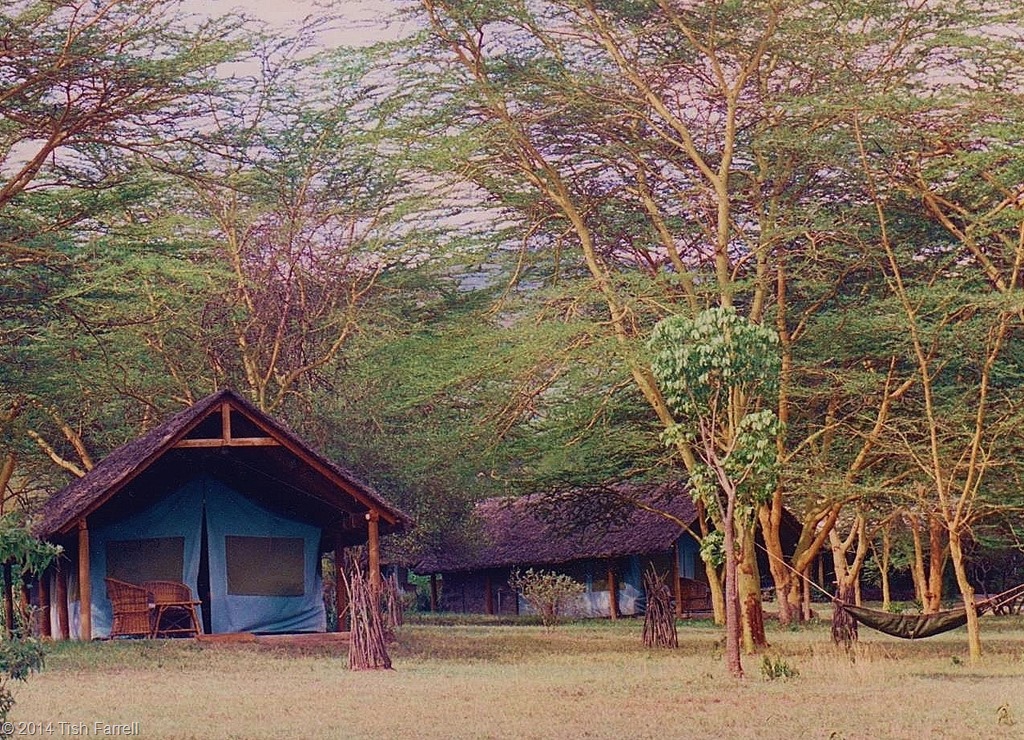
We came here often while we lived in Nairobi, staying at Delamere tented camp on the lake shore – a quirky, step-back-in-time establishment within its own nature reserve. The camp, itself was wholly unobtrusive -16 large tents, each sheltered by a thatched canopy and set out beneath fever trees that, here and there, hosted a sturdy canvas hammock.

The tents were functional – two wood-framed beds, simple cupboards, rattan chairs all locally made. They came, too, with a plain little bathroom attached out back – running water, flush loo and shower – all facilities that would still be an unobtain-able luxury to millions of Kenyans. Inevitably, knowing this added to the discomforting ‘them and us’  awareness that accompanied us pretty much everywhere. 

005

For us wazungu, then, Delamere Camp was an idyllic spot. I once spent a week here by myself while G was at a conference. There were no other guests for most of that time, external and internal tourism having been hit both by El Nino rains that had caused weeks of havoc, and by widely reported bouts of pre-election violence.  Manager, Godfrey Mwirigi, treated me as if I were his personal house guest.

I thus spent my days and nights being driven around Soysambu nature reserve in a safari truck with zoologist, Michael Kahiga as my expert guide, or taken on early morning bird walks through  the bush, or on late afternoon hikes up through the sage-scented leleshwa brush to Sogonoi cliff-top to watch the sun set over the lake with a glass of wine in my hand. This, the daily late afternoon pilgrimage to the sun-downer cliff, was a pleasing piece of  hospitality thought up by  Paul Kabochi, the camp’s ethno-botanist. I have written about him in an earlier post, but here he is again on the lake shore at dawn.

Scan-130602-0001

On this solitary sojourn I was sorry to find that he was away setting up another camp. He is a man whose great fund of knowledge is sadly missed, and I would have been glad to have had another chance to speak with him.  Instead, I talked to Godfrey about tourism. He kindly ate his meals with me so that I did not have to  sit in the dining room alone.

Between times, hot water bottles and extra blankets appeared like magic in my bed, or indeed in the truck for the evening game drives. (Nights in the Rift can feel frosty). And all the time I watched and watched until my brain ached with sensory overload.

Scan-140502-0013

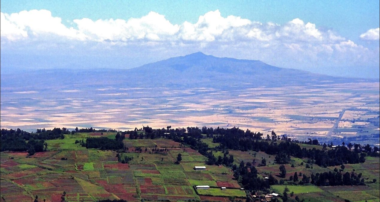
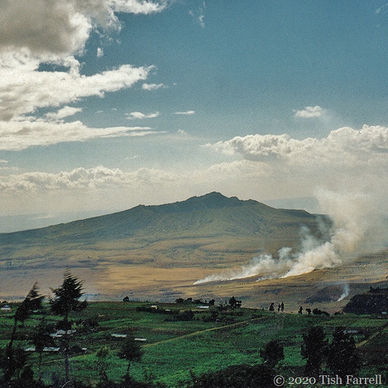
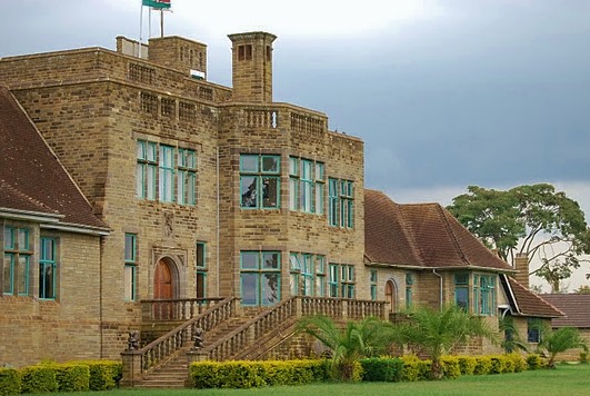
The camp overlooked the lake and the remnant volcanic cone that has long been known by the Maasai as the Elngiragata Olmorani, the Sleeping Warrior.  During colonial times it acquired a further name – Lord Delamere’s Nose, this apparently in tribute to the impressive dynastic proboscis of the third baron Delamere who, in the early 1900s, and as one of the first pioneer colonists, acquired  19 hectares (46,000 acres) of shore-land around the  the east, north and west of the lake.

His brother-in-law, Galbraith Cole, son of the Earl of Enniskillen, farmed the southerly shores at Kekopey. He was a man who was later exiled from British East Africa because he shot dead one of his labourers for stealing a favourite sheep. He later sneaked back to Kekopey disguised as a Somali, and his mother, Countess of Enniskillen successfully pleaded his cause. At the age of 48, and looking out over the lake, he shot himself, unable to bear the constant pain of his rheumatoid arthritis.

001

The descendants of these early settlers still live and retain most of their lands (including estates at nearby Lake Naivasha). In fact the only way to gain access to Elmenteita is to book into one of the exclusive safari lodges that now stand on the land that belongs to these old colonial families. This sense of British aristocratic exclusivity inevitably strikes a sour note. Doubtless these landowners will say they are custodians and that, without their dutiful care, the place would be wrecked by ramshackle trading operations and squatters, and the wildlife decimated.

001

Even in my home town in Shropshire we are still ruled by such feudal argument. ‘Keep Out’ signs exclude the people of Much Wenlock from the ancient Priory parkland that is  now owned by one family. In Great Britain we take for granted (or are even unaware of) the power of the self-appointed, self-aggrandizing elite who own most of our countries’ lands.  I imagine, though, that many people would be surprised to know that super-squiredom is also alive and well  in East Africa.

Scan-140502-0023

Before the British annexed East Africa in the 1890s, and all the (deemed) unoccupied territory became the property of the British Crown, and the locals obliged to stay forever  on the land where the British happened to find them,  land usage and territorial ownership was a much more fluid affair. For instance, up in the Rift highlands, and going back hundreds of years, the Kikuyu farmers had negotiated the legal acquisition of new land with the indigenous Okiek hunters, whom the Kikuyu judged to be the land’s original owners. Over the centuries this process of colonisation caused an occupational creep: as land became exhausted or overcrowded, so clan scions left their fathers’ homesteads and sought out fresh territories for their own families to cultivate. It is a similar story over much of the continent as the Bantu agriculturalists sought fresh ground.

As the boundaries of  allotted farm and pastureland nudged further into the Rift, so there was competition and conflict with the pastoral Maasai. The herders anyway believed themselves masters of the Rift, shifting up and down it as need for fresh grazing and water dictated. The farming communities with whom they traded and inter-married also at times presented an alluring target. This was inspired by the cattle herders’ belief that Enkai, the creator, had bequeathed all the cattle on earth to the Maasai. For young warriors intent on proving their courage and amassing cattle to augment family honour, armed cattle raids on their farming neighbours were a matter of necessity.

It is interesting, then, that colonial aristocrats such as Delamere, who established large stock ranches in the Rift, were inordinately admiring of the Maasai, seeing them as nature’s aristocrats. It is also tempting to put this down to a congruence of world vision: recognition of a mutual case of droit du seigneur? In fact in those early days, Delamere was the only white man for whom the Maasai would deign to work, although this did not stop them from making off with large numbers of his sheep and cattle.

Scan-140502-0067

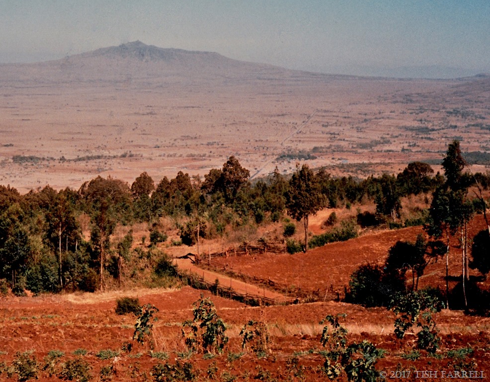
That the Rift was once Maasai territory is indicated by the many place names – Naivasha, Nakuru included – that are European renderings of Maa originals. Elmenteita derives from  ol muteita,  meaning  “place of dust” and, from time to time, this shallow soda lake does turn to dust.  At the best of times it is only around 1 metre deep. It shrinks and expands depending on the rains. But when not blowing away to dust, it extends over some 19-22 square kilometres.

The alkaline waters are rich in the crustacea and larvae that the greater flamingos feed on, and in the blue-green algae that the lesser flamingos syphon up through the top of their bills. The former have white plumage with a pink wash; the latter are more the colour of strawberry ice cream. Both honk, and grunt and mutter in a continuously shifting mass. All night you can hear them as you lie awake in your tent.

Scan-140503-0058

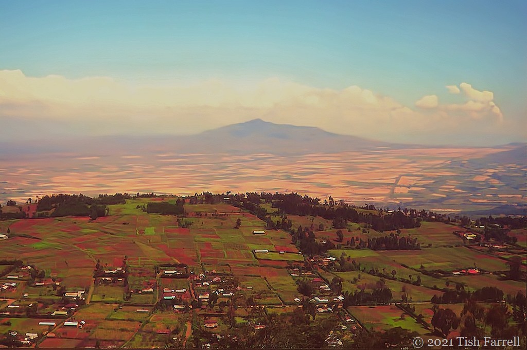
A view to dine for: Losogonoi Escarpment and the lake shore

*

But it is not only the bird life that make this place so special. The traditional ‘big five’ may be lacking in this part of the Rift, but it is still home to Rothschild giraffe, eland, buffalo, zebra, ostrich, impala, gazelle and a host of smaller game – aardvark, zorilla, porcupine, African wildcat. Since our time in Kenya much has changed at Soysambu. In 2007 the private Delamere Estate began operating as a not-for-profit conservation organi-zation called Soysambu Conservancy.

Delamere Camp has long gone. In its place is a new enterprise, the very expensive Serena Elmenteita Luxury Camp, a sort of out-of-Africa manifestation with bells on, the kind of set-up that intrudes a different kind of exclusivity on this piece of Kenya. But then of course there’s always the usual argument: that the provision of luxury on this scale does at least provide many, many jobs for Kenyans. Across the lake, however, something of the original Delamere Camp ethos has been re-created at the Sleeping Warrior Eco Lodge and Tented Camp – all within the Soysambu Conservancy.

In fact things have not been going well with the Delamere family. The sheer mention of the name has been enough to evoke great fury among many Kenyans. In 2005 and again in 2006, Thomas Cholmondeley, sole heir of the 5th Baron and Soysambu’s manager, admitted to shooting dead an African. The first case involved a plain clothes officer working for the Kenya Wildlife Service, apparently on the Soysambu farm to investigate a poaching incident. Cholmondeley says he thought the man was robbing his staff. Action against him was dropped.

In the second case, he caught a group of poachers with a dead impala, and said he was shooting at their dog when he fatally wounded one of the men. Later he claimed it was his friend, Carl Tundo, who had shot the poacher, and that he was covering for him. The whole sorry story was featured in the BBC Storyville film Last White Man Standing. Later the charge of murder was changed to manslaughter, and in any event Cholmondeley spent 3 years in Kamiti Maximum Security Prison, Kenya’s toughest jail. To many, though, it was thought to be far too lenient a sentence. The high profile media coverage also  reminded  millions of landless Kenyans that certain individuals had in their sole possession unimaginably vast estates. The old skeletons of racism and colonial oppression came rattling out of the cupboard to fuel the general furore, as the poacher’s widow asked for justice.

And so what in the end are we left with – a beautiful place enmeshed in tales of human intrigue, slaughter and misadventure.

I know I was lucky to spend so much time there when I did, and to see it through the eyes of the Kenyan naturalists who were my guides. I hope that many of them still work there – for Serena or Soysambu. They taught me how to watch out in that landscape: to recognize tracks of genet cat and mongoose, to poke through the little piles of dik dik droppings that marked this tiny antelope’s territory, to identify a black-breasted apalis or shy tchagra, to listen for the calls of the red-fronted tinkerbird, to know that an infusion of bark from the muthiga or Kenya Greenheart tree is good for toothache and stomach upsets, and most especially not to fall into aardvark holes as I was walking through the thornscrub.

Finally then, a few glimpses of Soysambu’s beautiful creatures.

Scan-140502-0042

Scan-140504-0002

Scan-140504-0003

Scan-140504-0004

Scan-140504-0005

Scan-140504-0009

Scan-140503-0036

Photos from bottom up:

Superb starling comes to breakfast

Waterbuck females

Dik Dik (one of the smallest antelopes, slightly larger than a hare)

Saddlebill stork, impala in the background

Eland (the largest of Africa’s antelope) and ostrich

Burchell’s zebra

Rothschild giraffe

Scan-140502-0046

© 2014 Tish Farrell

A Word A Week Challenge for more stories

In the Rift: in and out of focus

WP Photo Challenge: Focus

Rift Valley from Escarpment

You may have seen a version of this photo in an earlier post, but it’s worth another look for various reasons – all of them to do with FOCUS. This shot was probably taken late morning. The farmsteads of Escarpment are shadowed by the Eastern Rift behind. Out under the sun, the old volcano Longonot flattens and drifts into mistiness. Your brain tells you that your are witnessing a mirage.

You can climb up Longonot if you want to, and walk around the rim. (We never did.) Inside the crater, Rider Haggard-style, there is a wonderful hidden forest filled with wildlife. In the middle distance, but not quite visible, runs the old road from Nairobi to Naivasha, built by Italian prisoners of war in WW2.

But to come back to the foreground, and the largely Kikuyu community of Escarpment, this is one of the places where, in 1997-8, Team Leader and Nosy Writer carried out some of the Team Leader’s doctoral fieldwork on SMUT. Smut is a fungal disease that attacks Napier Grass, an important animal fodder crop. If you didn’t read the smutting post, coming up is a photo of the smut team in action, complete with some Rift Valley fog which usually happens during Kenya’s cold season in June and July.  Here it provides  the soft-focus-background-look without need of any technical jiggery-pokery.

napier grass sampling 3

Team Leaders Njonjo and Graham weighing clumps of Napier Grass. The object to establish a disease assessment scale for estimating the food loss of a smut-infected field.

*

Actually, the real leader in Operation Smut was Njonjo. He’s the one holding the bundle of Napier Grass. His family’s land is in Escarpment, much sub-divided between himself and his brothers. When we visited his home he told us that his own holding was about a quarter of an acre. This was one reason why he worked as a driver for the Kenya Agricultural Research Institute and was not as a full-time farmer. He had children to educate, and his land alone could not support them all.

*

napier grass on the Rift

Napier Grass in the foreground with Escarpment farms beyond. This important crop is grown on road verges and field terrace boundaries to feed ‘zero-grazed’ stock. The small size of most farms  (some less than an acre) means there is insufficient ground for both pasture and cultivation.

napier grass and farms

Kikuyu farmstead on a drizzly El Nino day.

*

And if you are wondering why Kenyan farms are so very small (several acres in the fertile Central Highlands would be considered quite large for many families) then that’s old colonial constructs for you. Kenya may have been an independent nation state for fifty odd years, but the colonial concept of land management and ownership, along with many other inappropriate British institutions, is alive and well.

Because that’s the thing about British institutions – they are sneakily feudal and thus very hard to unpick. Even in Britain, most of the population is generally unaware that most of the nation’s land is owned by a small number of people who are fully committed to keeping it that way. Ownership in the form of title deeds coupled with an elitist sense of superiority and personal entitlement based on heredity fortify their position. Increased urbanisation is in their interest; it keeps hoi polloi out of the deer parks and off the grouse moors (unless of course they are paying high fees to be there.)

In Kenya much of the population still occupies plots that were part of the designated Native Reserves back in the 1900s.  Since those days the population has increased many-fold, and family farms have been subdivided to point where they cannot easily support one family. This situation underpins much of the creeping poverty that you will see in Kenya today. It is the reason why at least 75% of the nation’s food is grown by women smallholders.

*

Wundanyi market 2

Women selling their excess garden produce at Wundanyi market, Taita Hills.

*

These essential growers are the rural wives who stay on what remains of family land to grow what they can, while their husbands  migrate to the towns to work in shops, hotels, and as drivers,security guards and house servants. These men will return home maybe once or twice a year when they have their annual leave. At such times they will help with the harvest and undertake house repairs. This is also the reason why most parents struggle so hard to educate at least some of their children – so they do not have to live this way.

*

When the British occupied British East Africa at the end of the 19th century, they treated the territory in much the way a British landowner would manage his inherited estates. There was the presumption of absolute ownership. All indigenous people who hunted for a living were labelled poachers and treated accordingly. Land was divided into Native Reserves and Forest Reserves and latterly there were also Game Reserves. All the land that had not been alienated for European settlement was Crown Land unless it was Native Reserve land. By 1914, five million acres had been allotted for European settlement. The Maasai had also been removed from their fertile grazing lands on the Laikipia Plateau and relegated to the poor land that is now known as the Maasai Mara.

001

European owned wheat fields, Laikipia, below Mount Kenya. Taken from a plane window hence the haze.

*

Under colonial rule, Africans could not leave their Reserves unless it was to work for Europeans. Hut and poll taxes were imposed to force them to do so. When overgrazing and land erosion became evident in overcrowded Reserves, well-meaning British Agriculture Officers informed the locals that they were doing everything wrong. Farmers were urged to plant in a European way, to grow strains and varieties of crops to suit British markets. In particular, the growing of nutrient-, water-guzzling maize over traditional, more nourishing crops such as millet was promoted. There was the enforced terracing of land and the confiscation of stock animals without compensation if deemed to be in excess.

Meanwhile, large blocks of the best settlement land were taken  up by British settlers, including a number of British aristocrats whose descendants still live on large estates in Kenya. After the 1st and 2nd World War, British veterans of the officer class were actively encouraged to settle the so-called ‘White Highlands’ around the Rift and grow cash crops. When many sold up at Independence, their tea and coffee estates were taken over by European corporations. Other settlers who wished to leave at that time were bought out by the British Government who then apparently handed over the bill to the new Kenyan government. The new nation state thus started out in debt, having paid to get its own land back. It was not a good beginning.

Scan-130601-0006.jpg

A beautiful corner of Lord Delamere’s estate of Soysambu at Elmenteita in the Rift Valley. The pink dots on the soda lake are flamingos.

*

the-castle2.jpg

Egerton Castle, built in Njoro in the Rift Valley between 1930-40. Its owner was the Fourth Baron Egerton of Tatton, Cheshire. It is now part of Egerton University and used as a wedding venue.

*

However you look at it,then, the land situation in Kenya does not present a pretty picture, and this is only a brief, soft-focus version. After the British left in 1963, Kenyans might have been able to leave their Reserves without passes, and walk on whichever side of the street they chose, but the Crown Lands concept of absolute possession has dogged the country ever since. Crown Land became state owned land; colonial institutions became state institutions. And as I said, such constructs are hard to unpick. Nor would the Kenyan elite wish to unpick them, any more than the British nobility would wish to surrender their hereditary land rights to the masses. As the fourth President, Uhuru Kenyatta (and son of the first President Jomo Kenyatta) takes office, so the thorny issues of land grabbing and wrangles over title deeds continue.

tea fields and workers' houses_thumb[140]_thumb

A  tea estate with workers’ quarters near Nairobi.

Limuru tea fields in the long rains

*

Today, ordinary land-poor Kenyans must look out on the large farms and estates still owned by the descendants of European settlers, or the ranches and flower factories of the Kenyan elite, or at the plantations of the multinationals whose profits go to foreign shareholders, or even at the great wildernesses set aside exclusively for wildlife, and wonder what Independence has brought them. Under colonialism most people were excluded from the wealth creating process except to provide manual labour. Today it seems that not much has changed.

*

Rift Valley and Longonot from Escarpment (2)

http://flickrcomments.wordpress.com/2013/08/27/iii-challenge/

© 2013 Tish Farrell

Weekly Photo Challenge: Change

Rift Valley from Escarpment


Change, what change? All seems so still in this shot of Kenya’s Great Rift Valley. The day is fine. The short rains have brought on the maize and pyrethrum crops on the small escarpment farms. The distant volcano, Longonot, appears dormant and suggests no kind of threat. It is hard to imagine, then, that this peaceful scene is a site of great seismic upheaval, and has been for the last 30 million years. Likewise it is hard to accept that even as I took the photo, the tectonic plates beneath the Rift floor were v-e-r-y slowly pulling apart. In another million or so years you might stand in the spot where I stood and look out on the Indian Ocean; the ground beneath your feet will be a brand new island, and the low Rift terrace where Kikuyu farm wives presently toil, lost under the sea.

The thought is unnerving. For it’s an interesting paradox: while we accept and embrace increasingly rapid changes in the man-made environment, we’re not too keen to confront the reality of a planet that transforms itself beneath our feet and in ways we cannot control. It is interesting then to think, as scientists have been doing, that our very origins as humankind, could well derive from the creation of the Rift Valley.

The argument runs like this. The Rift has long been referred to as “The Cradle of Mankind”. The earliest remains of human ancestors have so far been found along its length (in Ethiopia, Kenya and Tanzania), but the time when we see the big leap in hominid development coincides with the time of maximum uplift in the Rift. This happened around 7 million years ago when the so-called Wall of Africa was created and Africa’s climate thereafter began to change. The rain shadow created by the upthrust highlands caused the forests, the preferred habitat of our primate predecessors, to give way to the more arid savannah we see today.

Without trees for cover and look-out posts our ancestors became vulnerable; food would have become less easy to find, and so in order to hunt and not to be hunted they had to stand up on two feet in order to see over the tall plains grasses. Thus began the long march to cell phone, app and PC that much of humanity apparently cannot now live without. It’s interesting to think how things end up.

As to what created the 3,700 mile-long Rift, then that comes down to plumes of hot semi-molten rock surging up beneath the earth’s crust. In Kenya this surging has also left behind chains of dead and dormant volcanos, including Mount Kenya which, at 17,000 snow-capped feet, is only a vestige of its former unexploded vastness. The pulling apart of the Rift plates has also created the famous soda lakes of Magadi, Nakuru and Baringo, and the deep freshwater Lake Victoria.

Personally, though, I prefer the old Kenyan story that says the Rift was created by termites. It goes like this. Once there was a marauding giant abroad. He preyed on all the animals and none of them was strong enough to finish him off. In the end it took the cunning of many tiny insects to burrow away under the ground and create a well hidden ambush. The next time the giant came rampaging by, the ground gave way beneath his feet and he plummeted into the great trench that the termites had created and so was killed. It was doubtless a fitting end for a troublesome giant, while the hitherto disregarded insects could look forward to greater respect from their fellow creatures.

©2013 Tish Farrell