Yellowing Africa Memories And Shades Of Dark Safaris

PICT9928

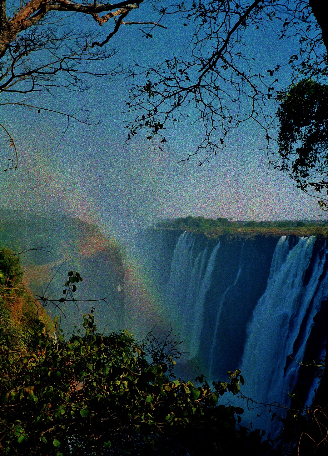
There are the experiences we had, and the ones we think we had: so many versions of the ‘truth’. And much like conscious memory, the Kodak negative from which this image comes, is much degraded; the colours distorted. I’ve had to do some de-saturating to reduce the negative’s livid cast. Not very successful, but the result, I think, is all my own  ‘Out-of-Africa-nostalgia’ effect.

Naturally my writer-self loves the romance of this and related yarns of the old safari era. And yet these are not the real story. They never were. That’s one of the problems with nostalgia, particularly the Anglo-African variety. It’s usually a longing for something that never was. It was the kind of longing that brought British settlers of the gentry class out to East Africa in the first place. Anything would grow there, they said. Fortunes would be made. And until the predicted riches rolled in – from ostrich feather farming, flax, wheat, coffee and tea –  the hunting potential for the sporting man (and sometimes woman) was limitless – herds of wild game from sky to sky, and a country full of cheap household servants and farm labourers. And all so handily available just when home supplies of both (animal and human) were on the wane.

Here’s a poster of the time, pre-1920, summing things up. The similarity to a Punch Magazine cartoon was apparently deliberate.

Uganda Railway and aristratic game resort

As railway advertisements go, this one truly takes the biscuit, and on so many fronts. Please note the very small print towards the bottom: ‘Arrival of the first Cook’s excursion and the result of carefully preserving the big game’. Also I’m not sure what the bipedal beast behind the train is meant to be. It looks like a bear to me. Perhaps he came with the aristocrats, captured on one of their North American shooting expeditions – also popular at the time.

So: elite settlerdom in East Africa seemed a fine idea. And as long as the European lower classes were kept out, the incomer Indian labourers and traders kept in their place (these mostly the survivors of the 18,000 ‘coolies’ imported  from India in 1896 to build the Mombasa-Uganda Railway), and the local Africans did the field work for minimal pay while their own traditional hunting practices were outlawed, then, by Jove and St. George, it would be paradise on earth. The British East Africa Protectorate (Kenya Colony after 1920) was, and forever would be, a dedicated White Man’s Country. A lordly sporting estate writ large. The happy hunting ground of new white landowners who believed that only they, gentlemen (and under certain circumstances, gentlewomen) had the god-given right to hunt. All the game was theirs.

Uganda railway poster

But hang on a minute. In this safari story the real protagonists are invisible, or overlooked, deliberately excluded; these, the many African hunters and expert trackers who facilitated the pursuits of their white overlords on the imperial safaris of the early 20th century; they who risked arrest for the crime of poaching if they dared to hunt for their own pot as their people had done for countless generations before the British invaded.

It is not for nothing that the settlers referred to their African workers as boys, reducing them to beings of little or no account. From such aristocratic notions of superiority and entitlement – a mind-set that persisted among many until Independence in 1963 – does the modern state of Kenya derive. In some ways little has changed. Ever since Uhuru, the post-colonial rulers (and with a similar sense of dynastic entitlement) have been intent on commandeering all resources for themselves, and ignoring the needs of those they rule.

*

But back to the aging photo of magnificent beisa oryx. It  was taken nearly 20 years ago. The Farrells were, in the manner of Kenya’s  well-honed, post-colonial tourism model,  ‘on safari’; flown in a twenty-seater plane – out of Nairobi and into Lewa, winging left at Mount Kenya.  Touching down on the airstrip cut from bush you could spot elephant and the strangely foreshortened view of Mount Kenya’s summit.

Scan-130608-0028 - Copy

Our destination was a small tented camp in Laikipia, northern Kenya, a three night sojourn out in the wilds. I should say at once that when we stayed at the Lewa Downs safari camp it had not accrued the expensive, life-style look it has now, nor the uber-nouveau-colonial glamour of Lewa House and its secluded guest cottages. (Prince William apparently proposed to Kate Middleton while staying there as a family guest). In our day we had a big green tent, one of a dozen. There was a small shower room and WC attached, and the whole lot camouflaged by a thatched canopy. When the flaps were back we could lie in our bunks and gaze at miles and miles of Africa  and inhale the sweet aromatic scent of thorn brush. The accommodation was simple and functional although we naturally thought a tent with its own clean, running water and a flush loo was a great luxury. But then as many travellers in Africa before us, and in pursuit of our own pleasure, we chose to ignore any moral issue associated with this provision. The camp was otherwise low-key, mostly set up to attract birding photographers, and one of several similar small camps run by the East African Ornithological Society.

Scan-140809-0028

*

The camp we stayed in occupied a small corner of the Lewa Downs estate, once a colonial cattle ranch staked out from former Maasai grazing territory in 1922 under the British government’s post-war Soldier Settlement Scheme. The colonial administration’s plan at that time was to double the colony’s European population. Meanwhile the Africans’ side of the story was as follows. All Kenya’s indigenous peoples had to live on their allotted tribal reserves unless they were working for Europeans. They could not acquire land outside the reserves. All men over the age of sixteen had to wear the kipande pass book containing their work record. All Africans paid poll and hut taxes, which had just then been increased to recoup costs from the European war effort. Taxation also had the aim of impelling Africans into the labour market. Africans who had served in the Great War were not eligible for the new settlement land (10,000 soldiers, 195,000 porters of whom 50,000 had perished).

For Europeans, however, that it is to say for ‘men of the officer class’, there was on offer by lottery or at cheap rates, large blocks of land in the fertile Central Highlands and the Laikipia Plateau below Mount Kenya. Officials apparently believed that such men, newly returned to civilian life and most with little or no practical farming experience, would in an untried African environment,  produce export quantities of cash crops. This trade in turn would fund the upkeep of 600 miles of now largely purposeless, but very expensive Mombasa-Uganda railway that the colonial administration had built between 1896 and 1901. (Also known as the Lunatic Line).

The railway’s original purpose was to provide access to land-locked Uganda, then believed to be the future source of vast natural resources. There were strategic reasons too. In the last decades of the 19th century, during the big European land grab of Africa, relations with Germany had become increasingly scratchy, and especially over possession of Uganda. British paranoia raised the spectre of the Germans sabotaging the source of the Nile at Jinja in Uganda, thereby scuppering Britain’s major shipping lanes in the faraway Suez Canal which relied on Nile water. Once thought of, only a railway would serve to bring troops swiftly to the scene to defend the vulnerable head waters.

Africa 1914 (St. Francis High School website)

*

Twenty years later, these functions unrealised or redundant, only large-scale European settlement would make the best of a bad job. Along with this ‘House that Jack Built’ mode of thinking was the idea that veteran officers, used to handling men, would be well fixed to manage and ‘civilise’ (i.e. instil discipline in) African labourers, this despite knowing nothing of their employees’ traditions or way of life or their language. Also if things went wrong at some future time, an uprising for instance, the officer chaps would usefully know how to handle a gun and not be afraid to use it.

As I’m writing this, I’m thinking that it sounds like a very bad joke with a dollop of Wodehouse daftness thrown in. But this is how the British Empire did things in East Africa. They were not prepared to invest in indigenous Africans, but they were prepared to take a punt on the ‘right sort’ of Europeans of whose farming prowess they knew not one single thing.

*

Roll forward 96 years…

Today Lewa Downs is still owned by descendants of the Craig/Douglas families who began the ranch. But now, and in cooperation with local indigenous communities, and the Kenya government, the owners use their 62,000 acres not for farming, but to protect threatened wildlife. Among their wards are populations of black and white rhinos whose territory is watched over around the clock by vigilant rangers, and whose horns are defended from poachers by armed Kenya Police Reservists.

lewa a

It is an award-winning, avowedly non-profit-making enterprise that has set out to demonstrate that up-scale tourism can serve both wild life conservation and local community development. Other funding comes from donation and sponsorship, and a big proportion of the total income is spent on community projects including clinics, education,  water management schemes, and low-interest loans to kick-start women’s small businesses.

Anyone who stays at Lewa Conservancy can be guaranteed unforgettable experiences – the full-on African wilderness, magnificent game viewing in breath-taking country, the chance to see how some of the tourist dollars are being spent. There are bush breakfasts, night game drives, camel riding, and star bathing. It would seem to be the 21st century eco-socio-sensitive take on the self-serving champagne safaris  of the 1920s and ‘30s when white hunters – John Hunter, Bror Blixen and Denys Finch Hatton et al – ran commercial shooting expeditions for the elite of Europe, India and America.

And while the trophies these days are photos and memories, and not elephants’ feet, tusks and antelope heads, and while the safari guests’ presence may help to fund laudable causes, and not the free-booting life-styles of maverick aristocrats and misfit adventurers, still the packaging of today’s safaridom evokes something of the old elitist romance. If we don’t watch out it clings like a parasitic infection and blinds us to the many ironies.

But have a look for yourself at what the Lewa Conservancy is doing for people and wildlife. The model is not without its critics. Other settler descendants have pointed out that big landowners who stayed on in Kenya after Independence have been increasingly under pressure to start sharing their acres if they were not seen to be doing something very useful with them. The Craigs and their management team seem to have come up with quite a solution. The safari story continues…

copyright 2018 Tish Farrell


Misty Mountains of East Africa


002 (2)

Kilimanjaro rising behind the Chyulu Hills, Ukambani, Kenya. Photo taken from the Mombasa Highway during the December short rains.

*

001

Mount Kenya from the plane window, looking over the European-owned wheat farms of Laikipia

*

It is one of history’s bizarre anecdotes, that one of these two old volcanoes was once given away as a birthday present. But before I reveal how this happened, please take a look at the map. Head for the centre.

4e1bbcd8-9af9-95ca[1]

Here you will see that Tanzania’s Kilimanjaro and Kenya’s Mount Kenya lie pretty much on the same north-south axis, albeit a couple of hundred miles apart. In an earlier post about Denys Finch Hatton’s burial place in the Ngong Hills (to the left of Nairobi on the map) I quoted Karen Blixen’s description of how  one sunset, she and Denys had witnessed a simultaneous sighting of Kilimanjaro and Mount Kenya. This must have been something to see, for these mountains can be frustratingly elusive when it comes to showing themselves. One moment you can be looking them full in the face; the next they have dissolved into a clear blue sky as if they were never there. You blink and wonder how this could have possibly happen. It is doubtless a quantum physics thing, but in the absence of more scientific explanations, the phenomenon anyway seems quite mystical. It is not surprising, then, that local people have long regarded these mountains as sacred places that may, from time to time, be visited by the Creator.

But to return to the mountainous birthday gift.

If you look again at the map you will see how the border between Kenya and Tanzania makes a sudden kink to encompass Kilimanjaro.  This daft piece of map-making is testimony of a tussle in colonial expansionism (Britain versus Germany) and the kind of queenly megalomania  that thought it perfectly reasonable to take possession of someone else’s mountain and then make a gift of it to a fellow monarch, a personage whom she rather despised even though he was a close relative.

I’m sure you will have guessed by now that we are talking of Queen Victoria  and Kaiser Wilhelm. One can only presume that someone who also called herself  the Empress of India would think nothing of the sharing out of stolen mountains. I dare say she thought it made up for the fact that she had bagged the territories now known as Kenya and Uganda when Wilhelm had wanted them too. Perhaps she also thought that giving Wilhelm the taller of the two would also help to placate him.  If she had stopped to consider the fact that Kilimanjaro was only a dormant volcano, she might have had second thoughts.  It was altogether too ominous a gift.

In the end the whole land-grabbing deal was  ratified in the Heligoland  Treaty of 1890, and the map-makers  then duly drew a line straight through the middle of Maasai territory coupled with the requisite detour round Kilimanjaro. They called one side British East Africa, and the other German East Africa. Meanwhile the locals, who comprised very many different ethnic communities, were largely unaware how far they had been scrambled, or indeed scrobbled, to borrow a term of dastardly rapine from John Masefield and The Box of Delights. They were soon to find out. On the British side it began with the setting up of forts along the proposed line of rail for the Uganda Railway. This 600-mile line from Mombasa to Lake Victoria would be the means by which the Empress of India would get her troops (mainly Indian ones) swiftly to the source of the Nile. Why she would ever need to do this will have to wait for another post. Suffice it to say that this project was substantially dafter  than the giving of mountains as birthday presents. Even at the time people thought so. In Britain they called it  the Lunatic Line. In East Africa the invaded called it the Iron Snake.

Scan-130510-0006

Glimpse of Kilimanjaro on the flight from Zanzibar to Mombasa

© 2016 Tish Farrell

*


The Smoke that Thunders

Scan-130703-0003

We inhabitants of Great Britain, that one-time source and bastion of Empire, somehow take it for granted that other people’s geography should be named after our explorers, our lords and our monarchs. It was part and parcel of the colonizing process, this laying claim to territory, the ‘making it ours’ rather than theirs, the indigenous inhabitants’. Also, much as a head-hunter gains spiritual power by consuming the brains of his enemy, so explorers, lords and monarchs accrued grandeur by bestowing their names on natural-world-wonders. It was one way of acquiring grand-scale permanence over frail bodily transience. Some might say it was a form of megalomania.

All of which is to say that the photo above shows one of the most famous examples of colonial misappropriation – the great southern African cataracts of Victoria Falls. They were ‘discovered’ by missionary, David Livingstone, in November 1855. This was in the days before the British map-makers had staked out the colonial territories of Northern and Southern Rhodesia, (named after the mineral-hungry Cecil Rhodes), and now known (respectively) as Zambia and Zimbabwe.

Livingstone is thought to be the first European to set eyes on the falls, and his presence is commemorated both in the name of Livingstone Island, just above the falls, and in the town of Livingstone on the Zambian side of the cataracts.

Scan-130703-0004

 Livingstone Monument

But the fact remains that when Livingstone arrived this, the largest falling curtain of water in the world, already had at least one very fine name. The rainbow spray from the toppling cascades rises like smoke that can be seen for miles, and the Zambezi, as it drops through 110 metres, simply roars. And so it is fittingly known by the indigenous Tonga people as Mosi-oa-Tunya, the smoke that thunders.  Also fittingly, and by way of restitution, this is also the name that UNESCO puts first in its World Heritage Site citation for the falls.

Victoria Falls and Zambezi

The falls from the Zimbabwe side at Victoria Falls town. The spray is a challenge to the the photographer.

*

The photo below shows the falls from the Zambian side. The rains had been poor when the shot was taken, and much of the water from the Zambian side of the Zambezi is anyway abstracted for industrial purposes. It is hard to convey the scale, but it shows well how the Zambezi has cut through the basalt plateau over which it flows. Over the last hundred thousand years the river has repeatedly carved out new gorges, wearing down cracks of softer sandstone within the basalt and creating a zigzag of massive fissures. The current falls go over the eighth gorge, but there are already signs that the ninth is beginning to form.

I have the foolhardy distinction of almost hang-gliding off the falls’ knife-edge courtesy my kanga-wrap, just then being used as an umbrella. G had business in Livingstone and we were staying in a hotel near the river, or I should say near the absence of river. I saw people walking across the waterless river bed towards the Zimbabwe side of the falls, and one Sunday afternoon, urged G. to set off on an outing. In no time we had a young Zambian boy offering to be our guide. He led us through a maze of huge boulders and oily stagnant pools. At one point I noticed fresh elephant droppings and fully expected the massive stones to transform into pachyderms, since that’s the sort of thing elephants do. All around the sky was turning from brilliant blue to a steely grey. I forgot about elephants and thought of flash-floods instead. I was beginning to wish we had not come.

Zambia's Victoria Falls looking along knife-edge to Zimbabwe's falls

But the boy pressed on, heading we later discovered for Livingstone Island. He had promised to show us the best place to view the falls. And so we followed. And then came the deluge. In seconds we were soaked to the skin by very cold, hard rain. When I looked back across the river, our hotel seemed very far away, and the empty river bed so very wide. We ran after the boy into the trees on Livingstone Island, and there we huddled under the dripping vegetation. Time passed. And more time passed. We grew colder and wetter.

Finally, when there was no sign of the rain letting up, G. asked the boy how far was this viewpoint. Oh, not very far, he told us. We followed him out into the driving rain. And sure enough, in a few paces, there we were on the knife edge. I held my kanga high above my head, fly-sheet style, in a bid to fend off the downpour. But as I craned over the precipice, the wind gusted and I felt the threatening lift as it filled the kanga…

After that there could only be a swift retreat. Shaken by my close shave with the abyss, I turned for the distant shore and tried to run. But the rocks were slippery, and every boulder looked like an elephant, and the more it rained the more I glanced upstream for that wall of rushing water. By now our guide had disappeared. I don’t think we had even given him a tip, and that was even more worrying. To leave without his kwacha? What did he know that we did not?

Of course it was all panic and no substance. After a hot shower and a bottle of Mosi back at the hotel, it seemed like a great adventure, though we did wonder if Livingstone Island was in Zambia or in Zimbabwe, and if, in the rainstorm, we had become illegal immigrants into Zimbabwe. Of course we hadn’t, but it added a little more spice to the story.

Scan-130703-0007 (2)

Victoria Falls - Cecil Rhodes' railway bridge

The Victoria Falls bridge, built in 1905 in a bid towards fulfilling Cecil Rhodes’ dream of the Cape to Cairo railway line. He insisted it was built where the falls’ spray would fall on passing trains.

Victoria Falls - Zambian side with rainbow

Related:

UNESCO World Heritage Site

Sun, Steel and Spray: A History of the Building of the Victoria Falls Bridge by Peter Roberts

Where’s My Backpack Ailsa’s Travel Theme: Height

More takes on height:

http://suejudd.com/2013/10/04/weekly-travel-theme-height/

http://cosytravels.wordpress.com/2013/10/04/travel-theme-height/

http://laavventura.wordpress.com/2013/10/04/travel-theme-height/

http://bastet1952.wordpress.com/2013/10/04/travel-theme-high/

http://sustainabilitea.wordpress.com/2013/10/04/travel-theme-height/

© 2013 Tish Farrell

In the Rift: in and out of focus

WP Photo Challenge: Focus

Rift Valley from Escarpment

You may have seen a version of this photo in an earlier post, but it’s worth another look for various reasons – all of them to do with FOCUS. This shot was probably taken late morning. The farmsteads of Escarpment are shadowed by the Eastern Rift behind. Out under the sun, the old volcano Longonot flattens and drifts into mistiness. Your brain tells you that your are witnessing a mirage.

You can climb up Longonot if you want to, and walk around the rim. (We never did.) Inside the crater, Rider Haggard-style, there is a wonderful hidden forest filled with wildlife. In the middle distance, but not quite visible, runs the old road from Nairobi to Naivasha, built by Italian prisoners of war in WW2.

But to come back to the foreground, and the largely Kikuyu community of Escarpment, this is one of the places where, in 1997-8, Team Leader and Nosy Writer carried out some of the Team Leader’s doctoral fieldwork on SMUT. Smut is a fungal disease that attacks Napier Grass, an important animal fodder crop. If you didn’t read the smutting post, coming up is a photo of the smut team in action, complete with some Rift Valley fog which usually happens during Kenya’s cold season in June and July.  Here it provides  the soft-focus-background-look without need of any technical jiggery-pokery.

napier grass sampling 3

Team Leaders Njonjo and Graham weighing clumps of Napier Grass. The object to establish a disease assessment scale for estimating the food loss of a smut-infected field.

*

Actually, the real leader in Operation Smut was Njonjo. He’s the one holding the bundle of Napier Grass. His family’s land is in Escarpment, much sub-divided between himself and his brothers. When we visited his home he told us that his own holding was about a quarter of an acre. This was one reason why he worked as a driver for the Kenya Agricultural Research Institute and was not as a full-time farmer. He had children to educate, and his land alone could not support them all.

*

napier grass on the Rift

Napier Grass in the foreground with Escarpment farms beyond. This important crop is grown on road verges and field terrace boundaries to feed ‘zero-grazed’ stock. The small size of most farms  (some less than an acre) means there is insufficient ground for both pasture and cultivation.

napier grass and farms

Kikuyu farmstead on a drizzly El Nino day.

*

And if you are wondering why Kenyan farms are so very small (several acres in the fertile Central Highlands would be considered quite large for many families) then that’s old colonial constructs for you. Kenya may have been an independent nation state for fifty odd years, but the colonial concept of land management and ownership, along with many other inappropriate British institutions, is alive and well.

Because that’s the thing about British institutions – they are sneakily feudal and thus very hard to unpick. Even in Britain, most of the population is generally unaware that most of the nation’s land is owned by a small number of people who are fully committed to keeping it that way. Ownership in the form of title deeds coupled with an elitist sense of superiority and personal entitlement based on heredity fortify their position. Increased urbanisation is in their interest; it keeps hoi polloi out of the deer parks and off the grouse moors (unless of course they are paying high fees to be there.)

In Kenya much of the population still occupies plots that were part of the designated Native Reserves back in the 1900s.  Since those days the population has increased many-fold, and family farms have been subdivided to point where they cannot easily support one family. This situation underpins much of the creeping poverty that you will see in Kenya today. It is the reason why at least 75% of the nation’s food is grown by women smallholders.

*

Wundanyi market 2

Women selling their excess garden produce at Wundanyi market, Taita Hills.

*

These essential growers are the rural wives who stay on what remains of family land to grow what they can, while their husbands  migrate to the towns to work in shops, hotels, and as drivers,security guards and house servants. These men will return home maybe once or twice a year when they have their annual leave. At such times they will help with the harvest and undertake house repairs. This is also the reason why most parents struggle so hard to educate at least some of their children – so they do not have to live this way.

*

When the British occupied British East Africa at the end of the 19th century, they treated the territory in much the way a British landowner would manage his inherited estates. There was the presumption of absolute ownership. All indigenous people who hunted for a living were labelled poachers and treated accordingly. Land was divided into Native Reserves and Forest Reserves and latterly there were also Game Reserves. All the land that had not been alienated for European settlement was Crown Land unless it was Native Reserve land. By 1914, five million acres had been allotted for European settlement. The Maasai had also been removed from their fertile grazing lands on the Laikipia Plateau and relegated to the poor land that is now known as the Maasai Mara.

001

European owned wheat fields, Laikipia, below Mount Kenya. Taken from a plane window hence the haze.

*

Under colonial rule, Africans could not leave their Reserves unless it was to work for Europeans. Hut and poll taxes were imposed to force them to do so. When overgrazing and land erosion became evident in overcrowded Reserves, well-meaning British Agriculture Officers informed the locals that they were doing everything wrong. Farmers were urged to plant in a European way, to grow strains and varieties of crops to suit British markets. In particular, the growing of nutrient-, water-guzzling maize over traditional, more nourishing crops such as millet was promoted. There was the enforced terracing of land and the confiscation of stock animals without compensation if deemed to be in excess.

Meanwhile, large blocks of the best settlement land were taken  up by British settlers, including a number of British aristocrats whose descendants still live on large estates in Kenya. After the 1st and 2nd World War, British veterans of the officer class were actively encouraged to settle the so-called ‘White Highlands’ around the Rift and grow cash crops. When many sold up at Independence, their tea and coffee estates were taken over by European corporations. Other settlers who wished to leave at that time were bought out by the British Government who then apparently handed over the bill to the new Kenyan government. The new nation state thus started out in debt, having paid to get its own land back. It was not a good beginning.

Scan-130601-0006.jpg

A beautiful corner of Lord Delamere’s estate of Soysambu at Elmenteita in the Rift Valley. The pink dots on the soda lake are flamingos.

*

the-castle2.jpg

Egerton Castle, built in Njoro in the Rift Valley between 1930-40. Its owner was the Fourth Baron Egerton of Tatton, Cheshire. It is now part of Egerton University and used as a wedding venue.

*

However you look at it,then, the land situation in Kenya does not present a pretty picture, and this is only a brief, soft-focus version. After the British left in 1963, Kenyans might have been able to leave their Reserves without passes, and walk on whichever side of the street they chose, but the Crown Lands concept of absolute possession has dogged the country ever since. Crown Land became state owned land; colonial institutions became state institutions. And as I said, such constructs are hard to unpick. Nor would the Kenyan elite wish to unpick them, any more than the British nobility would wish to surrender their hereditary land rights to the masses. As the fourth President, Uhuru Kenyatta (and son of the first President Jomo Kenyatta) takes office, so the thorny issues of land grabbing and wrangles over title deeds continue.

tea fields and workers' houses_thumb[140]_thumb

A  tea estate with workers’ quarters near Nairobi.

Limuru tea fields in the long rains

*

Today, ordinary land-poor Kenyans must look out on the large farms and estates still owned by the descendants of European settlers, or the ranches and flower factories of the Kenyan elite, or at the plantations of the multinationals whose profits go to foreign shareholders, or even at the great wildernesses set aside exclusively for wildlife, and wonder what Independence has brought them. Under colonialism most people were excluded from the wealth creating process except to provide manual labour. Today it seems that not much has changed.

*

Rift Valley and Longonot from Escarpment (2)

http://flickrcomments.wordpress.com/2013/08/27/iii-challenge/

© 2013 Tish Farrell