Past Lives ~ Beneath A Tropic Sun

Scan-130603-0062

352

Goodness, was this us – a seeming lifetime ago and half a world away from the present Sheinton Street homestead? Here’s Graham managing to look so unruffled in the steamy, sun-baked precincts of the old Portuguese fort in Mombasa. And there’s me perched on a rustic stool at a Tiwi Beach beach bar, a cooling Tusker beer to hand, a refreshing breeze off the reef. I’d not long run away from Shropshire with hardly a thing to my name. You could call it a mid-life caper; it was supposed to last three months, but somehow stretched into eight years. By the time I resumed permanent occupation of home territory, I did not recognise the place; it took us a lot of adjusting. These days I’m not recognising it either.

Back then Graham had not long completed his Masters field work on the Larger Grain Borer in Mexico. This tiny beetle of Central American origin is a voracious pest of maize, though it started out as a wood borer before it developed a taste for corn. If a grain store is badly infected you can hear it grinding its way through the cobs. Oh yes, it also likes another food staple of particular importance in West Africa: dried cassava. In the 1970s it was imported into Africa in a consignment of food aid and has invaded much of the continent since, most notably spreading along the line of rail. (A grim, if non-intentional “Beware of Greeks bearing gifts” situation).

In its home territory LGB is prey to another beetle Teretrius nigrescens, TN for short, which keeps it in check. In Africa, though, the alien invader had no controlling predator. And so in 1992 Graham went out to Kenya on a 3-month consultancy project to work with farmers in affected areas: the Taita Hills near the Tanzanian border and Ukambani just north of the Tsavo national parks. The aim was to enlist their help in field trials to release stocks of TN which had been screened and bred by a British agricultural research institute. The three months extended to nine, and so began a series of contracts that took us next to Zambia, then back to Kenya until 2000.

Scan-130520-0003

Our homes in Lusaka and Nairobi were way-stations for itinerant British crop scientists and socio-economists; the expatriates we mixed with were all aid gypsies who had roamed the globe from the Falkland Islands to Uzbekistan and Outer Mongolia; the Kenyan crop scientists Graham worked with were generous and welcoming; they had their own research projects that were dependent on UK funding; but some of them too had their own views about the value of foreign aid, and the abject dependency it too often created.

We were all caught up in the ‘development’ paradigm: the givers and receivers; a mindset predicated on notions of indigenous people’s ignorance and incompetence, while actually serving donor interests in other peoples’ lands. Our next door neighbour, a Kenyan human rights lawyer, put it bluntly: all aid should end. We’ll go back to ground zero, he said; it will be painful, but we will develop on our own terms. His wife was running a Nairobi slum project, set on undoing all the years of imported misinformation about infant feeding, and helping poor urban mothers to return to breast feeding their babies. On our late afternoon walks she would tell me the stories of her daily encounters. It didn’t take me long to fathom that in colonial and post-colonial Kenya things had been, and still were, going badly awry. Unpicking it was quite another matter.

Uganda railway poster

We British have our great explorers, Speke, Burton, Stanley et al to thank for informing us of East and Central Africa’s potential for exploitation and domination. In the late 1880s Britain’s invasion of East Africa was in the form of a military backed corporate enterprise: the Imperial British East Africa Company. They established their foothold  in a series of small forts across the territory we now know as Kenya. They did business by treaties, whose insidious long-term conditions the local people did not grasp until it was too late. When talking failed, military operations followed, targeting especially recalcitrant communities with punitive campaigns. This continued until 1914. The IBEAC’s interest was in the potential plantation wealth of landlocked Uganda to the north west. But to reap any rewards there they would need to build a 650-mile railway from Mombasa port, at that time a possession of the Sultan of Zanzibar.

Scan-130520-0009

Shimba Hills smallholdings, southern Kenya

*

In 1895 after the IBEAC went bankrupt, the line of rail surveyed but barely begun, the British Government proclaimed the territory a protectorate. The railway project was approved by Parliament in 1896, for by then thoughts of war with Germany were to the fore, and it was believed, if the territory were not secured, the enemy could sabotage the Nile headwaters in Uganda and so drain the distant Suez Canal dry, thereby strangling British trade with its other key occupied territory, India. And so the building of the Uganda Railway (using many thousand imported Indian labourers) began. Among disgruntled Members of Parliament back in London it came to be dubbed the Lunatic Line.

(Which is making me think: never was a lyric more apt: “mad dogs and Englishmen go out in the midday sun.”)

At the time when all these plans were simmering, Uganda was described as a powerful and highly developed feudal state:

The country was populous, productive and highly cultivated. (Permanent Way  vol 1  M F Hill p 25).

This image ‘populous, productive, highly cultivated’ is worth fixing in the mind’s eye. I think I can be pretty sure that this is not how most people think of any African nation, past or present.

The 1892 reports of the IBEAC railway surveyors who trekked up from Mombasa in a caravan comprising 7 Europeans, 41 Indian surveyors, 7 Swahili headmen-interpreters, 40 African soldiers (askari), 270 porters, 24 cooks, servants and gun-bearers, 60 donkeys, also described the farming communities they traded with for supplies:

When they reached Ukambani (one of the areas later involved in the LGB-TN release project) the survey report states:

All about here large supplies are obtainable, as much as 4,000 lb of flour can be bought in one day by a passing caravan. The people (Akamba) are industrious and thriving, good cultivators, and possess large herds of goats and sheep. (Permanent Way  vol 1 M F Hill p72).

And then when the expedition reached the Central Highlands near present-day Nairobi, the Kikuyu settlements within the forest fringes are described as follows:

For the last few miles the path up to the Company’s post lies entirely through fields of grain and sweet potatoes…Long tapering spurs and narrow valleys, covered alike with waving cornfields. Clumps of graceful plantains and sugar cane, endless acres of sweet potatoes. (ibid p 74)

Rift Valley from Escarpment

Smallholder farms, Escarpment, the Rift Valley just north of Nairobi, taken around 1997.

*

So: you may wonder, what happened to all this local prosperity and know-how? And it’s a question I am leaving with you. There are many answers and angles. Some of them I found in my readings of fifty years’ worth of Kenya colony’s agriculture reports, wherein I discovered that many traditional, long tried cultivation practices were actively discouraged by agriculture officers since they did not yield produce of export quality. It was a situation of totally conflicting interests. Ironically too, about the time we were leaving Kenya in 2000 I heard that German agricultural consultants there were advocating that smallholder farmers should return to mixed crop planting strategies, this to reduce the need for pesticides. Re-inventing wheels is a significant characteristic of foreign aid projects.

015

Kenya Agriculture Research Institute entomologist, Paddy Likhayo, using a pheromone trap to monitor insect numbers around Kiboko, Ukambani.

*

While Graham pursued food-decimating beetles and smut fungus on fodder grass, I wrote fiction: three short novels for the African children’s literature market, a picture book, Flame Tree Market,  that won first prize at the Zimbabwe International Book Fair in 1995, and many short stories for the US children’s magazines produced by Carus Publishing, Spider, Cricket and Cicada. The first of the short stories, Dudus, (Swahili for insects) made use of Graham’s LGB-TN project in the storyline.

I suppose at heart my aim was to explode that development paradigm that keeps us in the rich world seeing receivers as beholden and incapable of helping themselves, and donors as those who know what’s best for so-called undeveloped nations. It touches me more than anything that my story book Jessicah, about a street girl, originally published as Jessicah the Mountain Slayer by Zimbabwe Publishing House, and Flame Tree Market  have continued to be published by Phoenix Publishers in Nairobi for the last 24 years. And yes, they do pay me royalties.

*

By now you may be wondering about the success or not of the TN-LGB control project. Did it work? When I searched the available on-line literature this week, it seems that while TN has been exerting some control on LGB numbers in West Africa, the East African releases have ‘gone extinct’. It is thought TN prefers the humid tropics over the semi-arid tropics. LGB on the other hand, is utterly adaptable and has increased its menu to include plastic, soap, wooden domestic utensils and small-grained millet. Over a third of stored crops may be lost in 6 months.

All very dispiriting: a seeming charitable donation to relieve a famine situation delivered  fifty years ago to a Tanzanian port, creating the never-ending likelihood of significant food loss across East and Southern Africa. The upside is that the LGB project enabled the training of Kenyan researchers who are still on the front line, trying to improve the lot of pest-beleaguered smallholders. It’s something. Quite a big something.

Lens-Artists: under the sun

To The Day Ahead ~ Mombasa Beach Safari

sunrise on the reef

When we lived in Kenya during the 1990s we used to spend Christmas in a beach cottage on the south Mombasa coast. Much of the anticipation (not to say anxiety) surrounding this annual safari usually revolved around wondering if we would get there at all.

Mombasa is a good 300 miles from Nairobi and, in our day, the existence of the Nairobi – Mombasa highway was not to be taken for granted. December is the rainy season, and there were times when sections of the road were washed out. On one occasion when we were heading south, mudslides had created a huge traffic jam not far from Nairobi. Trucks, buses, tour vans and cars were double parked for tens of miles all across Ukambani’s rain-soaked bush country.

Villagers along the route thought all their market days had come at once – so many captive customers to be plied with cups of tea and fresh picked mangos from their shambas. All opportunities for making a few bob were quickly grabbed, and wherever you looked, gangs of of grinning lads were hard at work, pushing grounded vehicles out of the mudslides. Meanwhile the line of vehicles stretched on and on, out across the plains.

And it was then that our Land Rover Defender came into its own. You forgot that it generally leaked, juddered, clanged and banged while rearranging your spinal column and internal organs into ever new and painful configurations. This beast could walk on water. Well almost. Anyway, who needed a road? Not Team Leader Graham (aka My Man In Africa). He simply engaged equatorial swamp-drive, and took to the bush, picking his own route alongside the blocked highway.  Being English, I quailed before the thought that we were committing some major traffic offence. This, after all, was ‘undertaking’ of epic proportions, outdoing the maddest of matatu drivers. And just to give you an idea of Mombasa highway jams here’s a Kenyan press photo from April this year – a twelve-hour hold-up:

Mombasa Highway Nation Newspaper

http://nairobinews.nation.co.ke/news/caused-monster-traffic-jam-mombasa-road/

*

And so what with events like this, and the other usual highway hazards of broken-down trucks, police road blocks, jay-walking buffalo and the inevitable Likoni Ferry hold up, it was always a huge relief to finally find ourselves trundling along the cliff top track to Maweni Cove. Soon there would be paddling in warm lagoon waters, white coral sands sparsely populated, a cooling sea breeze on the headland, and the sound of the Indian Ocean roaring on the reef edge. Eggs and vegetables would be delivered to our door by a sweet Digo man on a bicycle. The fishermen would call by daily with fresh-caught lobster and parrot fish, and if you gave them a knife and chopping board, they would clean the fish for you. All of which meant that even when we were actually there,  it always seemed like a dream.

Scan-130603-0010Scan-130603-0001

Anticipation

Melting in Mombasa

Scan-130603-0019

The sticky humidity of Kenya’s coast is a shock to the system after Nairobi’s airy upland plains  where, even in the hot season, temperatures rarely rise above the low 80s F.  Back in our day, when were travelling the Mombasa Highway quite often, the road south comprised 300 miles of ragged tarmac that descended in stages through nearly 6,000 feet – from highland plains to lowland plains, and thence through the rugged thorn scrub of the waterless Taru Desert, until the final drop down to the Indian Ocean. It was like plunging into a warm bath, the air thick with sea smell and frangipani blossoms.

Scan-130603-0014

During the rains, large sections of highway were often washed out, sometimes with horrendous chasms opening up. In the dry season the potholes through Kibwezi were filled with sand like mini deserts. And if we found ourselves stuck behind a fume-belching truck, we could travel many miles before finding a stretch of road with a sufficient tarmac on which to overtake it.

None of this stopped us from setting out though. You simply had to be prepared for anything, and this could include a brooding big Cape Buffalo holding the road hostage through Tsavo.  And now here’s an excerpt from the diary I kept, and just found loitering in my filing cabinet:


Kenya Diary 30th August 1994

It was raining and steamy when we arrived in Mombasa at lunch time. The streets were jammed with hooting traffic, and there were vast rain lakes everywhere. The pavements were brilliant red with row upon row of ripe tomatoes, laid out by  the Swahili women  in their black buibuis.  Everywhere the roads rang with the chink-chink of the metal washer rattles on the delivery guys’ handcarts. The carts were piled high with everything and anything: crates of sodas, cooking oil, jerrycans of water, baskets of pineapples, coconuts, mattresses, a wardrobe. It struck me that Mombasa feels so different to much of inland Kenya it might as well be another country.

For once we drove straight onto the Likoni Ferry without the usual sweaty wait in a tail-back of trucks and safari vans. Soon we were bowling along the coast road to Tanzania, moving between plantations of coconut palms that bowed with the sea breeze, flitting past  tiny white-painted mosques  and palm thatched homes built from coral rag. Here it  was  the skyline not the pavements that was a brilliant red: all the roadside Nandi flame trees were in flower, fist-sized blooms glowing like coals against a stormy sky.

By two thirty we were sitting down at a Tiwi beach bar, eating spaghetti and homemade tomato sauce while the rain drove in suddenly across the reef, drumming on the thatch. The sticky heat dissolved in the wind and the ocean took on a mean and steely look, and roared. It all seemed very Somerset Maugham, that is if one overlooked the presence of the spaghetti.


Scan-130603-0023

copyright 2015 Tish Farrell

Jennifer Nichole Wells OWPC: humid

A little blurred on the road to Lunga Lunga

Scan-130603-0018

And blurred is often how we felt after driving down the Nairobi-Mombasa highway to Tiwi on Mombasa’s south coast. We used to spend Christmas down there. It was a three hundred mile trip, descending from the air-conditioned high plains of Nairobi to the  wet-hot steaminess of the coastal strip.  On a good day it would take around five hours. Other times we’d break the journey, staying at Tsavo Inn or Taita Hills. Sometimes the road was hardly there at all, washed out by December rains.  You never knew until you got there. The final leg of the trip also always involved the infamous Likoni Ferry  that carries traffic from Mombasa Island to the southern mainland.

To catch it, you first had to drive through Mombasa, negotiating mad matatu drivers and throngs of push-cart guys, shunting impossibly huge loads of cooking oil, coconuts, pineapples, coca cola. Then came the broiling wait for the ferry. If you timed it badly, the traffic tailed back into town.  Being tetchy Brits who do not bear overheatedness well, we did not welcome being sitting ducks for all the street traders, despite the fact that roasted cashew nuts were a favourite. Grumpy old us.

But then, when we found ourselves close enough to the head of queue to see the in-coming ferry, it was all change. Suddenly the excitement hit. This place was Africa with bells and whistles, and in every sense. All of life swarmed by as the ferry spilled out its trucks, multi-coloured matatus and crowds and crowds of humanity. The burst of colours under the tropic sun set the brain afire – the women in their vibrant kanga wraps, men in kanzus and embroidered kofia caps, the youth sporting the rich world’s recycled tee-shirts with every imaginable corporate slogan draped from skinny shoulders.

There was always a frisson of anxiety as we boarded. Would we make it to the other side? After all, the ferry had been known to cut loose and drift off towards the Indian Ocean. But no. It never happened to us.

Even so, the final glide up the mainland slipway always seemed a minor miracle. We’re here! And here was Likoni market – throbbing with rhumba rhythms, and hooting-whistling matatu crews. Ramshackle stalls line the road – hoteli, hair salons, tailors’, fruit and veg sellers, Chinese multi-coloured enamel ware and plastics. There are smells of steaming market waste, hot mandazi donuts, joss sticks, cheap perfume, diesel and dust.

351

The foot passengers poured around us. We crawled through the melee. Until – at  last – the open road – the long straight causeway that runs south through Kwale District to  Lunga Lunga, the last town in Kenya before the Tanzanian border.

This road is lined with coconut plantations, the palms all leaning with the sea breeze.  Cattle graze beneath baobabs and kapok trees. There are guest houses, and small-holdings, schools and tiny mosques. The homes have corrugated iron or palm thatch makuti roofs. The walls are coral rag or wattle and daub. Verandahs feature. There are more trading centres, curio carvers, furniture makers, general stores, charcoal sellers, second hand clothes, kangas flying in the breeze like flags.

Scan-130603-0022

Scan-130603-0021

We never went as far as Lunga Lunga. Tiwi was far enough. To arrive at Maweni, the little beach village perched above the Indian Ocean, to immerse in clear waters, and finally unblur with bottle of Tusker beer – bliss.

dawn on Tiwi with dugout - Copy


copyright 2015 Tish Farrell

Blur

Zanzibar: time’s twists and turns


…a gateway to Africa. Through its portals passed not only slaves, spices and ivory, but also missionaries, explorers and conquerors.  

Abdul Sheriff, Professor of History, Dar es Salaam University

Scan-130429-0054

Zanzibar  – it’s all in the name – the Indian Ocean shores where Arab merchants met with African farmers and created a new people: the Swahili. In the Arabic Kilwa chronicles of the Middle Ages, the word Zanj denotes non-Muslim black people, and the word bar means coast, and the term back then referred to much of the East African seaboard – to wherever the dhow traders seasonally put in to haggle with Bantu farmers for ivory, leopard skins, rhino horn, iron, ambergris and mangrove poles.  These, then,  are the shores of the Sindbad (Sendebada) tales, but today the term ‘coast of the blacks’ survives only in the name of the Zanzibar archipelago (Unguja and Pemba Islands), now part of Tanzania.

These days too, Zanzibar Island, more properly known as Unguja, is seen as the heartland of Swahili culture, and the place where the purest form of KiSwahili is spoken. Once, though, there were many other powerful Swahili centres – independent city states that included Manda, Lamu, Malindi and Mombasa in Kenya, and Sofala far to the south in Mozambique. Such states, with stone towns built of coral rag, began evolving from at least the early 800s CE (Manda),  by which time KiSwahili was already a fully developed language, albeit with many regional forms.

100_3629

*

In fact the trade along East Africa had been going on from well before the 9th century. The Periplus of the Erythraean Sea, a Greek account of Indian Ocean trade written around 60 CE, indicates that the people of the kingdoms of Yemen and Arabia already had well established trade routes as far south as Mozambique. The Romans had also been here, doubtless making use – as all the seafarers did – of monsoon winds that in season carried them south down the African coast, or east to India, and then, with the change in the wind,s northwards and homewards to the Gulf.

Scan-130510-0008

*

The earliest traces of a stone town  on Unguja date from the 12th century when merchant princes from Shiraz in Persia settled on the island.  Over successive centuries this settlement  was destroyed twice by the Portuguese (who, after Vasco Da Gama discovered  he could sail round Africa in 1498, seized control of the Indian Ocean trade) and once by the Omani  Arabs whom the Swahili sultans of the Kenya coast called in on several occasions to help rid them of the European tyrants. The Portuguese were ousted from Zanzibar and the Swahili mainland at the close of the 17th century, and thereafter, until the British declared Zanzibar a protectorate in 1890, it was the Omani Arabs who controlled the surviving Swahili states.

Scan-130429-0102

Scan-130429-0095


The Stone Town we see today dates mostly from the nineteenth century when the place was at its most prosperous. Abdul Sheriff describes the scene:

“Zanzibar was then a cosmopolitan metropolis. Its harbour teemed with square-rigged ships from the West and oriental dhows with their lateen sails from many countries in the East, carrying all the colours of the rainbow. Here Yankee merchants from New England drove a hard bargain with Hindu traders in their large crimson turbans or  Khojas in their long coats, exchanging ivory for American cloth; the Marseillais haggled with the Somali for hides and sesame seeds from Benadir; Hamburg entrepreneurs shipped tons of cowrie shells to West Africa, where they served as currency; and Arab caravans rubbed shoulders with their African counterparts from the Mountains of the Moon.”  (The History and Conservation of Zanzibar Stone Town 1995).

Scan-130429-0027

Beit al-Ajaib, The House of Wonders, was built by Sultan Barghash in 1883 to host ceremonial events. He was an extravagant man and, before his death in 1888, built 6 palaces across the island of Unguja. After the 1964 Zanzibar Revolution when the Omanis, along with many Indian residents, were killed or expelled, the building was used as government offices. When we visited in 1999 it was abandoned, but for one of the last sultan’s  cars (candy pink in colour) parked inside the atrium near the front door. A good friend who visited the House of Wonders recently tells me it is still there.

*

Trade was given much impetus in 1830 when the Sultans of Oman moved their capital to Zanzibar to oversee what turned out to the short-lived boom in clove production.  They and other Indian and Arab landowners owned many clove and coconut plantations  on the archipelago, and these were worked by African slaves.

The slave trade, then, was another source of the island’s prosperity. By 1860 the archipelago had some 60,000 slaves, not only working the plantations, but also fulfilling domestic and labouring tasks, and providing new wives for the sultan’s harem. And it is worth noting here that the slaves in Zanzibar were not generally ill treated in the way they were in the Americas; it was not unknown, after long service, for them to inherit their master’s land and property. The children of the harem slaves were also acknowledged by the sultans who fathered them, and treated as royal children with appropriate titles.

During the 19th century it is reckoned that some 50,000 slaves a year were being sold in the Zanzibar slave market. It was only in 1873 that the slaving was abolished, this after much pressure from the British who had first made a treaty with the Sultan Said in 1822 in an  attempt to kerb the trade. That treaty had produced little effect. There was too much demand. The French, in particular, needed slaves for their tropic island plantations.

And to meet the demand the Swahili and Arab slaving expeditions would set off from Zanzibar for the African mainland, taking their caravans of porters along well-walked slave paths through Tabora in Tanzania, and down into Zambia, or travelling up present day Kenya to the Great Lakes regions. The notorious Swahili slaver, and plantation owner, Tipu Tip, roved as far as the Congo , terrorizing villages across the territory.

Scan-130429-0020

Finding some way to end the trade was one of the motivations that drove the missionary-explorer David Livingstone ever onwards on his gruelling explorations across Africa. It was thought that if the continent was opened up to civilizing Europeans, then the ‘filthy trade’ could be stopped.  But then like the slavers, he and other European explorers (Burton, Speke, Stanley, Cameron, Thomson) started their journeys from Zanzibar. All such travellers, including  missionaries, relied on  the expertise of porters and seasoned safari guides who otherwise worked on the slave caravans.  In 1866, before his last expedition, Livingstone stayed at the house above. It had not long been built by Sultan Majid. Now it is the office of the Zanzibar Tourist Corporation.

001 (2)

From John Hanning Speke’s Journal of the Discovery of the Nile 1863

*

The slaving and ivory  trades worked in tandem. Newly captured slaves were not only driven on forced marches across the continent to the coast, but they were also made to carry supplies, and these included any elephant tusks that the slavers had procured – ivory destined for the production of piano keys and billiard balls for the European market.  It was only in 1897 that all slaves on Zanzibar were given their freedom. The Anglican church stands on the site of the slave market, beside the now famous sculptures commemorating the years of abuse. It is horrifying to consider what the cost of this trade has been for Africa: generation upon generation of  the strongest, brightest and  most  beautiful young people robbed from their communities.

Scan-130429-0005

Naturally the British could congratulate themselves on finally stopping the trade on Zanzibar, although I believe it continued well  into the 2oth century at Lamu. Today, too, slave mongering thrives, and under our very noses in Europe, only now the abused are not necessarily black, so perhaps we don’t think it’s the same thing – the brutal deprivation of liberty and dignity, along with forced labour?

But back to 1890, the end of the Sultans’ control and Britain’s laying claim to Zanzibar. Because now we come to a whole new angle. For this was also the year of the Heligoland-Zanzibar Treaty, an agreement between the Germans and the British, whereby (in return for Heligoland, the strategic North Sea island), the Germans waived rights to Zanzibar, Witu on the mainland coast, and to the territory now known as Kenya across which the British were planning to build the Uganda Railway. (Bismarck apparently called this deal swapping the trousers for a button). 

Suddenly, then, Zanzibar has a very particular purpose for the British Empire. It will become the spring board for the claiming of extensive East African territory, and it will start with that mad, mad railway from Mombasa to Lake Victoria. Of course, with slavery being outlawed, some new mechanism of harnessing native power will need to be thought up. Something civilized and civilizing. I know – we’ll call it colonialism, and enclose indigenous people in their own territory, make reserves of their own homes, which they can’t leave unless they have a pass. Then we’ll introduce hut and poll taxes so forcing them to work for Europeans…

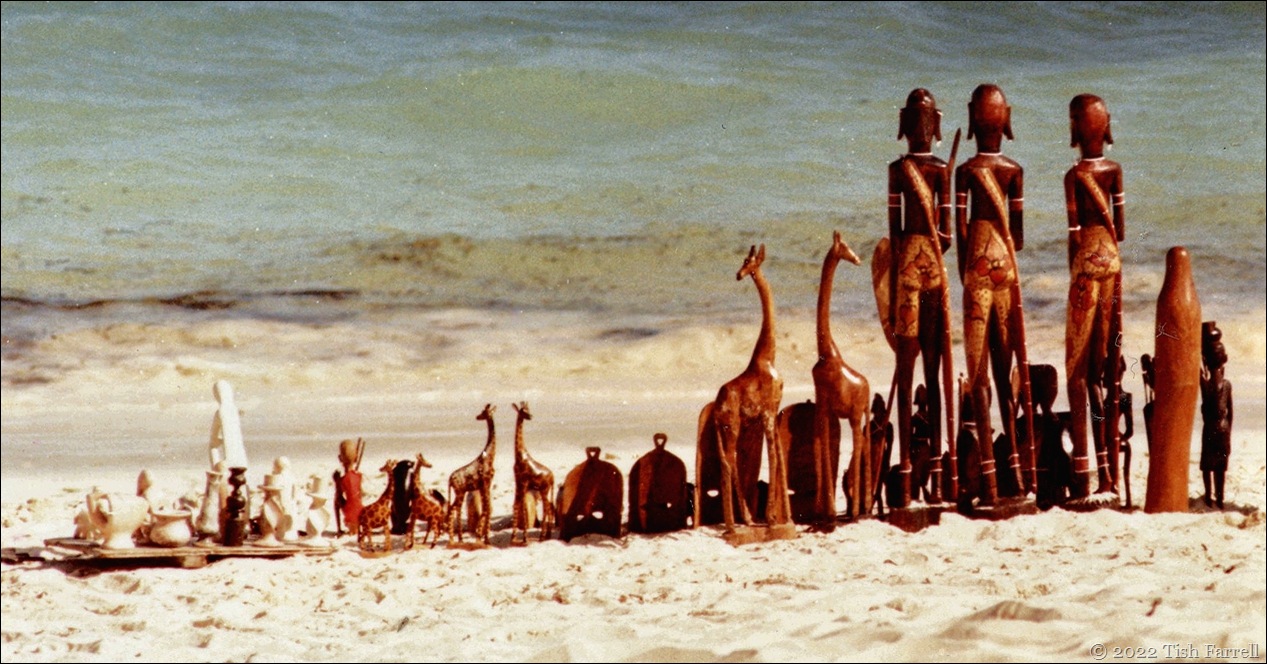
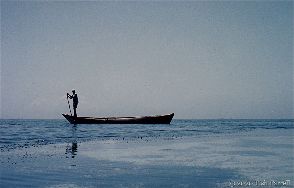
For more of the colonial story go to an earlier post Vulcanicity HERE. In the meantime below are some more soothing views in and around Stone Town, now a World Heritage site. Life is not so grand as it was in the days of the finely robed Omanis. Fishing, ferrying, farming (growing spices, coconuts and vegetables), curio trading, boat building, mangrove pole harvesting and tourism are the main sources of income. As in all African countries, people work hard to educate their children, and this is their number one priority.

Stone Town is also a devoutly Muslim community, and sometimes this does not sit well with tourist inclinations to behave in ways not considered either respectful or respectable by Zanzibaris. There are over 50 mosques of several different Muslim persuasions, but most are unobtrusive buildings without minarets, and are scarcely noticeable among the domestic dwellings. There is also a Catholic cathedral as well as the Anglican church. The streets are maze-like and shadowy, but we met with nothing but gracious hospitality when we wandered along them.  The place may seem run down (although here and there restoration is in progress), but in the sudden whiffs of jasmine the Sinbad romance lingers on…

(For more about the Swahili see an earlier post HERE.)

Scan-130429-0110

Scan-130429-0129

Scan-130429-0149

Scan-130429-0131

Scan-130429-0046

Scan-130510-0002

Scan-130429-0123

Scan-130429-0081

Scan-130429-0122


AILSA’S TRAVEL CHALLENGE: TWIST

FLICKR COMMENTS TAGGED ‘Z’

copyright 2014 Tish Farrell


Wind in the palms on Kenya’s coral shores

Scan-130603-0061

Tiwi Beach, South Mombasa

*

These leaning coconut palms and the photo of me holding on to my hat remind me that there is nearly always a breeze on Tiwi Beach. You need it too. In the hot season, around December to February, it makes the sticky tropical humidity bearable. It also keeps malarial mosquitoes at bay.

Scan-130520-0018

Don’t let go! Me, at Capricho Cove, too many years ago

*

But the tropical breeze is not so good for kite launching. The team leader never did get his kite airborne.; the wind endlessly beating it into the sand. No matter. I think we decided that kite flying was probably too active an activity, even at the day’s end. Much better to crack open a Tusker beer, one almost chilled in

Graham tries to fly his kite

Graham not flying his kite at Maweni Cove.

*

the beach cottage’s rackety  refrigerator.

Maweni cottage at sunset

Maweni Cottages built in the Swahili style.

*

In the holiday season, and especially at Christmas, these beach villages tend to be the haunt of expatriates (especially aid workers), and mixed race families who do not always receive the best of treatment in Kenya’s fancy beach hotels. The cottages are designed to keep out too much sun and let in maximum draught: coral rag walls, high makuti  thatch, glassless windows and shutters with moveable slats. This is of course a European take on indigenous Swahili architecture.

I have written in another post about Swahili culture and how it might be said to have been shaped by the monsoon winds: the north-easterly Kaskazi that for centuries brought Arab merchant ships down the coast of Africa; the south easterly Kusi that blew them away again after a windless sojourn during which sailing dhows were beached and repaired and liaisons with African communities forged.

From this age-old congress between Arab seafarers and Bantu farmer-traders, came a blending and melding of body, mind and spirit that evolved into the urban coastal people whom we know as the Swahili. Their language, KiSwahili, is also a fusion: of Arabic and Bantu vernaculars, and as such, presents a fascinating exemplar of multicultural integration that has forged a distinct identity of its own. That’s something to ponder on, isn’t it: how different races can create together; how it took the monsoon wind to bring them together?

Salamu (Greetings)

Scan-130429-0098

A Word A Week Photo Challenge: Wind: go here for more wind stories and see the ones below:

http://irenewaters19.com/2013/12/19/a-word-a-week-wind/

http://hamburgundmeehr.wordpress.com/2013/12/18/a-word-a-week-photograph-challenge-wind/

http://geophiliac.wordpress.com/2013/12/18/a-word-a-week-photography-challenge-wind/

http://bambangpriantono.wordpress.com/2013/12/18/a-word-a-week-photograph-challenge-wind-angin-the-wind-blown-flag/

http://schelleycassidy.wordpress.com/2013/12/17/a-word-a-week-challenge-wind/

http://mang0people.wordpress.com/2013/12/17/a-word-a-week-photograph-challenge-wind/

http://emiliopasquale.wordpress.com/2013/12/16/a-word-a-week-photograph-challenge-wind/

http://sillarit.wordpress.com/2013/12/16/a-word-a-week-photograph-challenge-wind/

Related:

Weekly Photo Challenge: Culture (The Swahili)

Travel Theme: Beaches (Mombasa)

Blue Lagoon

Weekly Photo Challenge: Horizon

DP Daily Prompt: The Golden Hour

sea-and-sky-on-the-reef-at-Tiwi.jpg

Beyond the shore, the reef, the sea, and then the sky: dawn one Christmas off Tiwi Beach, Mombasa

*

Other striking horizons:

Fractions of the World

Wind Against Current

Jolie Petite Maison

Hope*the happy hugger

Be Happy

Belgrade Streets

Artifacts and Fictions

vastlycurious

Northwest Frame of Mind

DARK CIRCLES, ETC

copyright 2013 Tish Farrell