The Changing Seasons: February

IMG_6748

There’s been little chance to take photos this month. We have had altogether too much bad weather: two storms and one on the way; rain that has been raining since the end of September; wind, sleet and hail; and for poor people who live near the River Severn, horrendous floods. Nearby Ironbridge has been deluged, the water breaching the flood barriers. Our county town, Shrewsbury, has been returned to the bad old winter flood days of the 1960s, this despite its modern flood defences. (You can go here to see the BBC coverage.)  In Much Wenlock ten homes on the High Street were treated to a slurry of liquid mud and gravel courtesy of run-off from surrounding hillsides delivered by road into their living rooms and parked cars.

There is much that could have been done since our region’s last big floods in 2007-8. No one seems to drain fields properly, or maintain lane and roadside ditches as they did in my childhood, interventions that would at least help to slow the flow. In fact our verge-side ditches seem to have mostly disappeared, presumably filled in and sacrificed to road widening. And so in times of heavy rains when highway drains may become quickly blocked, our roads serve as highly efficient flash flood delivery systems.

We need to start thinking about better water catchment management, and especially on our denuded uplands where our rivers rise.

Australian farmer initiatives show how all our water catchment areas could be managed better with the addition of ‘leaky weirs’ set at intervals down water courses: rocks, tree trunks judiciously placed to create a series of delta effects. No need for hugely expensive hi-techery. Such simple methods not only hold back flood water and sediment, but hydrate surrounding land and foster regrowth of bank-side vegetation that in turn restores biodiversity, providing resilience too in times of drought. AND, most importantly of all, reducing soil erosion.

BECAUSE apart from the absolute misery caused by flooded homes, the impact on life, health and livelihoods, the biggest long-term loss to us ALL, is the fertile soil that floods carry away. Once it is gone, it is gone. Many of our soils are already mineral depleted. This will ultimately have an impact on the quality of food produced and on human health. The way we treat the land, always clearing, forever taking out with an eye to greater efficiency and higher productivity, but without ever replenishing adn rebuilding, is a good way to degrade local and regional weather systems.  In fact creating land resilience and restoring the natural environment are probably the most useful things we could be doing now this minute to mitigate future extreme weather events.

And before too much blame is laid at farmers’ doors for industrial farming practices, the UK and Australia, it seems, have various laws that forbid landowner interference with water courses on their land. They must seek official approval to do anything that impacts on water flow. In the UK, riparian owners have some very serious responsibilities which include ensuring the clear movement of water through their properties.

Here’s an interesting video showing how leaky weirs work, and showcasing the pioneering efforts of farmers and the Mulloon Institute in New South Wales:

*

And back on the home front and to fend off sensations of all round rising damp, here’s a photo of my drying washing, taken on the one day this month when it was worth hanging it out in the garden. Nothing like filling one’s sheets with wind and sunshine; always makes for the best sort of sleep, I always think.

IMG_6811


The Changing Seasons: February 2020

Sue has a very lovely gallery of photos this month. Please go and see.

The Night Ploughing

IMG_5690

It was the strangest thing – to look out on the nightscape behind the house where there are no roads or houses as far as the Edge, which itself drops a thousand feet through near vertical woodland to farm fields below on the Shropshire flatlands, and see what looked like searchlights moving doggedly through the darkness. The sight induces a frisson of fear. Iron Curtain watch towers spring to mind; H.G. Wells and War of the Worlds: are these Martian invaders patrolling the hinterland? Have the Thought Police hacked into my anti-establishment cogitations and are now tracking me down?

Of course a second later, common sense regained, I knew exactly what was going on, though it was still surprising – this spot of nocturnal November farming, presumably intent on finishing the job before the next round of deluge. The two tractors had been out working on Townsend Meadow since early afternoon. One tractor was ploughing. I watched it moving up and down the field, the glint of steel blades, the rig periodically disappearing from view over the brow of the hill. The other tractor was working back and forth across the ploughed-in wheat stubble, it equipped with high-tech agri-gear fore and aft – (and I’m assuming) seed drilling and then harrowing.  I’ve yet to discover what crop was being sown. Doubtless there will be shoots any time now.

IMG_5689

But in the meantime, on my most-days slither and slide along the path to the allotment, I’m astonished how very spirit-lowering is the lustreless expanse of darkly sodden earth after months of pale and textured gold. No more taking short cuts across the field or fossicking for pot shards and clay pipe bits either. I’ve also noticed that the tenant who currently has the field in hand, has reduced the strip of uncultivated headland between our home boundaries and the crop by a good 2 or 3 metres. We always understood that the headland was there as a flash-flood reducing measure, to say nothing of providing a swath of bio-diversity. Only time and heavy rainstorms will reveal the consequences or not of this little development.

IMG_5678

IMG_5681

IMG_5659

The day before ploughing and drilling – 3rd November.


copyright 2019 Tish Farrell

From My Window ~ Black & White Sunday

P1070087

According to the old tithe maps the field behind our house was known as Townsend Meadow, and for obvious reasons: it lies on the north end of town directly below Wenlock Edge. For nearly a year now Shropshire Council has been building a large attenuation pond just over the brow of this hill. The objective is to reduce the effect of flash flooding, holding back storm water that runs off surrounding hills, turns all the roads and brooks into rivers which then converge in the centre of Much Wenlock.

In July 2007, over fifty houses in the town were badly flooded. Ours was fortunate not to be one of them; although our house is built into the foot of this hill, the main burden of run off flows around rather than through our property.

The fence in this photo was the first thing to go up before work on the pond began. The tree that appears to be in the corner is a piece of ‘borrowed  landscape’ and is actually some distance away in the field hedgerow. And the rooks were just passing.

Before the fence went  up I did not particularly notice the tree, but now I like the way this visual convergence gives an accent to what before was a rather featureless wheat field.

It was even more exciting when the big digger moved in.

P1070549 - Copy (2)

copyright 2017 Tish Farrell


Black & White Sunday  This week Paula’s challenge is STRUCTURE

On Edge With Stormy Weather Over Wenlock

IMG_1390 (2)

Before and after last summer’s wheat harvest.

100_6323

As I’ve mentioned once or several times, I spend much time watching the sky behind our house. I never cease to be fascinated by the false horizon created by this low hill. Behind it is a another false horizon created by Wenlock Edge which lies a half mile further on.  Here in Wenlock, then, we see the movement of clouds in the westerly sky  several hundred feet higher than do our neighbours below the Edge. It is a piece of geographic happenstance that makes for dramatic skyscapes. It’s a bit like watching a moving stage set.

I justify the time spent sky watching on the grounds that I need to make the most of this view. Doubtless the local landowner will get his way and one day build a sprawling housing estate here, this despite the fact the town has a Victorian drainage system that cannot cope with any more human effluent. Already, just to add an off-colour atmosphere to the scene, our sewage works is licensed to dump excess untreated waste into the stream which thence flows into the River Severn and through the World Heritage Site of the Ironbridge Gorge. This is clearly what is meant in England when certain politicians bang on about Victorian Values.  Sometimes I wonder how, as a nation, we can be so very smug about ourselves.

The poor drains of course add to the town’s flash flooding risk, and to replace them would cost many millions. We do not appear to have a planning system in this country that says NO to development, even though there is insufficient infra-structure to support it. Developers of course pay a pro rata community levy on the number of houses built, but such amounts could not begin to cover the cost of the kind of remedial work that is necessary. When Wenlock’s population is less than 3,000, why would a water company spend 10 million pounds on such a venture?

The main problem is that the town sits in a hollow behind the summit of Wenlock Edge. The town centre is at the lowest point and thus one of the most vulnerable areas. In 2007 over fifty houses were damaged. Many afflicted families were still trying to restore their homes up to a year later. And while insurance cover may make good the bricks and mortar, it does not bring back the personal belongings that were lost, or quickly eradicate the memory of having a metre high flood rushing through your house.

Mostly of course, the town does not flood, although parts of it are prone to run-off from surrounding hills in times of prolonged wet weather. As far as we know, our house has never flooded, although given its position, built into the bottom of the hill, this is in some ways surprising. There is anyway a low earth bund along the back boundary and, after earlier flood incidents lower down the street, the landowner’s tenant farmer continues to leave a broad swathe of uncultivated ground behind our houses, and then ploughs  in line with it.

In fact to create real problems it takes a certain kind of storm to hit our catchment area. But when it comes there is less than 20 minutes warning before a flash flood. The roads into the town become rivers. Every hard surface speeds up the flow, and given our antiquated system, all the storm water goes into the foul sewer. All of which is to say, as one of the flood alert wardens with the brief of forewarning elderly neighbours, I also have more pressing reasons for watching the sky, and keeping an eye on any storms brewing.

copyright 2015 Tish Farrell

Related:

In Much Wenlock An Inspector Calls

Please visit Paula’s place at Lost in Translation for more fascinating cloudscape photographs.

5 Photos 5 Stories: Hidden Wenlock #5

100_3612

For the final post in this Hidden Wenlock series I thought I’d show you Ashfield Hall, one of the most impressive houses on the High Street. Yesterday I said how many of the town’s ancient timber-framed buildings had become hidden within later stone exteriors. With this house it was rather different.

The left-hand wing with the arch was built some time between 1396 and 1421 by one William Ashfield, a town resident. The impressive timbered wing was added in the 1550s for Richard Lawley. He and his brother, Thomas, were members of a leading local family, and it was they who, after the Dissolution of the Monasteries, bought the Priory and its estate from Henry VIII’s physician, the Venetian, Augustino Augustini.

Augustino seems to have been a slippery type, always short of money. He had been Cardinal Wolsey’s physician before Wolsey lost royal favour. He then became embroiled in the intrigues of King Henry’s ‘fixer’, Thomas Cromwell, who had also been  a Wolsey retainer. One of Augustino’s missions was to go to Germany to lobby support for Henry’s divorce from Catherine of Aragon. The Priory was thus his reward for services rendered. He wasted little time in selling it off, and the Lawleys paid him £1,606 6 shillings  8 pence for it. On the proceeds of the deal he then headed home to Italy.

In the 17th century Ashfield Hall became the Blue Bridge Inn, named after the bridge that crossed the malodorous stream, the town’s open sewer that ran down the main street, and was known for good reason as the ‘Schet Brok’.

Despite the insalubrious quarter, legend has it that King Charles I stayed at the Blue Bridge in 1642, en route for Oxford and the Battle of Edgehill. Thereafter, the place went seriously downhill, and became a lodging for itinerant labourers.

But there are earlier stories than these relating to Ashfield Hall. The High Street used to be called Spital (Hospital) Street, and it is believed that the archway probably gave access to the Hospital of St. John whose existence is first documented in 1267. In 1275 an appeal went out for the Master and Brethren of the hostel “to which lost and naked beggars are frequently admitted for their relief, the house being in great poverty.” Merchants coming to town with grain and other goods to trade were called on to give some assistance. By 1329 the Priory was taking over the premises, although it is not known if they continued to run the charity.

This reminds me, though, of a statistic I read years ago in an economic history of Medieval Europe. It shocked me at the time, but it seems it was the norm pretty much everywhere in the Middle Ages for 20% of the population to be beggars (professional or otherwise) and living off lordly charity. Giving to the poor was apparently an important means by which the rich got over their guilt at being rich, and so gained grace. It was how society worked.

100_4920

By the 18th century, we have a different story. Much Wenlock has some of the most comprehensive pre-1834 English Poor Law records still surviving. The dismal picture they paint is more about local bureaucrats trying to save the town from the expense of supporting any more poor than it absolutely has to.  The destitute were mostly women and children. The women, often no more than girls who had been sent off as apprenticed labour and returned, impregnated by their overseers and masters, were subjected to pre-birth, and post-birth bastardy examinations to determine their right to stay in the parish. If churchwardens and overseers found against them, they were subject to removal orders. Pauper children were sent as indentured apprentices to anyone in need of cheap labour. I have a copy of a Much Wenlock churchwardens’ indenture of 1805 which places

Thomas Williams aged eight years or thereabouts, a poor Child of the said Parish ~ Apprentice to James Barker of Madeley Wood, Whitesmith…with him to dwell and serve…until the said Apprentice shall accomplish his full Age of twenty one years ~

In return, James Barker is to train the lad in the business of a whitesmith (tin working), and give him “sufficient (the quantity is unspecified) meat, drink, apparel, lodging, washing and other things necessary and fit for an apprentice.”

It’s a sobering glimpse of life for the powerless and underprivileged. It shows, too, the disparities between rich and poor, the respectable and socially unacceptable in a small, but  largely prosperous town like Much Wenlock.

Which rather brings me back to the Schet Brok, the town’s once infamous open sewer. In fact it was not until Victorian times that the stream was finally enclosed and culverted, and a proper sewerage system installed. These improvements were down to the town’s good physician, Dr William Brookes, he who also masterminded the Wenlock Olympian Games and inspired the modern Olympic  movement.

The brook still causes the town problems, even though (mostly) we can no longer see it. Come heavy storms on Wenlock Edge, and the culvert has been known to cause terrible flooding, the last event being in 2007. But that, as they say, is another story, although I’ll leave you with some pictures courtesy of Much Wenlock’s Flood Action Group. It is a good example of how the doings of the past, hidden though they may be, can be very much with us.

copyright 2015 Tish Farrell

collagehighst[1]


5 Photos 5 Stories Challenge

Pauline at Memories Are Made of This nominated me to take up this challenge. The idea is to  “post a photo each day for five consecutive days and attach a story to the photo. It can be fiction or non-fiction, a poem or a short paragraph, and each day nominate another blogger for the challenge”.

So today I would like to nominate Anke at Life in Baku. She has been living and working in the capital of Azebaijan since 2012. Her blog is an on-going quest to reveal in words and photos, places and people, their ways of life. Join her on this fascinating journey. 

P.S. To those who are taking up my challenges, I gather from Jo at Restless Jo (who is also doing it this week) that it should be ONE photo. Oh well.

Hidden Wenlock #1

Hidden Wenlock #2

Hidden Wenlock #3

Hidden Wenlock #4


Reference: W F Mumford Wenlock in the Middle Ages

Floating not flooding: Adeyemi’s ‘Ark-ademy’


Makokos-Floating-School-NLE-2[1]

Photos © 2014 NLÉ

Makoko_approach-960x550[1]

And what is this extraordinary structure?

Why, a floating school of course. It is also a prototype building created by Nigerian-born architect, Kunle Adeyemi  and his Amsterdam-based company NLÉ. Adeyemi has more plans too, ones that will relieve the dire conditions for the 100,000 people who currently live in this, Nigeria’s Makoko slum. The fishing settlement in Lagos Lagoon has been there since the 18th century. To cope with changing tidal levels, the shanties are built on stilts, rising from the lagoon mud; the main way to get around is by boat. There is zero sanitation, and consequently much disease. Life expectancy is reckoned to be less than 40 years.

For the past two centuries Makoko slum dwellers have adapted to tidal changes, but now climate change, with rising sea levels and increasingly extreme weather events, is putting them at grave risk.

Recently the Nigerian authorities have addressed their plight by demolishing many of the stilt-built dwellings, making the inhabitants homeless. There will be re-development  naturally – not for the poor who have long lived there, but to replace their community with flashy lagoon-view high rises. Makoko as it stands is deemed a blot that must be erased. It is an interesting approach to social deprivation: to make it worse.

_61618156_a1zaixbb[1]

*

See instead Adeyemi’s vision:

NLEs-floating-school-casts-anchor-in-Lagos-Lagoon_dezeen_14[1]

Now doesn’t this make your heart sing? Homes to live for.

And here is where it begins:

ml_schoolatSea_Makoko_d2_600[1]

Diagram courtesy of NLÉ.


Makoko floating school, then, is literally the flagship of NLÉ’s proposed waterborne city. The structure was designed and built in collaboration with the Makoko Waterfront Community and with input from Dutch naval architect, Erik Wassen. It is movable, and capable of dealing with storm surges and flooding. The triangular frame which is mounted on 256 floating plastic barrels makes it very stable and with a capacity to keep 100 people safe in storm conditions. PV cells on the apex generate solar power, and there are facilities to recycle organic waste and harvest rainwater. Most importantly of all, it was built using the techniques and skills of local craftspeople. It is a building that fits with people’s view of themselves. And it is beautiful.


Makoko-Floating-School-5-606x400[1]

Photo © 2014 NLÉ

The school has three levels with a capacity for 60 -100 pupils. The 1st level is an open play area for breaks and assembly. Out of school hours this space may be used by the community. Level 2 is an enclosed space for 2-4 classrooms, and Level 3 has a partially enclosed workshop space.

The only fly in the ointment of NLÉ’s scheme for Makoko’s regeneration is the fact that Nigerian authorities say the floating school is an illegal structure, and should not be there. NLÉ are currently in negotiation with Lagos state government and are said to be optimistic that no immediate action will be taken.

I for one hope that this African solution to an African problem will be seen for what it is – an amazingly wonderful, life-giving, life-enhancing scheme of which Nigeria should be heartily proud. The floating school addresses both present need and future uncertainty, and in ways that its community can reproduce and embrace. It has inherent sustainability. It is a pattern to build on, adapt, develop, replicate, but on an individual human scale that everyone can understand. And as time goes on, we may all have need to tap into some of NLÉ’s ingenuity if we wish to continue living well and safely on our home planet. Town Planning that gladdens my heart and gives me hope, and believe me, that does not often happen.

text copyright 2014 Tish Farrell


Further info:

Kunlé Adeyemi Founder NLÉ

Kunlé-Adeyemi_1c_Photo-by-Reze-Bonna-293x400[1]

The Architectural Review Jan 2014

http://www.nleworks.com/case/makoko-floating-school/


Flickr Comments F – archive

In Much Wenlock An Inspector Calls

100_3606

Much Wenlock, the place where I live,  is a small town with a big history. You could say it owes its existence to the discovery of some holy bones. And no, this is not the reason for the inspector’s visit.  I’ll get to him in a moment. (In fact his arrival in town relates to the making of some new history). But about those bones…

First of all, they are very, very old. In life they belonged to a Saxon princess, whom we know locally as Milburga, though she comes in other spellings. She was daughter of the Mercian King, Merewalh, who held sway over much of the English Midlands during the 7th century.  These were turbulent times – the spread of Christianity going hand in hand with securing territory. To this end, Merewalh was a man with a plan. Instead of arranging dynastic marriages for his three daughters, he established them as rulers of new religious houses across his kingdom. Even his own queen, a Kentish princess, in later life returned to faraway Kent to become Abbess of Minster. In this way Merewalh consolidated spiritual and political prestige, commanding both bodies and souls.

In preparation for the religious life, Milburga was sent for her education to the double monastery of Chelles in Paris. According to the historian, and her contemporary Saint Bede, this was common practice for English girls. Sometime towards the end of the 7th century Milburga then took charge of an abbey in Much Wenlock. This was also a dual monastery i.e. for both men and women, and each sex had their own church. It was also the most important religious house in the region. There she presided for the next thirty years, ministering to the people of her extensive domain lands. Many legends grew up: that she had the power of healing the blind and of creating springs of water. After her death in 725 AD there were more and more stories about her miracles, and so in due course she became Saint Milburga.

Fast forward to the Norman Conquest of Britain (1066), and now we have brow-beating Norman earls establishing their power bases across the land. Their plan was to use ‘big architecture’ to dominate the natives: castles, fortified manors, churches and monasteries – the bigger the better. In Much Wenlock, Earl Roger de Montgomery built a Benedictine priory on the site of Milburga’s abbey. It was affiliated to the monastery of Cluny in France, and so French monks came over to live in it. The building was an impressive enterprise too. Today, the picturesque ruins in the heart of the town do little to indicate the vast scale of the original.

File:St Milburga's Priory, Much Wenlock - geograph.org.uk - 1652411.jpg

Wenlock Priory and the ruins of 12th century Benedictine monastery that was built on the site of Milburga’s Saxon abbey. In its day, this was one of the biggest and most prestigious religious houses in Europe. Photo: Creative Commons, Chris Gunns


But building big is not everything. The Normans faced a problem that every interloper faces: how to give their occupation legitimacy. Milburga was a much-loved saint and a Saxon saint to boot. It was essential to confirm possession, not only of her extensive lands (which was quickly achieved), but also of her remains.

The last proved less easy and, it may well be imagined, then, that when the French monks arrived in Wenlock and found the silver shrine of Milburga empty but for “some rags and ashes”, there was much consternation. Where were the saintly bones?

100_4921

Bishop Odo unfolds the mystery in an account written after he visited the Priory in 1190. It appears that the nuns’ church of Milburga’s abbey (now our town church, Holy Trinity, above) still survived in Norman times, but lay in ruins. The monks decided on some restoration, and it was during work on the altar that a monastic servant found an ancient Saxon document. The monks, being French, could not read it and  so a reliable translator had to be found forthwith. Thus was discovered the testimony of a priest called Alstan who said that Milburga had been buried near the altar in the nuns’church.

Of course by now  nearly four centuries had passed since her death, but news of the document reached Anselm, Bishop of Canterbury and he gave the monks permission to excavate. But before this could happen, two boys playing by the dilapidated altar, caused the floor in front to collapse, which in turn led to the more rapid discovery of Milburga’s remains. This was in 1101 AD, and we know they were her bones because they were “beautiful and luminous” and accompanied by the requisite saintly fragrance deemed to be given off by such relics.

The discovery gave Much Wenlock instant pilgrim-appeal, and the monastic publicity machinery rolled. The Prior commissioned the leading writer on saints of the day, Goscelin,  to write about the life of Saint Milburga and so firmly establish the cult of miracles that surrounded her. From that time pilgrims flocked to Wenlock, and the town grew to cater for them. Some of the surviving public houses have their beginnings in the Middle Ages. The Priory itself was wealthy in land and employed a large workforce who were engaged in agriculture and early industrial development including coal mining and iron working. Artisans and merchants were attracted to the area. Trades and services developed to cater for the pilgrims and the Priory. And over all this human business presided the Prior, delivering both spiritual and temporal edicts. It was not until 1468 that the town was handed over to a secular authority.

And so here we have the little market town of Much Wenlock, continuously occupied for a thousand years and presently home of 2,700 souls. It sits below the long limestone ridge of Wenlock Edge whose geology is of international renown. After the monastery was dissolved by Henry VIII in 1540, the town continued to thrive as entrepreneurs moved in to develop the industrial potential of former monastic holdings. The cloth trade and tanning became important. Agriculture and quarrying continued as mainstays since Much Wenlock’s limestone was not only useful for building, but was also burned in kilns to use as fertilizer. Most importantly, as time went on, it became an essential ingredient in the making of cast iron, acting as a flux to remove impurities from the iron.

Indeed, it was at furnaces on Milburga’s former domains at Coalbrookdale, Madeley, and in Broseley that many breakthroughs in the iron industry were made, thus setting off the World’s Industrial Revolution. And the reason these technological innovations took place here was because the locality had all the vital ingredients:  limestone, ironstone, fireclay and coal. The tributaries of the Severn could be harnessed for water power, and the river itself provided a trading route down to Bristol. Not only that, generations of monastic workers meant there was a skilled workforce to be utilised when post-Dissolution entrepreneurs moved in to take over monastic mines, iron works and water mills.

041

100_3609

100_4919

100_4926

043

We have other claims to fame too. The reason why one of the Olympic mascots was called Wenlock was because it was here in 1850 the town’s physician, Dr William Penny Brookes began the first modern Olympian games. For the next few decades people flocked to Wenlock in thousands to see them.  Brookes passed his ideas on to Baron de Coubertin who often visited the town, and so began the International Olympic Committee. The Wenlock Olympian Games are still held every year and provide a popular competition venue for sportsmen and women from all over the country. 

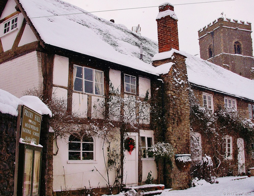
But back to the inspector who was left stranded at the top the page. Two years ago Much Wenlock was one of the seventeen front-runner communities in the country chosen by Government to create a Neighbourhood Plan. Since then, cohorts of Wenlock and other volunteers have worked with the community to produce a plan that sets out the kind of development we want in the parish over the next thirteen years. Last week the inspector, the man assessing the plan, came to the Priory Hall, the town’s community centre, to conduct a public hearing.
100_4923

For reasons that may become apparent by looking at the next photos, large scale development is not a popular proposition in the community. Most of us feel that we have had more than enough. The town sits in a basin. Wenlock Edge and surrounding hills drain through it down a culverted medieval watercourse once known as the Schittebrok. The Victorians did the culverting and there have been so-called remedial schemes since. Some argue these ‘improvements’ have made the problem worse. The town’s footprint has increased some 300% in the last decades with much unsympathetic development that has covered agricultural land with hard surfaces that speed up flooding. Our narrow medieval street system turns roads into rivers during heavy rain. The other serious problem then (apart from traffic congestion) is drains.

001 (4)

001 (3)

001 (2)

In 2007, after 91 homes were flooded due to a combination of flash flooding and poor drainage, the town held a referendum. The vote was 471 to 13 to have no more development until the town’s traffic and drainage problems were resolved. Nothing has been done to improve these matters, our sewage farm is under capacity. The bill for new drainage will cost millions and our private water company is unlikely to fork out. In the meantime the developers and major landowner informed the inspector that they are itching to build 85 houses in the near future, with a suggested total of 250 over all.

At the hearing the inspector gave them ample chance to make their case, and he himself gave no clue as to which side’s view would hold sway. The Neighbourhood Plan wants only small numbers of affordable homes for locals to rent, and a maximum of 25 market homes on a single low density development. But this is not how housing developers work. Much Wenlock’s property prices are high; it is a desirable place to live. They thus want to build up-scale houses with multiple bathrooms. Meanwhile our ageing community would like comfortable smaller places so they can downsize and release their homes to people with families. It is a divergence of objectives that appears to have no sensible resolution.

The British Government’s stance is that building houses is the only way to create ‘sustainable’ communities. So even if the Neighbourhood Plan is passed by the inspector, there is no knowing how far it will protect the town from inappropriate development.

As I said at the start, Much Wenlock is a small town with a big history. But perhaps our story has not yet been well enough told. Perhaps we are not shouting it loud enough. Events that occurred in and around Milburga’s former domain have helped change the world we all live in. A few miles away is the World Heritage Site of the Ironbridge Gorge (site of the world’s first cast iron bridge built in 1779). The iron, porcelain and decorative tile industries that grew up in this area traded their goods across the world. Monastic enterprise underpinned the development of  British industry.

Today if you visit Much Wenlock it may strike you as a Rip Van Winkle sort of place. It has a slumbering air, as if dozing under the weight of ancient timbers and stonework. But it can be lively too.There are some excellent shops including two excellent book shops and a gallery. There are small markets during the week, a museum, the church, the Priory, the Olympian trail, good pubs and hotels, many societies to join, a fully equipped leisure and arts centre. 

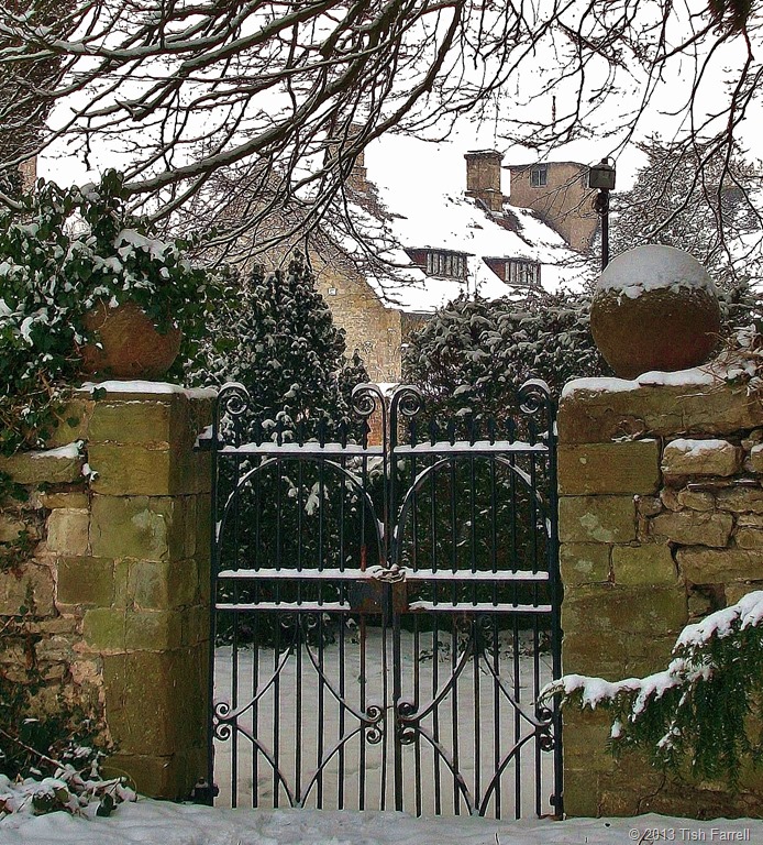
Above: glimpse of the Prior’s house, now a private home. Below: cottages on the Bull Ring

We have much  to protect and preserve here, and much to share with those who visit us. And we do want the town to grow and thrive, but on the community’s terms and according to their expressed needs. But looking over the last thousand years, this story does have a common theme. Whether we’re talking of Saxon kings, Norman earls or housing developers, those who have power and land do all the ruling, too frequently asserting their will over the wishes of the general populace. It remains to be seen whether the inspector will pass our plan. He said he would let us know in November. In the meantime, I, like others in the town, watch rainy skies with anxious eyes, if not for ourselves, then for vulnerable neighbours. Fingers crossed for Neighbourhood Planning and that it actually will serve our purpose.

© 2013 Tish Farrell

Related:

https://tishfarrell.wordpress.com/2011/06/27/of-silurian-shores/

https://tishfarrell.wordpress.com/2013/06/04/windows-in-wenlock/

https://tishfarrell.wordpress.com/2012/01/26/of-wolf-farts-windmills-and-the-wenlock-olympics/

twitter: @Wenlock_Plan

www.wenlockplan.org

https://www.facebook.com/pages/Wenlock-Edge/532033273535604?ref=profile

https://www.facebook.com/pages/Wenlock-Edge/119957538050970

BOOKS:

W F Mumford Wenlock in the Middle Ages 1977 re-published under ISBN 0950561606

Vivien Bellamy A History of Much Wenlock 2001 Shropshire Books ISBN 9780903802796