So What’s Missing Here?

IMG_2799

We were walking along the top of Wenlock Edge earlier this week – Edge on the left of this photo, Ironbridge Gorge right of centre. This is a circular walk that can include Windmill Hill as a slight detour, but otherwise takes you out of Much Wenlock before sending you up a field path (with fine views of the Wrekin) to the Edge above Homer village.

The final climb to the Edge top is quite steep and rocky, but once negotiated, you step out on a  pleasingly level track, farm fields on one side, hanging woodland on the other. I should say, though, that for those nervous of heights it doesn’t do to stop and look down into the wood. There, the huge ash, beech, oak, and sycamore trees grow hugger mugger on prodigiously tall, straight trunks that cling to several hundred feet of near vertical hillside. Here and there, between rare gaps in the canopy, you can just glimpse the fields of the Shropshire plain way below.

This is a winter’s day view of the Edge trackway, the seeming benign but beetling Edge wood on the right:

P1060126

*

There’s a point further along this track where a path hives off at right angles, taking us back and down to the town. There’s also a particular fence post here that I often use in lieu of the tripod. I used it to take the header shot, including the grass stem pointer,  but in the past I used it to capture these views – the cooling towers of Ironbridge Power Station, shortly to be developed into a very large riverside housing complex:

 cooling towers

Here’s another winter’s view with the cooling towers steaming away, and to the left a glimpse of the chimney beacon that finally came down this summer:

101_4973

cooling towers resized

All gone now. This may well be a good thing. On the other hand,  we need to think very hard and carefully how, and at what precise cost, we will heat and power our homes in the future. At present there is, to say the least, something of a technological shortfall. Nothing, it seems, is settled.

IMG_2803

Caught In The FogLight – Ghosts Of Cooling Towers Past

IMG_5993sq

This photo was taken at the end of November not long before Ironbridge Power Station was spectacularly demolished. I’ve always been drawn to the epic quality of the cooling towers, though not necessarily always in a comfortable way.  I’m ever a sucker for earthenware and the smooth curves of the terracotta brickwork, and the way it caught the light, certainly did appeal. I’ve not yet been back to Dale End Park in Coalbrookdale to see what the Severn Gorge looks like without the towers. I’m thinking a loss of grandeur.

The CGI below envisages a complete small town of 1000 houses plus community infrastructure for this riverside cul de sac, though there is the surprising inclusion of a steam railway. You can see the recently submitted plans HERE and HERE. The cooling towers occupied the area above the far left-hand bridge. The bridge on the far right is the Buildwas Bridge. This is the road to Much Wenlock a few miles away. The road to Telford (a new town with massive ongoing housing development, plus well planned existent infrastructure, schools, shopping centres, station, motorway and industrial complexes) runs along the bottom of the photo. Access to it from the Power Station site is over the narrow Buildwas Bridge (???)

power station development

Photo: Harworth Group Ironbridge Power Station Proposed Development Plan

January Light #15

Power Lines ~ Ironbridge Switch-Off

IMG_5200

Ironbridge Power Station has run out of steam, its huge cooling towers presently stark monuments to the era of dirty energy, an era that kicked off in this very valley, the Ironbridge Gorge, where in millennia past the River Severn turned its back on the north and, turbo-charged by glacial melt-water, drilled its way through inconvenient uplands and headed south, thereby exposing strata whose properties ingenious humankind would one day find well suited to industrial enterprise.

Limestone. Ironstone. Coal. Fire and brick clay. These were the materials revealed by Severn’s pre-emptive workings. They provided the means for the building and fuelling of blast furnaces. The first iron works in nearby Coalbrookdale were run by monks and lay workers of Wenlock Priory. After the Dissolution of the Monasteries in 1540, there was a massive sell-off of monastic land and facilities around the Gorge to London merchants and get-rich-quick gentry all keen to make iron; or mine coal; or extract natural bitumen that also occurs here.

The Gorge and its tributary valleys were, in their way, covert places, and later proved attractive locations for 17th century iron masters set on pioneering new technologies: coke-fired casting; fine boring of cannon; trialling of new materials in new constructions that would astonish the world and change it and us forever.

But back to the power station that now no longer burns trainloads of coal to feed the national grid. It sits on a floodplain at the head of the Gorge, a World Heritage Site no less, the Ironbridge Gorge. A local lordly landowner once observed to me that the discharges of warm water from the cooling towers heated up the river along his stretch of bank by one degree, thus ruining his salmon fishing; the salmon, he said, did not care for warmth and rushed on by. To his credit his lordship did not seem too bothered. At least for now the river is subject only to natural forces when it comes to temperature.

Soon the demolition teams will move in, and trainloads of furnace ash will be shipped out along with countless tons of strategic reserves of gravel which happen to occur on the site. And down will come the four cooling towers – and what a sight that will be. Then the plan is to build 1,000 homes and create a business park to create thousands of jobs, and all beside a river with a history of monumental flooding, and on a site with all manner of embedded pollutants, and in a geographical cul de sac with only two narrow lanes either side the river by which to access the outside world. The head of our local authority that is championing the scheme is on record saying that he won’t let considerations of climate emergency get in the way of the county’s need for economic growth.

It takes one’s breath away – this Age of Bonkers!

Line Squares #23

Ironbridge Cooling Tower As Seen From Under Another Severn Bridge

I’m standing under the Albert Edward Bridge to take this photo. It was built in 1863 and opened the following year, named for Queen Victoria’s eldest long before he became the totally notorious  King Edward VII.

You might also say the Albert Edward Bridge is the ugly great great grandchild of Darby’s Iron Bridge just downstream; and the end of the line too – in all senses. It is the last large cast iron railway bridge to be built in the UK, and originally carried the Severn Junction Railway across the river to meet up with the Severn Valley Railway (one of England’s loveliest lines decimated by Mr. Beeching in the 1960s). In more recent times it was used to carry coal to the power station.

It may not be as striking as its ground-breaking elder (and it certainly proved very hard to photograph) but it has much in common with Darby’s bridge. Designed by Sir John Fowler, the single 200 foot span comprises 4 cast iron ribs, each of 9 parts bolted together. The moulds for the spans were prepared nearby at the Darby family’s Coalbrookdale Company ironworks. The steel deck that you can see in the photo was installed in 1933, replacing the original timber and wrought iron deck.

P1060645sq

Now that the power station has run out of steam, one wonders what will become of Albert Edward. Fortunately it is a Grade II listed building  so it will be preserved. At least one hopes it will.  Also the local Telford Steam Railway enthusiasts have their sights set on it to extend their rather limited rail track, and since there is presently a 5mph speed limit on the bridge due to its age, one can conjure a slow and splendid steam-train trundle across the Gorge to Buildwas – poop-poop!

P1060643sq

Roof Squares 12 Not quite a roof, I know, but I was standing under it for the header shot. Please pop over to Becky’s for a plethora of rooftops.

Some Ironbridge Towers ~ The River Between

P1060599sq

Following on from yesterday’s Iron Bridge visit, this first photo is for Jude. She wanted to know if the Ironbridge cooling towers still existed. The power station, just upstream from the Iron Bridge, has been recently decommissioned. There are plans for demolition, and the site to be developed for housing.

There are four cooling towers, and if you walk along the river they loom dramatically above you. Love them or hate them,  Jude and I are for them. They are anyway part of our industrial heritage, though mainly I like them because they look like giant flower pots. And I like them even more now they aren’t giving off dirty-coal fumes.

Across the river, just downstream of the cooling towers is the Severn Warehouse – now part of the Ironbridge Gorge Museum (where I used to work). This building has much smaller towers, but they are impressive in their own way. Built in the gothic style by the Coalbrookdale Company in 1834, it was used to store the factory’s iron goods until they could be shipped by barge to Bristol and thence out to the wide world. You can see the tramway down to the wharfage (bottom left). A veritable citadel of industry then, though a spot of weeding looks to be called for up in the castellations:

P1060617sq

If you would like to take a very interesting walk around the Ironbridge Gorge there is an excellent trail guide HERE


Roof Squares  See Becky’s very unusual Portuguese bread oven

Six Word Saturday  And some marvellously commemorative artwork from Debbie

Present and Past in the Ironbridge Gorge

P1010073

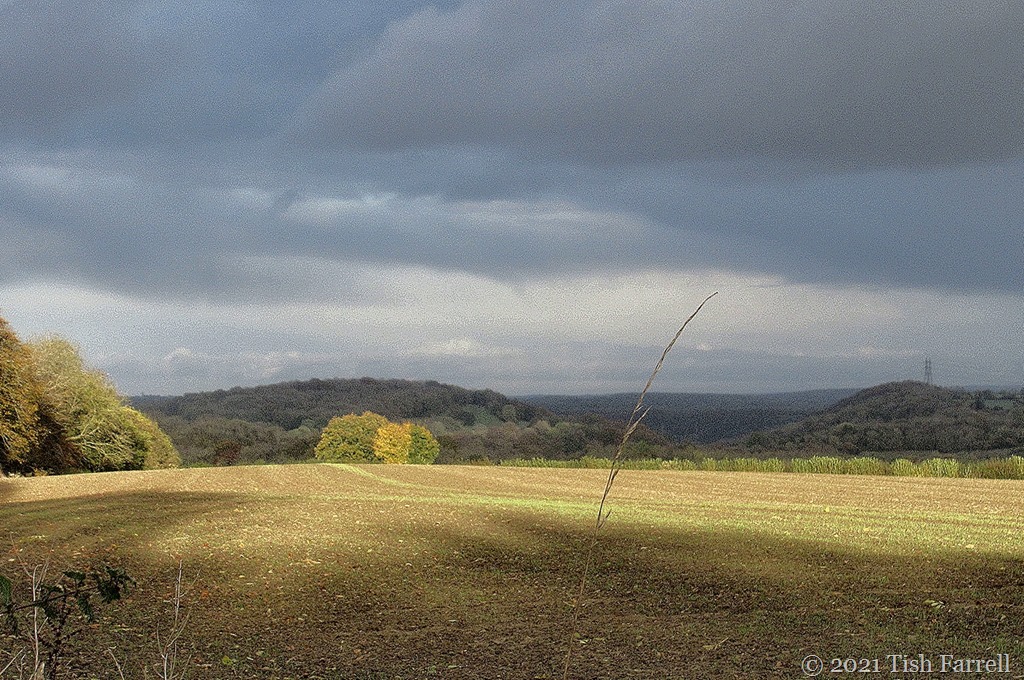
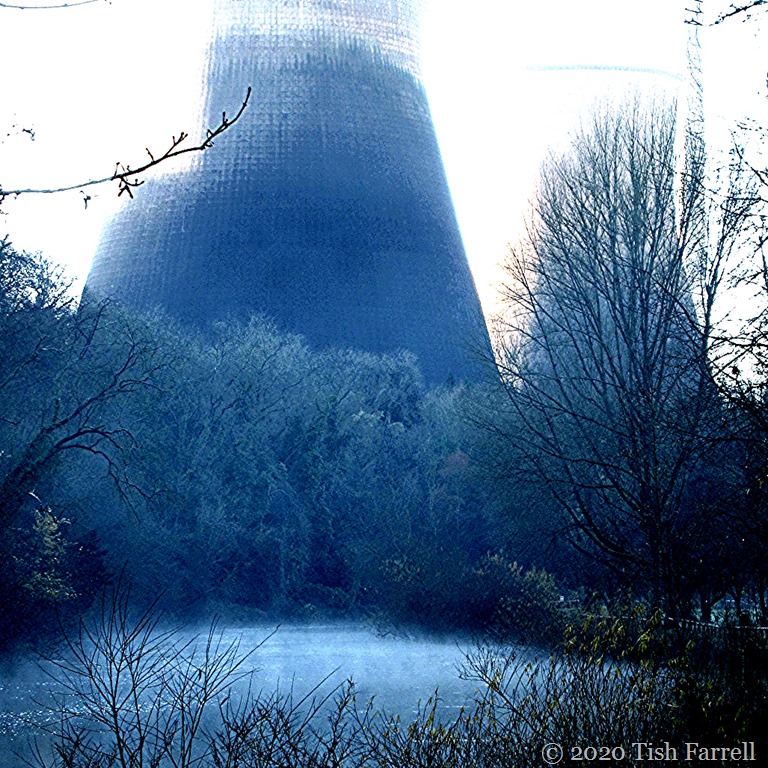
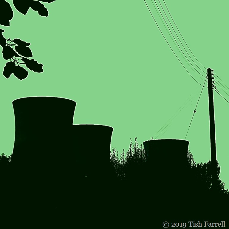
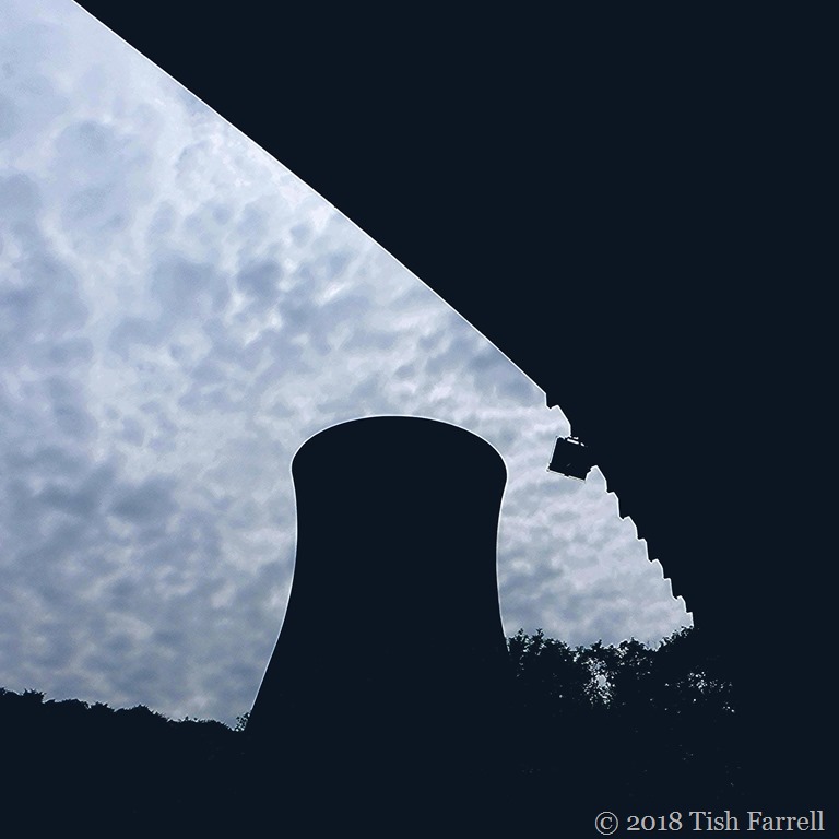
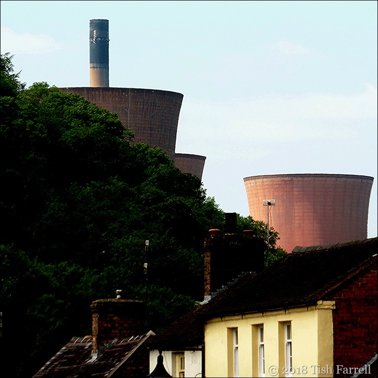
This coal-fired power station sits at the entrance to the scenic Ironbridge Gorge on the River Severn in Shropshire. Even when you know it’s there, to come upon the four great cooling towers through the trees, is always a surprise. Its days, however, are numbered, and many of us are wondering how the power station powers-that-be will go about recycling the place, and especially on the edge of a World Heritage Site. Just downstream is Ironbridge town, named after the world’s first cast iron bridge, built between 1779-1781 by Coalbrookdale ironmaster, Abraham Darby III. (See my earlier post Bridge, What Bridge)

P1000828

Before this bridge arrived on the scene as an 18th century world wonder, earlier bridges were mostly built of stone, usually with several low arches. The particularly novel aspect of the Iron Bridge’s design, then, was the high single arch, devised to allow the large sailing barges, known as Severn trows to pass beneath without lowering their masts. This was a clear piece of Coalbrookdale Company bravado, since the trows would have had to lower their masts for all the numerous other Severn bridges, both up and downstream of the Iron Bridge.

Looking at the sleepy river today, it is hard to imagine that in 1712, Coalbrookdale’s iron works were exporting  1,400 tons of iron wares downriver. It’s hard to imagine too, that although a hundred miles from Bristol, that the towns of Ironbridge and Broseley (on either side the bridge) were busy inland ports, with boat builders’ yards, and locally owned trows. The trade also went upriver to Shrewsbury which in turn exported cloth from the Welsh hinterland and local agricultural produce.

IMG

Ironbridge town and bridge, trows in the foreground; attributed to J. Fidlor some time after 1837, Shrewsbury Museum

*

Fascinating details of the trade are preserved in the Gloucester Port Books. For instance, they record one of the  Bristol-bound cargoes of the Broseley barge Thomas & Mary  in 1722. It included:

10 tons of ironware; 8 tons of cheese; 8 packs of Manchester ware; 2 packs of sadlery ware; 2 hogsheads of oats; 2 barrels of oats; 8 hogsheads of hair; 80 crates of earthenware; 1 barrel of brass; 2 trunks of wearing apparel; 2 boxes of wearing apparel.

An upriver cargo that same year comprised:

40 bags of cotton wool; 40 packs and a truss of cloth; 4 hogsheads of train oil; 1 ton of saltery; 2 barrels of herrings; 5 cwt. of salt fish; 4 cwt. of red lead.

The prestigious nature of the trade is perhaps embodied in the Severn Warehouse, now part of the Ironbridge Gorge Museum Trust. It stands on the river mid way between the Ironbridge Power Station and the Iron Bridge, and was built by the Coalbrookdale Company in 1834 in flamboyant Gothic Revival style. Down its iron rails to waiting barges would have trundled carts loaded with iron castings of every sort, both functional and decorative, heading for markets throughout Britain and across the Empire. It did a particularly thriving trade in iron bellied, so-called Missionary Pots – some holding up to 400 gallons, and thus big enough to hold a  missionary or two.  They were actually used for processes like soap making and rendering down whale blubber.

P1000856

But back to those cooling towers. I am rather fascinated by them; as indeed was TV historian Dr. David Starkey, when I was showing him around the Severn Warehouse many moons ago. He was doing some consultancy for me at the time, and when I told him that in 1979, the Iron Bridge bicentenary year, the cooling towers had been lit up at night, he grew very animated, and said it was a pity that this was not a permanent feature. He felt that the power station provided a dramatic analogy of industrial prowess that would help visitors to the Gorge to grasp a sense of the importance of past technological innovation. Some people will of course hate them as ‘blots on the landscape’. But anyway, see what you think. Here’s a shot that Graham took during their nightly illumination in 1979:

Scan-130804-0002

copyright 2015 Tish Farrell


Black & White Sunday Go here for more ‘unusual’ shots in B & W