


Sharing my garden’s glow – pass it on!
*

Sharing my garden’s glow – pass it on!
*

The following is the account of a conversation I had with Sheilagh in 2014, a year before her death. She is sadly missed.
*
I thought it was time I welcomed good friend and artist, Sheilagh Jevons, to this blog. She lives a few miles from me along Wenlock Edge, in the little village of Easthope. There, and in her studio not far away, she creates arresting work that explores the sense of belonging that people have with landscape. From time to time she and I have involving conversations about the creative process – the stumbling blocks, the sources of inspiration, the way we work (or in my case, don’t work).
A few weeks ago she came round for coffee. I wanted to ask her about a painting I had seen in her studio. I had thought it striking and mysterious, and wanted to know what she meant by it. Besides which, it is hard to resist the opportunity to grill an artist when you have one captured inside your house.
The header image is a small detail from a work called The House of Belonging. This figure has appeared in Sheilagh’s other works and represents women artists. Some of their names are written on the smock, artists perhaps not well known to the general public. Here she pays homage to their work, but also alludes to the fact that, overall, very little work by women artists is to be found in museums. The writing of names and of repeated key-words and equations is characteristic of many of Sheilagh’s pieces. It was one of the things I was going to ask her about. But first, the painting.

It is a large canvas, some 4 feet (120cm) square. The next photo gives a better sense of scale. Here it is hanging in Sheilagh’s studio:

I asked Sheilagh how the work began. She told me that some years ago the idea of belonging had become very important to her. As she says on her website:
Our ‘sense of belonging’ ripples out from our homes to our village, street, town, county, region and country and help to shape our identity…
Key, then, to her work is a sense of connection to land and how that relationship defines us. This in turn has physical expression in community repositories, the places where we keep artefacts, our history, the knowledge of ancestors – all the familiar things we recognise and which tell us something of who we are. In other words, the museum, or as Sheilagh describes it: the house of belonging. The script running down the left-hand margin of the painting in fact repeats over and over the words ‘the museum’, ‘the house of belonging’. The repetition reflects the strong political stance of Sheilagh’s work.
To me this is ‘the writing on the wall’, a statement of collective ownership; The House of Belonging staking a claim. Its contents are manifestations of how humans have interacted with their landscape and the place they call home. Sheilagh also says that adding text creates a certain texture; that the sense of a hand moving across the work creates a connection with her, its maker. The wheeled blue structure, then, is the House of Belonging. The words written inside say ‘everybody’s knowledge’. This is written twice so there can be no mistake. It feels like something to stand up for, a rallying call.
It is also important, Sheilagh says, that the House can move across the landscape to where the people are, rather than the other way round; this makes it more egalitarian. Inside the House are images and artefacts, symbols of creativity. Some of them are stereotypical of ‘heritage’ and therefore instantly recognisable. For instance, the chess pieces (centre left in the painting) are derived from the Scottish Isle of Lewis Chess Set in the British Museum. The set dates from AD 1150-1200 and suggests Norse influence or origins.

Sheilagh copied and simplified the images from a sales catalogue that specialises in heritage reproductions. The placing of the queen in the central position is also significant. She says she feels bound to redress an imbalance: the fact that in most of our media women only occupy centre stage when they are being commodified in some way. And then there is the mathematical equation painted in red beneath the red tree, centre right of the painting.  The presence of equations in Sheilagh’s works adds a further layer meaning for her, and although she doesn’t think it necessary to explain them, she is always very pleased when people recognise them. This particular one refers to mathematical research by American academics in the 1920s called The Geometry of Paths. The appearance of equations in Sheilagh’s paintings also has more personal origins. She tells me she started to include them some years ago – after she had been helping her daughter revise for her Maths and Physics A’ level exams. It is another connection. There are many more signifiers in the work: motifs that have links and resonance with Sheilagh’s other works. The red tree above the equation is a symbol of timelessness, indicating ‘forever’ in human terms.
  The red arrow in the top right creates a sense of energy and direction; a ‘look what’s here’ sign. There is the sense of a force field, drawing people to the House of Belonging.
Finally, we talked about the overall composition. Sheilagh says that she began the work some years ago after she noticed that a small building denoting ‘museum’ often appeared in her landscapes. This time she wanted it to have it as the main subject, and to make it both an enticing and a mysterious place. At this point she also created the friezes at the top and bottom of the picture, these in order to suggest other layers of reality behind the surface painting. The top frieze is the wider, timeless landscape of which the museum is also symbol. The bottom frieze is deliberately ambiguous and suggestive; it invites the viewer to consider what might lie behind.
And having created the work’s essential structure, the painting was then abandoned. It was only some fifteen months later, when Sheilagh, looking for a large canvas to start another work, returned to it. She was fully intending to paint over it, but when she looked at it again she suddenly knew how to proceed and completed the work very swiftly. She says it probably is not quite finished, and suspects that something may still need to be added. In the meantime she has been occupied with a large body of work relating to Scotland.
*

Notes and reference materials from Sheilagh Jevon’s studio
© 2014 Tish Farrell


There have been worrying reports this week that wild bumble bees are now catching deadly diseases from domesticated honey bees. Numbers are declining across Europe, North America, South America and also in Asia. You can read the Guardian article about the situation HERE. Then there are problems with pesticides that halve bees’ capacity to gather pollen. Last month the Guardian reported that:
“A two-year EU ban of three neonicotinoids, the most widely used insecticides in the world, began in December, following research that showed harm to honey and bumblebees. The neonicotinoids are “systemic” pesticides, being applied to seeds so that the chemical spreads within the plants. Over three-quarters of the world’s food crops require insect pollination, but bees have declined in recent decades due to loss of flower-rich habitat, disease and pesticide use.”
You can read the rest of the article HERE.
One thing is certain, without bees we will start going hungry. But if this is all too depressing, here’s a view of our Much Wenlock garden taken last summer where there were in fact very many bees. So for all of us who think that winter will never end, take heart. Summer will come again.

Weekly Photo Challenge: threes for more trios
@guardian @guardianeco
SIGN HERE: Change.org petition against developing land below the hill fort
*
Last Sunday it made the national press – the campaign to stop housing development beside Old Oswestry Hill Fort. You can read The Guardian/Observer article HERE.
Recently I wrote about the Great War poet, Wilfred Owen. Oswestry is his birthplace, and I mentioned that the garden of his former home has planning approval for several upscale houses. All of which leads me to ask, who values heritage the more – the developers trying to cash in on its cachet and so add mega-K to their price tags; or the rest of us, who too often ignore, or take for granted threats to the historic fabric of our towns and countryside? Or who only find out after the event when it’s too late to speak up? Of course, some of us may not care at all: what has the past ever done for me?
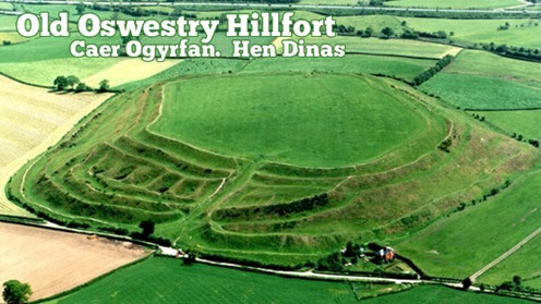
In Oswestry, however, they are rallying to the cause of their hill fort, and they have every reason to. It is one of the best preserved examples in Europe, built around 3,000 years ago. On its south side is another important monument – a section of the 40-mile long Wat’s Dyke, probably dating from the early post-Roman period.
Unusually, too, for a hill fort, Old Oswestry is very accessible, being close to the town; it is an important local amenity and landmark and currently in the care of English Heritage. This government funded body does appear to be objecting to at least some of the development plans, but not strongly enough in some people’s opinions. EH will apparently be meeting the developers to discuss matters in December.

Photo from: The Heritage Trust Old Oswestry Hill Fort Under Threat
*
The photo above shows (along the top edge) how close the town is to the fort. The farm complex in the upper left-hand corner, nearest the hill fort, is one of the sites allocated for upmarket housing. Hill Fort Close, Multivallate Avenue anyone?
Below is the view from the other direction, showing the proposed developments. These sites (in pink) are outside the town’s present development boundary. Usually there can be no development outside a development boundary, unless a good case can be made for an exception site for affordable houses. On such sites, houses must remain affordable in perpetuity and are thus normally managed by a housing association or social landlord. So, you may well ask, how come the environs of this hill fort are suddenly under threat, and not from affordable, but from upscale market housing?

*
SAMDev – who’s heard of it?
In Shropshire we have a thing called SAMDev (a nasty-sounding acronym standing for site allocation and management development). Shropshire is one of Britain’s largest counties, mostly rural and agricultural, but with light industry and retail zones on the edges of market towns like Oswestry. SAMDev is a response to National Planning Policy which enshrines the concept of presumption in favour of sustainable development. Spot the weasel word here.

For the last two years Shropshire Council has been ‘consulting’ (theoretically with the communities concerned) on areas of land outside existing development boundaries and identifying locations for housing and employment growth up to 2026. The final plan will be produced by the end of this year and it will be available for public scrutiny before going to an independent assessor.
As part of this process, land owners and developers have been invited to put forward their own development proposals. In other words, SAMDev is rather like a county-wide preliminary planning application. Developers are thus in negotiation with Council planning officers throughout this process. This usually happens anyway with any large development proposal.
This means that when a formal application is finally submitted, it is likely to be passed by the Planning Committee with little argument. The Planning Committee is made up of councillors, people who may have little understanding of planning matters. They rely on the reports presented to them by planning officers. It is the officers who are compiling the SAMDev document.
Although this entire process is available for public scrutiny (all draft plans including individual communities’ Place Plans are on Shropshire Council’s website) I think it’s safe to assume that most people in Shropshire don’t know that SAMDev has been happening. They might have been invited to consult, but somehow they did not understand the invitation, or the implications of not responding. Most people have thus not participated in the consultation process.
The biggest problem is that most normal people do not understand the kind of words that planning people use. I may be cynical, but is this not deliberate? What is clear is that inexplicable quantities of houses have been allocated for big and small towns throughout the county. SAMDev, through its provision of specific sites for specific purposes, is the means by which they will be realised.
*
A case close to home – Much Wenlock
In my small town of Much Wenlock the local landowner has offered up farmland along the southern and western boundaries of the town. This has enabled Shropshire Council’s Core Strategy to make an astonishing allocation of up to 500 new houses in the next 13 years – this in a flood-prone, poorly drained town of 2,700 people, where employment opportunities are poor, and the mediaeval road system is not fit for purpose, either for traffic or for parking. In other words, the town is already full, and its ancient centre cannot be changed, short of flattening it.
")
Shropshire Council’s Core Strategy states that Much Wenlock needs up to 500 new houses in the next 13 years, increasing the town’s footprint by another 50%. The town sits in a bowl with a river running through it. The development in the foreground is one of the newer ones. Its drains were apparently connected to the old town sewer instead of to the separate system for which it had approval. New developments like this have hidden costs for existing communities. This particular problem has not been rectified six years on from the 2007 flood that damaged up to 90 homes.
*
Development = Sustainable Growth?
The ensuing development fest that will be enabled once SAMDev is passed is seen as a means to stimulate growth. The argument seems to be that communities will die if they do not grow in huge tranches. But this is only a point of view, not an absolute truth. There are other models for sustainability, perhaps more meaningful ones. Besides, every community has its particular characteristics that might suggest other narratives; strategies that enable them to grow without necessarily expanding all over the landscape. Of course it is always easier, and presumably cheaper, to build over new ground than it is to reclaim old buildings and clean up brown field sites within existing settlements. Perhaps this is the reason why Councils do not take over unoccupied homes in towns, even though they have the powers to do so?
*
Trading on the past
In places like Much Wenlock house prices are high because, to quote estate agents and developers, “everyone wants to live here”. People want the best of both worlds, a high-spec modern house with multiple en suites, but in close proximity to gentrified antiquity where people live in homes that be cannot double-glazed because of listed building regulations. The new-home dwellers perceive acquired value by association with the past, and are prepared to pay for it. The kind of properties envisaged for the upscaled farmyard site near Oswestry hill fort will doubtless command a premium for similarly nebulous reasons.
")
Much Wenlock – view towards the town centre, a ‘60s development on the far hillside.
*
In this way, then, developers trade on something that does not belong to them – the historic setting that is cared for and maintained by other people. Buyers buy into the connection, distracted by the ‘look of the thing’. It’s all rather Emperor’s New Clothes-ish. But then if student debt can now be sold on by banks as a commodity, perhaps heritage detraction can also be a tradable commodity. Communities should exact compensation directly from those developers whose poorly designed housing schemes erode the quality of their environment, whether visually or through added strain on existing infrastructure. (In places like Shropshire effective infrastructure provision does not precede any new housing development; nor, if Much Wenlock is anything to go by, does it follow it.) And I’m not talking here about the modest Community Infrastructure Levy (CIL) that developers must pay to communities to build the small but useful things like playgrounds and car parks that councils no longer provide. But something far more substantial.
*
How much for this ancient monument?
So what value do we set on a hill fort? Is it worth twenty million pounds say? Fifty? More? Perhaps august academic institutions around the world might invest in shares in our monuments for their scholarly worth, and provide us with the means to buy off developers, or at least keep them at a respectable and respectful distance.
And I am only half-joking here. It would not be so bad if developers in this country built wonderful, good quality eco-houses in versions to suit everyone’s financial capacity, but mostly they don’t. And in the case of Much Wenlock the cost of large new developments around the town has been high – homes flooded from backed up drains and flash-flood run-off.
*
Standing up for heritage
But where does this leave Old Oswestry and all those who are campaigning against developing the nearby farmland?
Since the Guardian article, support has been gathering from across the country and beyond. You can follow the campaign at Old Oswestry Hill Fort on Facebook. But the problem is that there are only so many arguments you can make against unwanted development, and they have to comply with planning law and the Local Authority’s Core Strategy. They include loss of amenity value, visual impact, access, safety and sustainability.
At present, planning laws and high property prices give all the power to developers. If planning authorities cannot base refusal on the strongest case, then developers will opt for a judicial review to get their way. This costs local authorities a lot of money, and so us a lot of money. Developers’ planning consultants write letters to planning officers threatening legal action. You will find such letters in Council files. This is one reason why authorities cave in without a fight.
The heritage consultant’s impact report on the proposed development near Old Oswestry concentrates on view, THE VIEW of the development from the hill fort, and of the development looking towards the hill fort. The impact is considered to be negligible, but this again is a point of view. Housing developments also come with multiple cars, parking issues, garbage storage areas, satellite dishes, and people living their lives as they might expect to do in their own homes. There is also the future to consider. The Trojan Horse concept is a familiar one in development: approval of one development in due course setting a precedent for the next one alongside.
*
So why protect our past?
One would hope that the land around the hill fort would remain as farmland; that the farm could be sold as a farm. Or it might make a good visitor centre for the hill fort, using existing buildings. In reality there is no need to build anything at all in the vicinity of the hill fort. Better that Shropshire Council use its powers to take control of unoccupied dwellings in the town rather than sanction intrusion into the setting of a historic monument of national importance.
After all, why would anyone think that this was a good idea? These ancient places are resorts, and in all kinds of ways. They feed our imaginations and spirits; for children they grow understanding of other times, and other ways of living: all things that in the end make us wiser human beings. And isn’t this the kind of development we really need? People development? And before we carry on building all over the planet, shouldn’t we stop to consider what we already have, and see if some creative re-purposing cannot shape un-used buildings and derelict sites for our future growth requirements? Or is this approach too much to ask of our elected representatives and public servants?
Copyright 2013 Tish Farrell

SIGN HERE: Change.org petition against developing land below the hill fort
*
Find out about protecting your heritage at Civic Voice and Council for Protection of Rural England and join your local CIVIC SOCIETY
*
Related:
Petition to Shropshire Council at Change.org
The Essential Oswestry Visitor Guide
Old Oswestry Hill Fort on Facebook
The Heritage Journal Oswestry Hill Fort Under Attack
The Heritage Journal Old Oswestry Hill Fort: a campaigner asks – “why aren’t EH entirely on the side of the Public?”
The Heritage Journal Old Oswestry Hill Fort Safe?
The Heritage Journal Oswestry Hillfort “top level talks”: will those who care for it stand firm?
The Heritage Journal Oswestry Hill Fort: is it a forgone bad conclusion?

I like the idea that I, like many in and around Much Wenlock, live inside blocks of repurposed, and well-travelled seafloor – the compressed and decomposing shells, sponges, bony fish, sea scorpions, trilobites and corals of the Silurian Sea. It is also intriguing to know that some 400 million years ago, this shallow tropical ocean was part of a land mass that lay off East Africa, somewhere near the Comoros Islands. We even have our own geological epoch – The Wenlock that lasted from 428 to 423 million years ago. And yes, I know, it is hard to fathom – this mind-boggling vastness of geological time, the tectonic shunt and shift across the globe to create the continents we all now recognise.

My own view of the world, I find, is firmly fixed, and distinctly two-dimensional, being the usual flat configuration found in an atlas. And of course, when I consult the world map I can surely see that Much Wenlock is definitely in the northern hemisphere, in England’s Midlands to be exact, nudging towards Wales. Yet the proof that this was not always so, is all around me – in the stones of church, priory, and the many barns and cottages, even in my chimney breast – this place, this ground beneath the wooded ridgeback of Wenlock Edge, where the stone was quarried, WAS ONCE IN THE TROPICS. And since I once lived in the tropics myself, I like to think that returning to Shropshire has brought me back to the place where I was in Africa, but in a different time zone – a bit like a Time Lord, a Doctor Who without a Tardis.

The Farrell Silurian fireplace built c 1830
*
But back to the stones. The circular sections you can see in the first photo are the remains of crinoids or sea lilies. These were animals, echinoderms, not plants, and looked something like this:
From McGraw-Hill Science and Technology Encyclopedia; Articulata
*
Bony fish also made their first appearance during the Silurian:
Artist’s impression of Silurian Fish (creative commons copyright expired) from Nebula to Man by Joseph Smit 1905
*
And the landscape may have looked like this, although was apparently entirely inhospitable above water, with roaring winds and hot flying dust, and no signs of life.

Silurian Sea reconstruction by Richard Bizley: http://www.bizleyart.com/
*
And here is bed of the Silurian Sea today, the upthrust levels that form the fifteen-mile wooded ridge of Wenlock Edge. Its geology is of international importance. (For more on Wenlock Edge, see its Facebook page here.)

The Edge has been quarried for centuries, but the quarries lie mostly empty now, waiting to be repurposed themselves. In the town our earliest surviving stone buildings date from monastic times. (In Much Wenlock An Inspector Calls.) But old buildings have always been recycled into new buildings, and you can see signs of this as you walk along the streets nearest the priory ruins.


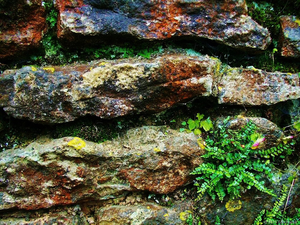


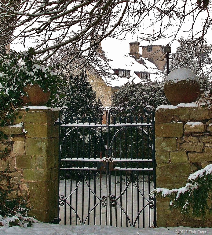
And finally (below) is the Farrell establishment – a blend of old and new construction. Hopefully the inhabitants are not yet as fossilized as their surrounding walls, although clearly it is only a matter of time.

© 2013 Tish Farrell

Much Wenlock, the place where I live, is a small town with a big history. You could say it owes its existence to the discovery of some holy bones. And no, this is not the reason for the inspector’s visit. I’ll get to him in a moment. (In fact his arrival in town relates to the making of some new history). But about those bones…
First of all, they are very, very old. In life they belonged to a Saxon princess, whom we know locally as Milburga, though she comes in other spellings. She was daughter of the Mercian King, Merewalh, who held sway over much of the English Midlands during the 7th century. These were turbulent times – the spread of Christianity going hand in hand with securing territory. To this end, Merewalh was a man with a plan. Instead of arranging dynastic marriages for his three daughters, he established them as rulers of new religious houses across his kingdom. Even his own queen, a Kentish princess, in later life returned to faraway Kent to become Abbess of Minster. In this way Merewalh consolidated spiritual and political prestige, commanding both bodies and souls.
In preparation for the religious life, Milburga was sent for her education to the double monastery of Chelles in Paris. According to the historian, and her contemporary Saint Bede, this was common practice for English girls. Sometime towards the end of the 7th century Milburga then took charge of an abbey in Much Wenlock. This was also a dual monastery i.e. for both men and women, and each sex had their own church. It was also the most important religious house in the region. There she presided for the next thirty years, ministering to the people of her extensive domain lands. Many legends grew up: that she had the power of healing the blind and of creating springs of water. After her death in 725 AD there were more and more stories about her miracles, and so in due course she became Saint Milburga.
Fast forward to the Norman Conquest of Britain (1066), and now we have brow-beating Norman earls establishing their power bases across the land. Their plan was to use ‘big architecture’ to dominate the natives: castles, fortified manors, churches and monasteries – the bigger the better. In Much Wenlock, Earl Roger de Montgomery built a Benedictine priory on the site of Milburga’s abbey. It was affiliated to the monastery of Cluny in France, and so French monks came over to live in it. The building was an impressive enterprise too. Today, the picturesque ruins in the heart of the town do little to indicate the vast scale of the original.

Wenlock Priory and the ruins of 12th century Benedictine monastery that was built on the site of Milburga’s Saxon abbey. In its day, this was one of the biggest and most prestigious religious houses in Europe. Photo: Creative Commons, Chris Gunns
But building big is not everything. The Normans faced a problem that every interloper faces: how to give their occupation legitimacy. Milburga was a much-loved saint and a Saxon saint to boot. It was essential to confirm possession, not only of her extensive lands (which was quickly achieved), but also of her remains.
The last proved less easy and, it may well be imagined, then, that when the French monks arrived in Wenlock and found the silver shrine of Milburga empty but for “some rags and ashes”, there was much consternation. Where were the saintly bones?

Bishop Odo unfolds the mystery in an account written after he visited the Priory in 1190. It appears that the nuns’ church of Milburga’s abbey (now our town church, Holy Trinity, above) still survived in Norman times, but lay in ruins. The monks decided on some restoration, and it was during work on the altar that a monastic servant found an ancient Saxon document. The monks, being French, could not read it and so a reliable translator had to be found forthwith. Thus was discovered the testimony of a priest called Alstan who said that Milburga had been buried near the altar in the nuns’church.
Of course by now nearly four centuries had passed since her death, but news of the document reached Anselm, Bishop of Canterbury and he gave the monks permission to excavate. But before this could happen, two boys playing by the dilapidated altar, caused the floor in front to collapse, which in turn led to the more rapid discovery of Milburga’s remains. This was in 1101 AD, and we know they were her bones because they were “beautiful and luminous” and accompanied by the requisite saintly fragrance deemed to be given off by such relics.
The discovery gave Much Wenlock instant pilgrim-appeal, and the monastic publicity machinery rolled. The Prior commissioned the leading writer on saints of the day, Goscelin, to write about the life of Saint Milburga and so firmly establish the cult of miracles that surrounded her. From that time pilgrims flocked to Wenlock, and the town grew to cater for them. Some of the surviving public houses have their beginnings in the Middle Ages. The Priory itself was wealthy in land and employed a large workforce who were engaged in agriculture and early industrial development including coal mining and iron working. Artisans and merchants were attracted to the area. Trades and services developed to cater for the pilgrims and the Priory. And over all this human business presided the Prior, delivering both spiritual and temporal edicts. It was not until 1468 that the town was handed over to a secular authority.
And so here we have the little market town of Much Wenlock, continuously occupied for a thousand years and presently home of 2,700 souls. It sits below the long limestone ridge of Wenlock Edge whose geology is of international renown. After the monastery was dissolved by Henry VIII in 1540, the town continued to thrive as entrepreneurs moved in to develop the industrial potential of former monastic holdings. The cloth trade and tanning became important. Agriculture and quarrying continued as mainstays since Much Wenlock’s limestone was not only useful for building, but was also burned in kilns to use as fertilizer. Most importantly, as time went on, it became an essential ingredient in the making of cast iron, acting as a flux to remove impurities from the iron.
Indeed, it was at furnaces on Milburga’s former domains at Coalbrookdale, Madeley, and in Broseley that many breakthroughs in the iron industry were made, thus setting off the World’s Industrial Revolution. And the reason these technological innovations took place here was because the locality had all the vital ingredients: limestone, ironstone, fireclay and coal. The tributaries of the Severn could be harnessed for water power, and the river itself provided a trading route down to Bristol. Not only that, generations of monastic workers meant there was a skilled workforce to be utilised when post-Dissolution entrepreneurs moved in to take over monastic mines, iron works and water mills.


We have other claims to fame too. The reason why one of the Olympic mascots was called Wenlock was because it was here in 1850 the town’s physician, Dr William Penny Brookes began the first modern Olympian games. For the next few decades people flocked to Wenlock in thousands to see them. Brookes passed his ideas on to Baron de Coubertin who often visited the town, and so began the International Olympic Committee. The Wenlock Olympian Games are still held every year and provide a popular competition venue for sportsmen and women from all over the country.
But back to the inspector who was left stranded at the top the page. Two years ago Much Wenlock was one of the seventeen front-runner communities in the country chosen by Government to create a Neighbourhood Plan. Since then, cohorts of Wenlock and other volunteers have worked with the community to produce a plan that sets out the kind of development we want in the parish over the next thirteen years. Last week the inspector, the man assessing the plan, came to the Priory Hall, the town’s community centre, to conduct a public hearing.

For reasons that may become apparent by looking at the next photos, large scale development is not a popular proposition in the community. Most of us feel that we have had more than enough. The town sits in a basin. Wenlock Edge and surrounding hills drain through it down a culverted medieval watercourse once known as the Schittebrok. The Victorians did the culverting and there have been so-called remedial schemes since. Some argue these ‘improvements’ have made the problem worse. The town’s footprint has increased some 300% in the last decades with much unsympathetic development that has covered agricultural land with hard surfaces that speed up flooding. Our narrow medieval street system turns roads into rivers during heavy rain. The other serious problem then (apart from traffic congestion) is drains.
")
")
")
In 2007, after 91 homes were flooded due to a combination of flash flooding and poor drainage, the town held a referendum. The vote was 471 to 13 to have no more development until the town’s traffic and drainage problems were resolved. Nothing has been done to improve these matters, our sewage farm is under capacity. The bill for new drainage will cost millions and our private water company is unlikely to fork out. In the meantime the developers and major landowner informed the inspector that they are itching to build 85 houses in the near future, with a suggested total of 250 over all.
At the hearing the inspector gave them ample chance to make their case, and he himself gave no clue as to which side’s view would hold sway. The Neighbourhood Plan wants only small numbers of affordable homes for locals to rent, and a maximum of 25 market homes on a single low density development. But this is not how housing developers work. Much Wenlock’s property prices are high; it is a desirable place to live. They thus want to build up-scale houses with multiple bathrooms. Meanwhile our ageing community would like comfortable smaller places so they can downsize and release their homes to people with families. It is a divergence of objectives that appears to have no sensible resolution.
The British Government’s stance is that building houses is the only way to create ‘sustainable’ communities. So even if the Neighbourhood Plan is passed by the inspector, there is no knowing how far it will protect the town from inappropriate development.
As I said at the start, Much Wenlock is a small town with a big history. But perhaps our story has not yet been well enough told. Perhaps we are not shouting it loud enough. Events that occurred in and around Milburga’s former domain have helped change the world we all live in. A few miles away is the World Heritage Site of the Ironbridge Gorge (site of the world’s first cast iron bridge built in 1779). The iron, porcelain and decorative tile industries that grew up in this area traded their goods across the world. Monastic enterprise underpinned the development of British industry.
Today if you visit Much Wenlock it may strike you as a Rip Van Winkle sort of place. It has a slumbering air, as if dozing under the weight of ancient timbers and stonework. But it can be lively too.There are some excellent shops including two excellent book shops and a gallery. There are small markets during the week, a museum, the church, the Priory, the Olympian trail, good pubs and hotels, many societies to join, a fully equipped leisure and arts centre.
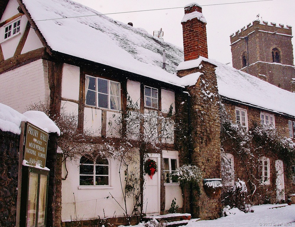
Above: glimpse of the Prior’s house, now a private home. Below: cottages on the Bull Ring
We have much to protect and preserve here, and much to share with those who visit us. And we do want the town to grow and thrive, but on the community’s terms and according to their expressed needs. But looking over the last thousand years, this story does have a common theme. Whether we’re talking of Saxon kings, Norman earls or housing developers, those who have power and land do all the ruling, too frequently asserting their will over the wishes of the general populace. It remains to be seen whether the inspector will pass our plan. He said he would let us know in November. In the meantime, I, like others in the town, watch rainy skies with anxious eyes, if not for ourselves, then for vulnerable neighbours. Fingers crossed for Neighbourhood Planning and that it actually will serve our purpose.
© 2013 Tish Farrell
Related:
https://tishfarrell.wordpress.com/2011/06/27/of-silurian-shores/
https://tishfarrell.wordpress.com/2013/06/04/windows-in-wenlock/
https://tishfarrell.wordpress.com/2012/01/26/of-wolf-farts-windmills-and-the-wenlock-olympics/
twitter: @Wenlock_Plan
https://www.facebook.com/pages/Wenlock-Edge/532033273535604?ref=profile
https://www.facebook.com/pages/Wenlock-Edge/119957538050970
BOOKS:
W F Mumford Wenlock in the Middle Ages 1977 re-published under ISBN 0950561606
Vivien Bellamy A History of Much Wenlock 2001 Shropshire Books ISBN 9780903802796
In response to Frizztext’s ‘Tagged W’
Here are some scenes of the town where I live, Much Wenlock, a settlement continuously lived in for the last thousand years. For more of its history see my post Of Silurian Shores.

The town grew up around a medieval monastery. This is the tower of Holy Trinity church which survived Henry VIII’s Dissolution of the Monasteries in 1540. It has been our parish church since around 1100 AD. Originally it was part of the monastic complex.

The Priory ruins are now owned by English Heritage. This twelfth century Cluniac Priory was once one of the largest religious houses in Europe. It was built on the site of a much earlier abbey founded in the seventh century by St Milburga, daughter of King Merewald of Mercia. England’s Norman rulers wished to cash in on the sanctity of St. Milburga’s remains as well as making a big architectural statement on the Saxon landscape.

This is street is called The Bullring, once the place for bull-baiting, a popular local sport until the early 19th century.

The Guildhall was built around 1540 as the court house to replace the monastic court after the Dissolution. Town Council meetings are still held here. The ground floor is used for various markets. In this photo, taken in 2012, townspeople are celebrating Much Wenlock’s Olympic Games connections. See Of wolf farts, windmills and the Wenlock Olympics.

The George and Dragon is one of the few survivors of the town’s once numerous inns and public houses. The town’s main industries were limestone quarrying, lime burning and agriculture – all hard-working pursuits guaranteed to build up a thirst.

Raynald’s Mansion (above) on the High Street dates from around 1600.
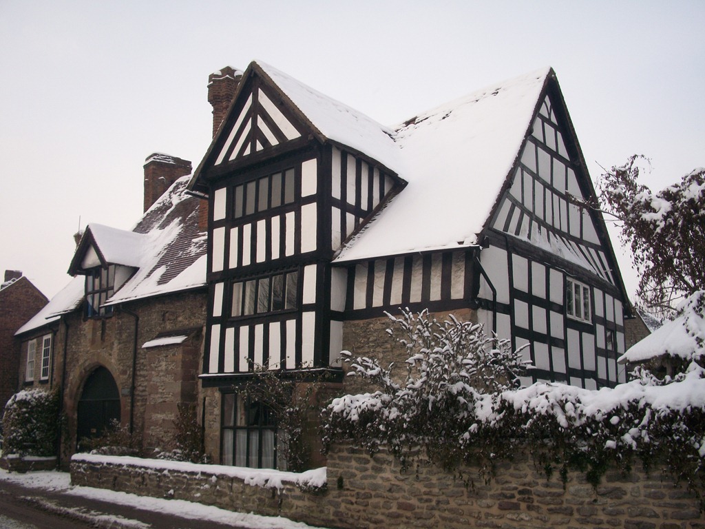
Ashfield Hall, also on the High Street, was built before 1421. It was possibly built on the site of St. John’s Hospital for ‘lost and naked beggars’. For a time is was the Blue Bell Inn and then a lodging house for itinerant labourers. (A History of Much Wenlock by Vivien Bellamy.)

These ogival windows are a local ‘speciality’.
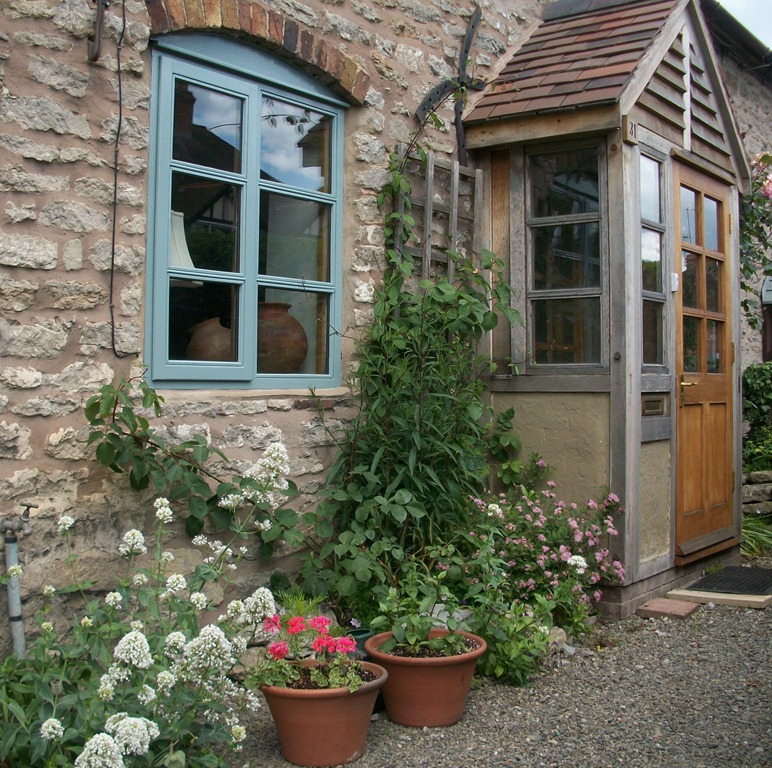
And some of my windows.
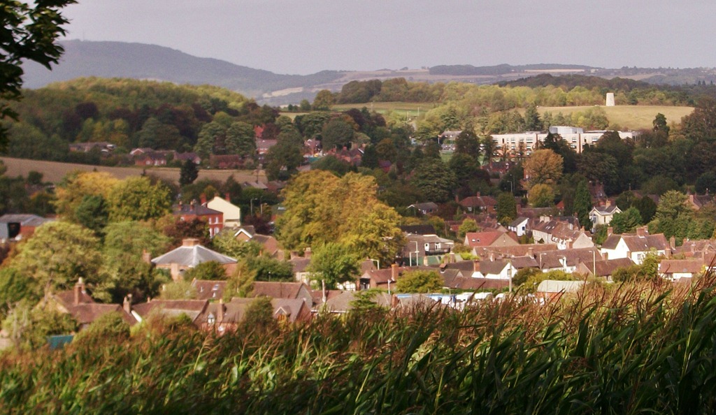
Looking down on the town from the south west, Windmill Hill top right, The Wrekin top left.
© 2013 Tish Farrell

Overlooking Townsend Meadow: on the edge of Wenlock Edge
All is peripheral in the place where I live – my house beside the path beside the field whose name on the 1847 tithe map, Townsend Meadow, marks the old town boundary of Much Wenlock. The town, itself, is very ancient and it has long outgrown the town’s-end frontier along the Sytche Brook. It also lies below its own impressive periphery – the long limestone scarp of Wenlock Edge.
I cannot quite see the Edge from my house, but I see the big sky above it, the dramatic false horizon that the Edge creates and thus the endless movement of weather along it. Hours can be wasted sky watching: the breezy march of clouds across the roof lights, the flush of hundreds of rooks from Sytche Lane wood at dawn and at dusk, peppering the skyscape.

Sky over Wenlock Edge
In fact most inhabitants of the town cannot quite see the Edge. This is something of a paradox given that its massive limestone presence has shaped Much Wenlock in so many ways, and not only in the fabric of its many stone cottages. You need to be outside the town to get a proper glimpse of it and, even then, it is hard to get the full measure of it. Nevertheless, as landmarks go, it will not fail to make an impression however you come at it: whether wending up the hairpin bends from Shrewsbury; or taking the road over the top from Wenlock to Church Stretton and the Shropshire Hills beyond, or yet meandering down below it along the narrow lanes through Kenley, Hughley, Church Preen and Longville. From the lowland, the Edge’s steep north-west slopes look so heavily wooded that they bristle up like a giant hog’s back. For some fifteen miles this dark spine stretches, bearing down on the scattered hamlets and farm fields. It is unavoidably mysterious.

Driving along the Edge on Christmas Day
The south-east slopes, by contrast, have a more domesticated feel, and something of an industrial air, having been dug into for centuries. The road that cuts along the top passes beside vast quarries (now mostly hidden by hedges and woodland and visible only to walkers). These quarries yielded limestone for building and for the iron works of Coalbrookdale where it was used as a flux in smelting, and for burning in lime-kilns to make fertiliser. In more recent times most of the stone went for road building. But now quarrying has stopped and Much Wenlock’s houses no longer shudder in a pall of white dust as they once did whenever the quarrymen were blasting; nor do the streets vibrate with the endless rattle of passing stone trucks.
There are other sources of disturbance of course – over-sized farm vehicles and garden fencing lorries. They pass by on the other side of my house, which sitting as it does on the A4169 is not so scenic, although it is interesting in other ways. For instance when I’m standing in the kitchen eating toast, I might look up to meet the serially startled gazes of a tour bus party as their coach nudges them past our windows, brushing hard through our privet hedge in order to wheedle a way past another HGV. It is the only way to do it on a road too narrow for two large vehicles to pass. We locals amuse ourselves by taking photos of the trucks and buses that several times a day get jammed outside our homes while officers at Shropshire Council shrug helplessly, quite unable to say what their predecessors were thinking of when they upgraded a bottle-neck lane into an ‘A’ road. There’s nothing to be done, they say. One day a European mega-truck will drive down from nearby Telford and block the road forever.

Coaches getting stuck on Much Wenlock’s narrow streets
But for all the present day shove and shunt, there is still a sense of romance about the town and Wenlock Edge. Spirits from the past make their presence felt in all sorts of ways. Housman set the Edge in verse; Vaughan Williams rendered it in song; the explorer, Stanley, sat upon it, his dark heart brooding on his time in Africa as he surveyed the more benign Shropshire landscape below. Even Henry James and Thomas Hardy came visiting, (James several times and said to have worked on Turn of the Screw while staying in the old Prior’s House that adjoins the Priory ruins).
Last but certainly not least, Shropshire writer-poet, Mary Webb spent her adolescent years living upon the Edge at The Grange and was well known about the town. When, in the 1950s, her novel, Gone to Earth, was turned into a film by Michael Powell and Emeric Pressburger, some of the scenes were shot in and around Much Wenlock. In fact I’m told by my neighbour that one of the film’s extras used to live in our house and was also the town’s projectionist. Perhaps he even showed Gone to Earth in the little cinema that is now the museum, thrilled to bits as the scenes flickered on the screen: seeing himself and other townspeople alongside Hollywood’s Jennifer Jones.
Wenlock Edge, of course, has much older stories than this to tell. Back in the Silurian Age, some 430 million years ago, it was a tropic seabed, and in rare moments when my mind can even begin to consider such vast temporal constructs, I imagine my house on the shore of the Silurian Sea. (A Solaris moment perhaps). Of course back then the ground on which my house stands was not even in the Northern Hemisphere. Back then the earth’s landmasses were still on the move, shifting up the globe from the South Pole. The English Midlands and Welsh borderlands that I think I know so well thus lay south of the Equator; 15 degrees south in what is now the Indian Ocean, where they were part of the micro-continent of Eastern Avalonia that in turn bordered the Iapetus Ocean. And so while Shropshire lay somewhere off Mozambique, the world warmed and the Ordovician ice caps melted and the low-lying lands filled to become the Silurian Sea. I also like to imagine, that after living in East Africa for seven years, returning to settle in Much Wenlock is like coming back to the place where I was; for I miss Africa very much. Also it gives a new connotation on the phrase ‘world travel.’
Wenlock Edge, then, is a fossil hunter’s treasure place and, as such, is the most famous Silurian site in the world. In its seaside days, warm, shallow waters were home to sea lilies, corals, multi-radiate starfish, trilobites, gastropods, brachiopods and fish. Indeed, somewhere over my garden hedge, there may have been some reef lagoon that hosted ammonites, squid and, horrifically, water scorpions five feet long. In fact, my house is composed of these Silurian deposits, dug from those vast quarries along the Edge. I thus inhabit a re-shaped fossil seabed. There are crinoid stems and corals in the chimney-breast, and all belonging to an age before the birth of amphibians or dinosaurs, or before there were mammals and birds in the world.
While I can easily picture my house on a flat, gravelly shore and a teeming shallow sea beyond, it is hard to conjure the great absence of earth-life. We might easily begin to think that the terrestrial world would be a painfully quiet and very still place, although this, I gather, would be a grave misconception. The land may have been lacking in life forms but there was instead a perpetual wind. And because the paucity of land life meant there was little with which to bind the earth’s surface, the Silurian seashore would have been a dreadful place of roaring sandstorms and lashing gravel.
Today, the farmland that surrounds the town is lush and homely. It has sheep and cattle, arable crops and pasture, woods and thickets, the old quarries and sundry ruins, remnant green lanes and farm cottages. There are deer and rabbits, foxes and rodents and also, as far as the town’s allotment owners are concerned, far too many birds. That said, though, it is good to hoe and dig to the mewing of buzzards.

Bird-scaring bunting at the allotment
Most of the land within the town boundary, and this includes Townsend Meadow, is still feudally owned and tenanted and, within these little bounds of landowner imposition has grown a small market centre that has been continuously lived and worked in for the last thousand years.
But then that is only the historical record.* Archaeological investigations show that humans settled this valley by the Edge from at least the Bronze Age. These first Wenlockians were probably early Celts, and as venerators of water, were doubtless attracted to the many springs that rise below the limestone escarpment. The Celts were also skilled metal workers and Wenlock Edge would have provided a natural, upland byway for itinerant smiths and metal traders going to and from the mineral-rich hills of Wales. Certainly Bronze Age hoards have been found in and around the nearby River Severn which, through many ages, was one of the country’s busiest inland trade routes.
After the Celts came Roman and Saxon settlers, Viking and Norman invaders, and the town not only still has substantial ruins of an eleventh century Benedictine Priory, but many of the present houses and cottages are built from stone plundered from the monastery after its dissolution in 1540. The medieval Prior’s House, however, largely survived this recycling. It adjoins the Priory ruins, from where it may be glimpsed, and has been restored as a breathtakingly beautiful private house.
The common theme, then, that runs throughout Much Wenlock’s settlement history is the belief in sacred water. The town has many holy wells. Excavations of the Priory that sits beside a brook that runs off the Edge yielded not only the carving of a Celtic deity but also a substantial Romano-British residence that seems to have its own Christian chapel. In Saxon times, around 670 A D, Merewald, King of Mercia, founded an abbey there, and his daughter, Milburga, after training at Chelles, near Paris, became the foundation’s second abbess. She is also our saint and the heroine of a local legend that tells how she escaped an assault on her honour by a rapacious suitor. She is known, too, for striking holy springs from the ground and for her miracles of healing. The water from her well near Barrow Street was reputed to cure eye diseases.

Much Wenlock Priory ruins
The Benedictine Priory that succeeded the Saxon Abbey in 1079 was part and parcel of the Norman master plan to control all aspects of Saxon life. Much Wenlock’s age-old reputation for holiness guaranteed that the Norman earl, Roger de Montgomery, would choose the town for a big demonstration of power and piety. It was he who invested so heavily in the priory that was to become one of the most imposing religious houses in Europe. And to ensure the new priory’s prosperity as a lucrative place for pilgrimage, St.Milburga’s reputation for miracles was duly annexed to the cause and a new shrine to her established.
Today, most of the pilgrims to Much Wenlock are tourists, stopping off briefly en route for Wales. But this coming year we are expecting many more visitors, as news of Much Wenlock’s further claim to fame spreads around the world. For it was here in 1850 that the town’s physician and apothecary, Dr William Penny Brookes (1809-1895) founded the Wenlock Olympian games that were to become the inspirational force behind the modern Olympic movement. It was he who in 1890 (six years before the 1896 Athens modern Olympics) passed on to a young Baron Pierre de Coubertin not only a wealth of experience gained from running the town’s annual games, but also his passionate belief that exercise wrought moral, physical and intellectual improvements in all who took part.

The Linden Field, Much Wenlock: birthplace of the modern Olympic Games
The Linden Field where the Wenlock Olympian Games were held amid crowds of up to 10,000 spectators is still there and is now a public park, bequeathed by a former feudal worthy for the pleasure and recreation of the people of Much Wenlock. Since it is only a step from my house, I sometimes toy with idea of running down the avenue of lime trees that Dr. Brookes planted there one hundred and fifty years ago. Perhaps such active activity would improve my mind. Perhaps it would spur on the story-telling process. Perhaps I would escape the peripheries and finally get some work done…finish a new edition of my one-time award winning African novella, Jessicah the Mountain Slayer, finally create some new tales from my backed-up story-making stock. Or perhaps, like the Silurian seabed, I will simply go on accreting: stuff and more stuff, piles of notes and scribble and memory sticks slowly compacting, although hopefully not enfolding anything as alarming as a fossilised giant water scorpion. That is a worrying thought.
© Tish Farrell 2011
* for many historical details I am indebted to Vivien Bellamy. See her book A History of Much Wenlock, Shropshire Books, 2001

