

*
Barn roofs, gates, styles, fence- field- crop- and power-lines, pylons and pole shadows. Oh yes, and some bull rushes…

A brilliant sun-frosty morning and, so we’re told, the last of the super-cold days. But just the morning for a hike up to the dew ponds above the town.
I love this green lane, perhaps the remains of an ancient thoroughfare between settlements, this before the creation of the modern road system, or maybe even part of the old drovers’ routes out of Wales, shepherds and cattlemen driving their flocks and herds to markets in the English Midlands.
Bishop’s Castle was anyway an important market centre at least as far back as the thirteenth century, when the Bishops of Hereford ruled it from their castle at the top of town. Charters were granted for weekly markets and seasonal fairs to be held outside the castle walls.
On market days this now quiet track might well have been bustling with carts, farmers’ wives with their produce: ducks, geese, hens, eggs, butter, cheeses; farm boys on foot, driving pigs, goats, cattle and sheep to sell. Other traders too might have come this way: basket, hat and chair makers, dealers in songs, fortune tellers, herbalists, and street musicians.

The Long Mynd
*
At the top of the hill are some dew ponds. These are man-made pools, created in upland areas without natural water sources, to provide for grazing stock. Water then collects in them, either rain or field run-off. Some may date from the Neolithic period, that is 6-7,000 thousand years ago. Others may date from the Middle Ages or more recently in the 18th/19th centuries when there was still a high demand for wool. Much skill was required to make them. They started out as a saucer-shaped excavation, about a metre (3 feet) deep, and anywhere between 3-15 metres in diameter. This was then lined with straw, followed by an impermeable layer of puddled clay.

*
One of the dew ponds no longer in use for stock watering is in its own enclosed domain and filled with bull rushes.

*
There are many fine views all round from this point on the footpath; also another dew pond, not presently in use:


*
And in the field with the operational dew pond, lots of ewes waiting to have their lambs:

*
At this point we retrace our steps, although we could (if all of us were willing) follow the path for several more miles, taking a wide loop back into town. Instead, we head straight down the hill, watching the ribbon of fog flowing along the far valley from Clun towards Craven Arms. We’ve recently learned that this mist phenomenon, rather common in these parts, is also called brume.

*
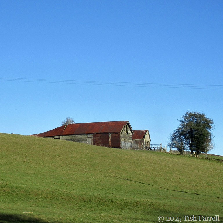
Finally at the foot of the hill by the Wintles, another favourite old barn:

*
And by now it was lunchtime so we called in at Tahira’s Chai Shop on the High Street for some delicious beef and vegetable samosas (also geometrical) plus lots of good chatting, topped off with (triangular) slices of Rose’s light-as-a-feather, and mouth-wateringly warm cardamom cake. None of which stayed on our plates long enough to think about taking photos. Sorry.
